Category:OpenStreetMap maps of Washington, D.C.
Jump to navigation
Jump to search
States of the United States: Alabama · Alaska · Arizona · California · Colorado · Connecticut · Florida · Georgia · Hawaii · Illinois · Indiana · Iowa · Kansas · Kentucky · Louisiana · Maine · Maryland · Massachusetts · Michigan · Minnesota · Mississippi · Missouri · Montana · Nebraska · Nevada · New Hampshire · New Jersey · New Mexico · New York · North Carolina · Ohio · Oklahoma · Oregon · Pennsylvania · Rhode Island · South Carolina · Tennessee · Texas · Utah · Vermont · Virginia · Washington · West Virginia · Wisconsin · Wyoming – Washington, D.C.
Puerto Rico · United States Virgin Islands
Puerto Rico · United States Virgin Islands
Media in category "OpenStreetMap maps of Washington, D.C."
The following 34 files are in this category, out of 34 total.
-
Blagden Alley-Naylor Court Historic District map.png 398 × 367; 93 KB
-
Carte Tentative assassinat Reagan 1981.png 346 × 589; 423 KB
-
CCAF headquarters.png 1,210 × 852; 698 KB
-
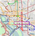
Dccirculator.png 1,535 × 1,611; 1.34 MB
-
Dccirculator.svg 461 × 483; 3.14 MB
-
Dcdistrictssketch.png 1,196 × 746; 627 KB
-
Dcmeetup7map-large.png 1,134 × 747; 147 KB
-
Dcmeetup7map.png 1,111 × 714; 537 KB
-
Fifteenth Street Financial Historic District map.jpg 478 × 846; 142 KB
-
Georgetown campus and neighborhood map from osm.svg 1,413 × 898; 3.61 MB
-
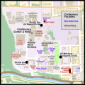
Georgetown campus wikimania2012.svg 684 × 684; 1.11 MB
-
Georgetown university campus map.PNG 995 × 1,023; 595 KB
-
Georgetown university overview map.svg 750 × 500; 1.1 MB
-
Grant Road Historic District map.png 469 × 540; 186 KB
-
Herring Hill boundary.jpg 671 × 541; 114 KB
-
Hostelling International Washington DC and environs.png 1,122 × 626; 310 KB
-
Kalorama Triangle map.jpg 525 × 508; 62 KB
-
Location map District of Columbia street.png 781 × 718; 792 KB
-
Location map Washington DC Cleveland Park to Southwest Waterfront.png 717 × 734; 718 KB
-
Location map Washington, D.C. central.png 627 × 599; 218 KB
-
Location map Washington, D.C. central.svg 304 × 290; 8.79 MB
-
Location map Washington, D.C. east.png 767 × 731; 644 KB
-
Location map Washington, D.C. Mount Vernon Triangle.PNG 1,144 × 1,026; 1.7 MB
-
Mount Vernon Triangle Historic District map.png 696 × 424; 113 KB
-
National Archives and environs.png 1,156 × 637; 272 KB
-
Openbikeheroscreenshot 2023-02-21.png 2,152 × 1,206; 3.78 MB
-
OpenSteetMap of Georgetown Washington DC 2014.jpg 1,523 × 851; 1.21 MB
-
Radially concentric created streets in Washington, D.C..svg 1,799 × 1,216; 12.7 MB
-
Site of Eisenhower Memorial - Washington DC.jpg 545 × 507; 50 KB
-
Sixteenth Street Historic District map.png 406 × 586; 265 KB
-
Strivers' Section Historic District map.png 673 × 577; 344 KB
-
Walking map from Hostelling International to National Archives.png 261 × 713; 96 KB
-
Washington, D.C.png 1,257 × 816; 754 KB
-
2009 Inaugural Parade Route.png 1,238 × 872; 678 KB


