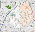
Category:OpenStreetMap maps of New York City
Jump to navigation
Jump to search
Media in category "OpenStreetMap maps of New York City"
The following 23 files are in this category, out of 23 total.
-
Broadway.png 724 × 2,000; 2.13 MB
-
From the B82 SBS td (2019-01-25) 02 - Information Screen.jpg 5,472 × 3,648; 3.67 MB
-
Governors-Island-map.svg 687 × 733; 338 KB
-
Kill-Van-Kull-map.svg 687 × 733; 340 KB
-
Location map Lower Manhattan extended.jpg 5,683 × 8,250; 18.47 MB
-
Location map Lower Manhattan extended.png 385 × 561; 348 KB
-
Location map Lower Manhattan.png 820 × 995; 1.01 MB
-
Location map New York City.png 1,118 × 1,074; 1.28 MB
-
Location map United States Manhattan.png 394 × 703; 342 KB
-
Manhattan NYC OpenStreetMap 2023-08-21.png 5,210 × 11,040; 33.15 MB
-
Map of East Williamsburg (2009).jpg 991 × 910; 831 KB
-
Map-Six-and-Ten-Day-Race.jpg 885 × 655; 571 KB
-
New m12.jpg 1,024 × 801; 170 KB
-
New York City.png 1,258 × 824; 787 KB
-
Nm12.png 480 × 598; 497 KB
-
NYC-14th Street Canal Street.png 340 × 475; 294 KB
-
OSM Map Alexander Hamilton Bridge.png 818 × 784; 432 KB
-
Park51 location map.png 1,197 × 941; 623 KB
-
Pelham Bay Monorail Route.png 1,123 × 794; 579 KB
-
Spring Creek Park Map 1.png 2,495 × 1,591; 2.39 MB
-
Spring Creek Park Map 2.png 2,495 × 1,591; 2.39 MB
-
Spring Creek Park Map 3.png 2,495 × 1,591; 2.49 MB
-
Staten Island Ferry OSM Map.svg 1,556 × 1,556; 10.37 MB


