Category:Old maps of Poland
Jump to navigation
Jump to search
Use the appropriate category for maps showing all or a large part of Poland. See subcategories for smaller areas:
| If the map shows | Category to use |
|---|---|
| Poland on a recently created map | Category:Maps of Poland or its subcategories |
| Poland on a map created more than 70 years ago | Category:Old maps of Poland or its subcategories |
| the history of Poland on a recently created map | Category:Maps of the history of Poland or its subcategories |
| the history of Poland on a map created more than 70 years ago | Category:Old maps of the history of Poland or its subcategories |
Subcategories
This category has the following 24 subcategories, out of 24 total.
*
D
E
K
L
M
O
P
Ł
Media in category "Old maps of Poland"
The following 200 files are in this category, out of 358 total.
(previous page) (next page)-

-
 01779 Schloßberg Wachhügel Wołek bei Porąbka Grundriss.jpg 671 × 466; 108 KB
-

-
 01787 Trzcinica.jpg 663 × 461; 89 KB
-

-
 01879 Trzcinica.jpg 654 × 453; 100 KB
-
 02014 Miedzybrodzer Ansichten um 1783.JPG 590 × 589; 114 KB
-
 1. Militärische Aufnahme (-1787) Trepcza - Horodyszcze am Sann.JPG 816 × 816; 625 KB
-
 1592 Polonia Silesia Wenceslao Godreccio.png 547 × 526; 631 KB
-
 1747 La Feuille Map of Poland - Geographicus - Pologne-ratelband-1747.jpg 2,500 × 1,776; 1.77 MB
-
 1799 Cary Map of Poland, Prussia and Lithuania - Geographicus - Poland-cary-1799.jpg 5,000 × 4,416; 7.6 MB
-
-

-
 (1838) PLAN VON DER SCHLACHT BEI GROCHOW 1831.jpg 2,621 × 2,237; 2.95 MB
-
 (1863) Map of Poland (physical).jpg 3,033 × 2,619; 2.25 MB
-
 1865 Spruner Map of Germany in Antiquity - Geographicus - Germania-spruner-1865.jpg 3,500 × 2,900; 2.28 MB
-
 BAEDEKER(1914) p079 Poland, Warsaw (I).jpg 3,176 × 2,428; 1.3 MB
-
 2. Militärische Aufnahme (-1869) Miedzybrodz am San, Sanok.JPG 814 × 814; 678 KB
-

-
 3. Militärische Aufnahme (-1887) Miedzybrodzie am San.JPG 470 × 469; 196 KB
-
 3. Militärische Aufnahme (-1887) Trepcza - Horodyszcze am San.JPG 814 × 814; 632 KB
-

-

-

-

-
 65 of 'Очеркъ Бѣлостока, etc' (11239561725).jpg 4,707 × 5,546; 5.33 MB
-

-
-

-
 Andree21-2.jpg 1,832 × 1,411; 1.17 MB
-
 Andree24-2.jpg 1,828 × 1,410; 1.17 MB
-
 Anton Mayer von Heldensfeld, Carte von West-Gallizien, 1808, Ilowa.JPG 500 × 500; 304 KB
-
 Atlas of Heinrich Thomé - No 2. Elbing.jpg 7,524 × 5,982; 3.59 MB
-
 Atlas of Heinrich Thomé - No 3. Elbing.jpg 7,440 × 5,934; 3.45 MB
-
 Atlas of Heinrich Thomé - No 8. Braunsbergen Ist von den Schweden Ao 1626.jpg 8,736 × 5,610; 3.21 MB
-
 Atlas Ortelius KB PPN369376781-081av-081br.jpg 3,000 × 2,194; 4.64 MB
-
 Barwald mapa 1590 ortelius.jpg 1,280 × 800; 1.07 MB
-
 Belarusians - on Ethnic Map of European Russia by Aleksandr Rittich - 1875 AD.jpg 6,800 × 5,416; 17.69 MB
-
 Bialy cment.jpg 487 × 248; 52 KB
-
 Bohemia 1138–1254.jpg 2,001 × 1,561; 1.59 MB
-
 Brockhaus' Konversations-Lexikon (1892) (14780785062).jpg 1,616 × 2,514; 832 KB
-
 Brockhaus' Konversations-Lexikon (1892) (14784202522).jpg 1,660 × 2,552; 1.03 MB
-
 Carte du relief de la plaine polonaise.jpg 3,181 × 2,305; 1.59 MB
-
 Carte Nouvelle des Royaumes de Galizie et Lodomerie, avec le District de Bukowine. NYPL3937526.tiff 6,373 × 5,484, 2 pages; 100.27 MB
-
 Central Europe in the early 14th century..jpg 700 × 538; 148 KB
-
 Charta specialis Dynastia Plesnensis.jpg 1,688 × 1,359; 2.55 MB
-
 Charte des Königreichs Polen.jpg 8,515 × 7,046; 15.91 MB
-
 Charte vom Königlich Preussischen Regierungsbezirk Frankfurt.jpg 1,724 × 2,141; 930 KB
-
 Charte von Polen.jpg 8,400 × 7,023; 18.77 MB
-
 Chromówka na mapie Wojskowego Instytutu Geograficznego z 1931 r..jpg 1,042 × 546; 137 KB
-
 Cyrkuł Przemyśl.jpg 727 × 574; 326 KB
-

-
 Cząstków fragment mapy z 1914r.jpg 1,579 × 753; 383 KB
-
 Cząstków fragnent mapy z 1944r.jpg 1,461 × 745; 462 KB
-
 Droysens-22-23.jpg 5,544 × 4,543; 4.44 MB
-
 Duchnice na mapie z 1794.jpg 1,039 × 711; 310 KB
-
 Ein Theil Preusen Handritade Kartverk 12 front.tif 14,723 × 6,302; 166.92 MB
-
 Ejszyszki-Korkuciany-1926-Poland.jpg 503 × 609; 250 KB
-
 Estats de Pologne, subdivisés suivant l'Estendue des Palatinats (cropped).jpg 10,478 × 6,960; 7.5 MB
-
 Estats de Pologne, subdivisés suivant l'Estendue des Palatinats.jpg 10,562 × 7,652; 7.81 MB
-
 Europe at the fall of the Western Roman Empire in 476.jpg 5,491 × 3,506; 4.35 MB
-
 Europe-1139.jpg 1,618 × 1,428; 380 KB
-
 Exercieren Des Kalischer Reserve-Corps am 16ten September 1835 1.jpg 6,556 × 8,271; 10.29 MB
-
 Exercieren Des Kalischer Reserve-Corps am 16ten September 1835 2.jpg 6,669 × 8,310; 11.14 MB
-
 Exercieren Des Kalischer Reserve-Corps am 16ten September 1835 3.jpg 2,371 × 3,970; 1.58 MB
-
 Forest rail Dabrowa Krepa Krajenska.jpg 943 × 1,240; 713 KB
-
 Fortyfikacje w rejonie Cypla Mątowskiego podczas potopu szwedzkiego.jpg 8,416 × 8,468; 14.38 MB
-
 Fragment mapy dóbr Nieporęckich.png 1,024 × 701; 1.2 MB
-
 Fragment mapy Reymanna obejmujący Iłowę i Rudnię (XIX w.).JPG 579 × 415; 71 KB
-

-

-
 Gdola i Zalin na mapie topograficznej Królestwa Polskiego z 1839 r..jpg 718 × 584; 258 KB
-
 Gdola i Zalin na mapie topograficznej Królestwa Polskiego z 1839.jpg 801 × 480; 156 KB
-
 Gdola na mapie D.G. Reymanna (XIX w.).jpg 690 × 429; 100 KB
-
 Gdola na mapie Wojskowego Instytutu Geograficznego z 1931 r..jpg 906 × 615; 138 KB
-

-
 Geographic distribution of ethnic Poles.jpg 3,264 × 1,836; 1.69 MB
-
 GermanHamletsSince15th.jpg 2,797 × 2,095; 1,020 KB
-
 Gmina Bukowa na mapie administracyjnej Rzeczypospolitej z 1937 r..jpg 1,595 × 1,508; 588 KB
-
 Gmina Huszcza (woj. wolynskie) na mapie administracyjnej RP z 1936 r..jpg 1,773 × 2,424; 1,012 KB
-
 Gmina Swierze na mapie administracyjnej Rzeczypospolitej z 1937 r..jpg 1,521 × 1,321; 479 KB
-
 Gotowka na mapie topograficznej Królestwa Polskiego z 1839 r..jpg 751 × 362; 167 KB
-
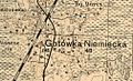 Gotówka na mapie Wojskowego Instytutu Geograficznego z 1931 r..jpg 1,008 × 612; 155 KB
-

-
 Gulczewo 1838.jpg 2,168 × 1,436; 1.33 MB
-
 Herkules Kopalnia mapa - wycinek z 1915 roku.JPG 995 × 721; 238 KB
-
-

-
 Hniszów na mapie D. G. Reymanna (ok. poł. XIX w.).jpg 810 × 477; 100 KB
-
 II. Rákóczi Ferencz (1907) (14593950970).jpg 2,928 × 2,344; 2.24 MB
-
 Ilowa i Rudnia na mapie Rosji Zachodniej z 1915 roku.jpg 967 × 588; 175 KB
-
 Ilowa Rudnia okolo 1887.jpg 1,553 × 846; 354 KB
-

-
 Image from page 972 of "Budushchaia vona v' tekhnicheskom" (1898) (14598563158).jpg 2,512 × 1,556; 514 KB
-
 Image from page 986 of "Budushchaia vona v' tekhnicheskom" (1898) (14784850142).jpg 3,856 × 2,886; 1.66 MB
-
 Image from page 992 of "Budushchaia vona v' tekhnicheskom" (1898) (14598564458).jpg 3,824 × 2,578; 1.9 MB
-
 Img154 - Kopia (2) - Kopia.jpg 1,746 × 1,169; 1.49 MB
-
 Imielin na mapie Śląska z 1799 roku.png 759 × 491; 820 KB
-
 Iłowa na mapie topograficznej Krolestwa Polskiego 1839. (2)jpg.jpg 639 × 404; 94 KB
-
 Jazikow na mapie Wojskowego Instytutu Geograficznego z 1931 r..jpg 738 × 338; 55 KB
-
 John III Sobieski's trip to Tatar forces.jpg 793 × 640; 124 KB
-
 Julianow 1921.png 1,422 × 1,318; 3.66 MB
-
 Julianów 1923.png 1,003 × 786; 2.09 MB
-

-
 Karolinów na mapie Wojskowego Instytutu Geograficznego z 1931 r..jpg 1,346 × 736; 250 KB
-
 Karpicko 1902.jpg 553 × 477; 164 KB
-
 Karpitzko-Seeberg 1940.jpg 2,353 × 1,757; 1.86 MB
-
 Karta över del av Polen. Del av Östersjön. Omkring 1600-1620 - Skoklosters slott - 97991.tif 4,122 × 3,509, 2 pages; 41.4 MB
-
 Karta över Polen, 1662.PB hist.288 - Skoklosters slott - 87581.tif 4,936 × 3,544; 100.16 MB
-
 Karte der Kolonie Tauenzinow um 1773.png 802 × 403; 370 KB
-
 Karte der Woiwodschaften Podolien und Brazlaw 1789.png 1,506 × 1,112; 3.87 MB
-
 Karte des Deutschen Reiches von 1893 Kaiserkanal.jpg 7,904 × 4,377; 8.64 MB
-
 Karte des Marcus Beneventanus, 1507.jpg 800 × 582; 199 KB
-
 Karte von Polen und den angränzenden Provinzen - Zusatz.jpg 2,623 × 3,623; 1.38 MB
-
 Karte von Polen und den angränzenden Provinzen 01.jpg 5,572 × 4,568; 7.27 MB
-
 Karte von Polen und den angränzenden Provinzen 03.jpg 5,533 × 4,586; 7.11 MB
-
 Karte von Polen und den angränzenden Provinzen 04.jpg 5,430 × 4,534; 4.74 MB
-
 Karte von Polen und den angränzenden Provinzen 05.jpg 5,575 × 4,620; 6.8 MB
-
 Karte von Polen und den angränzenden Provinzen 06.jpg 5,658 × 4,664; 7.41 MB
-
 Karte von Polen und den angränzenden Provinzen 07.jpg 5,651 × 4,649; 7.26 MB
-
 Karte von Polen und den angränzenden Provinzen 08.jpg 5,563 × 4,620; 5.81 MB
-
 Karte von Polen und den angränzenden Provinzen 09.jpg 5,602 × 4,613; 7.48 MB
-
 Karte von Polen und den angränzenden Provinzen 10.jpg 5,608 × 4,602; 7.58 MB
-
 Karte von Polen und den angränzenden Provinzen 11.jpg 5,677 × 4,638; 6.83 MB
-
 Karte von Polen und den angränzenden Provinzen 12.jpg 5,593 × 4,618; 5.85 MB
-
 Karte von Polen und den angränzenden Provinzen 13.jpg 5,597 × 4,626; 5.52 MB
-
 Karte von Polen und den angränzenden Provinzen 14.jpg 5,605 × 4,622; 5.75 MB
-
 Karte von Polen und den angränzenden Provinzen 15.jpg 5,543 × 4,615; 6.45 MB
-
 Karte von Polen und den angränzenden Provinzen 16.jpg 5,579 × 4,585; 6.09 MB
-
 Karte Von Polen.jpg 12,177 × 9,027; 17.16 MB
-
 Karte zur Schlacht bei Kunersdorf (12.08.1759).jpg 368 × 334; 55 KB
-
 Konkolewo Hauland.png 294 × 294; 154 KB
-

-
 Kreis Kamin 1772.jpg 1,063 × 1,069; 468 KB
-
 Kreis Konitz bis 1818.jpg 1,609 × 1,175; 721 KB
-
 Kreis Lauenburg-Bütow 1794.jpg 797 × 1,432; 546 KB
-
 Kręgi and neighbourhood.png 1,566 × 988; 3.06 MB
-
 Ks.swidnickie,mapa.jpg 802 × 759; 265 KB
-

-
 Lamsdorf1930's-Uebungsplatz&Lager 1870-1946.jpg 702 × 600; 255 KB
-
 Lancuchowka1852.jpg 847 × 804; 330 KB
-
 Land given up to Silesian dukes (Dr. T. Szulc).jpg 1,266 × 779; 218 KB
-
 Lange diercke sachsen deutschland dichte der bevoelkerung.jpg 1,248 × 1,054; 570 KB
-
 1779 schoneberg-map1.jpg 1,000 × 1,282; 444 KB
-
 Lesniczowka na mapie topograficznej Królestwa Polskiego z 1839 r..jpg 689 × 399; 173 KB
-
-
 Leśniczówka na mapie D.G. Reymanna, XIX w..jpg 718 × 445; 105 KB
-
 Leśniczówka na mapie Wojskowego Instytutu Geograficznego z 1931 r..jpg 1,059 × 714; 208 KB
-
 Charte vom Königlich Preussischen Regierungsbezirk Liegnitz.jpg 1,423 × 1,600; 948 KB
-
 London-geographical-institute the-peoples-atlas 1920 russian-battlefronts.jpg 3,012 × 3,992; 1.97 MB
-
 Lublin województwo mapa Juliusz Kolberg.jpg 834 × 626; 225 KB
-
 Lukowek Josephnische landesaufnahme.jpg 1,066 × 446; 103 KB
-
 Manöver am 17ten September 1835 2.jpg 6,635 × 8,342; 11.55 MB
-
 Map - Special Collections University of Amsterdam - OTM- HB-KZL 31-08-64.tif 7,216 × 6,057; 125.05 MB
-
 Map - Special Collections University of Amsterdam - OTM- HB-KZL 34.13.10.tif 9,052 × 6,939; 179.71 MB
-
 Map of Poland in 1791 by Reilly 039.jpg 1,191 × 882; 523 KB
-
 Map of Poland in 1791 by Reilly 040.jpg 1,191 × 887; 494 KB
-
 Map of Poland in 1791 by Reilly 041.jpg 1,181 × 892; 516 KB
-
 Map of Poland in 1791 by Reilly 042.jpg 1,206 × 907; 519 KB
-
 Map of Poland in 1791 by Reilly 043.jpg 1,171 × 867; 434 KB
-
 Map of Poland in 1791 by Reilly 044.jpg 1,171 × 882; 512 KB
-
 Map of Poland in 1791 by Reilly 045.jpg 1,186 × 882; 476 KB
-
 Map of Poland in 1791 by Reilly 046.jpg 1,206 × 1,017; 542 KB
-
 Map of the Kingdom of Poland - and the Grand Dutchy of Lithuania LOC 2009579472.jpg 7,417 × 5,987; 6.18 MB
-
 Map of the Kingdom of Poland - and the Grand Dutchy of Lithuania LOC 2009579472.tif 7,417 × 5,987; 127.05 MB
-
 Map of the Kingdom of Poland - and the Grand Dutchy of Lithuania LOC 2009579473.jpg 7,521 × 6,064; 6.34 MB
-
 Map of the Kingdom of Poland - and the Grand Dutchy of Lithuania LOC 2009579473.tif 7,521 × 6,064; 130.48 MB
-

-
 Mapa 2 paktu Ribbentrop-Mołotow.gif 510 × 708; 22 KB
-
 Mapa lasów klucza nieporęckiego - fragment.jpg 885 × 639; 259 KB
-
 Mapa odręczna.jpg 4,221 × 2,931; 14.56 MB
-
 Mapa Paktu R M Izwiestia-18.09.1939.jpg 963 × 861; 360 KB
-
 Mapa wielkiego stwolna.jpg 300 × 367; 60 KB
-
 Mappa Geographica Regni Poloniae.jpg 6,528 × 5,878; 13.77 MB
-
 Marynin na mapie Wojskowego Instytutu Geograficznego z 1931 r..jpg 715 × 525; 96 KB
-
 Marysin na mapie Wojskowego Instytutu Geograficznego z 1933 r..jpg 752 × 510; 98 KB
-
 Mazowsze voivodship in 1827 (western part).JPG 2,338 × 3,400; 2.93 MB
-
 Mazowsze voivodship in 1827.JPG 2,338 × 3,400; 2.76 MB
-
 Mediaeval and modern history (1905) (14801242663).jpg 1,860 × 2,946; 645 KB
-
 MERCATOR G HONDIUS J Lithuania Amsterdam 1634.JPG 571 × 415; 51 KB
-
 Messtischblatt 2056 - Stuchowo 1947.jpg 5,711 × 6,312; 13.34 MB
-
 Messtischblatt 688 - Greifenberg 1890-1929.jpg 5,760 × 6,287; 12.25 MB
-
 Messtischblatt 772 Plenzeiger 1891-1929 - Gülzow.jpg 6,640 × 6,994; 14.83 MB
-
 Mikorzyn mapa.jpg 997 × 594; 189 KB
-
 Miłosław na mapie Wojskowego Instytutu Geograficznego z 1931 r..jpg 686 × 399; 60 KB
-
 Mlawa - 38-53.jpg 3,079 × 5,022; 3.11 MB
-
 Molotov-Ribbentrop Pact showing the new German-Soviet border Sept 28 1939.png 1,505 × 1,999; 630 KB
-
 Nadberezyncy.jpg 3,912 × 4,136; 10.63 MB
-
 Nadberezyncy2.jpg 1,305 × 1,033; 946 KB
-
 Nagy Lajos királyságai.JPG 541 × 616; 95 KB
-

-

-
 Nuremberg chronicles - map 2.png 2,199 × 1,538; 7.59 MB
-

-
 Poland (NYPL b14428893-1503433).jpg 6,299 × 5,248; 6.93 MB
-
 Poland (NYPL b14428893-1503433).tiff 6,299 × 5,248; 94.6 MB
-
 Poland (NYPL b15373374-1505135).tiff 4,536 × 6,299; 81.77 MB
-
 Poland (NYPL b15376638-1404030).tiff 6,300 × 5,248; 94.61 MB
-
 Okolica Warszawy w diametrze pięciu mil - 2.jpg 7,497 × 7,651; 20.56 MB
-
 Okolice Starego Dworu.jpg 1,024 × 760; 335 KB


_Stadt_Sanok_in_Galizien_Sanoker_Kreis_(cropped).png)


_Trepcza_-_Horodyszcze_am_Sann.JPG)


_-_Geographicus_-_UpperSaxony-cary-1799.jpg)
_PLAN_VON_DER_SCHLACHT_BEI_GROCHOW_1831.jpg)
_Map_of_Poland_(physical).jpg)

_p079_Poland,_Warsaw_(I).jpg)
_Miedzybrodz_am_San,_Sanok.JPG)
.jpg)
_Miedzybrodzie_am_San.JPG)
_Trepcza_-_Horodyszcze_am_San.JPG)
%27_(11093895234).jpg)
.jpg)
%27_(11053286765).jpg)
.jpg)
.jpg)
%27_(11176611086).jpg)
_(14598336527).jpg)
_(14784851695).jpg)


_(14780785062).jpg)
_(14784202522).jpg)


.jpg)


.JPG)
_und_Chotyn_(%D0%A5%D0%BE%D1%82%D0%B8%D0%BD).jpg)
_und_Nemyriw_(%D0%9D%D0%B5%D0%BC%D0%B8%D1%80%D1%96%D0%B2)_bei_Brazlaw_(%D0%91%D1%80%D0%B0%D1%86%D0%BB%D0%B0%D0%B2).jpg)


.jpg)


_na_mapie_administracyjnej_RP_z_1936_r..jpg)


.jpg)
_(14593950970).jpg)


_(14598563158).jpg)
_(14784850142).jpg)
_(14598564458).jpg)
_-_Kopia.jpg)

jpg.jpg)


,_BI-B-FM-090-82.jpg)


.jpg)


.jpg)


.png)


.JPG)

_(14801242663).jpg)


.jpg)
.jpg)

