Category:Maps of the history of Poland
Jump to navigation
Jump to search
Wikimedia list article | |||||
| Upload media | |||||
| Instance of | |||||
|---|---|---|---|---|---|
| Location |
| ||||
| |||||
Subcategories
This category has the following 27 subcategories, out of 27 total.
1
A
- Maps of the Antes (9 F)
F
G
H
M
- Military maps of Poland (38 F)
O
P
S
T
W
- Maps of the White Croatia (24 F)
- Maps of White Serbia (28 F)
Media in category "Maps of the history of Poland"
The following 177 files are in this category, out of 177 total.
-
Polen und Litauen 1125 bis zu ihrer Vereinigung 1386.jpg 5,008 × 3,499; 12.54 MB
-
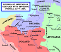
Polish and Lithuanian Conflict with Prussia. 1377-1435..png 968 × 834; 182 KB
-
Poland Lithuania Commonwealth map.jpg 606 × 463; 65 KB
-
Poland under Jagello.jpg 592 × 491; 321 KB
-
Teutonic Order 1466.png 1,200 × 1,043; 744 KB
-
Toeppen Preussen 1525.jpg 6,834 × 5,513; 4.52 MB
-
Polen nach der Lubliner Union.jpg 604 × 520; 116 KB
-
Polska i Litwa w 15. wieku.jpg 2,918 × 2,304; 1.52 MB
-
16-17世紀波蘭.png 300 × 235; 69 KB
-
Polen in den Grenzen vor 1660.jpg 731 × 561; 409 KB
-
Rzeczpospolita po I rozbiorze.png 1,590 × 1,568; 97 KB
-
1611duchyofwarsaw.jpg 565 × 970; 115 KB
-
Battles of January Uprising in Lithuania, Belarus and Ukraine.JPG 5,020 × 6,902; 3.73 MB
-
Pomorski Inspektorat Okręgowy Straży Granicznej.jpg 1,089 × 870; 83 KB
-
1DP Królestwa Polskiego 02-12-1830.jpg 1,592 × 908; 1.52 MB
-
1st Polish Commonwealth at its greatest extent.png 1,024 × 1,038; 200 KB
-
Accordo di Monaco.png 2,253 × 1,961; 73 KB
-
Amount of all taxes per Voivodeship of Polish-Lithuanian Commonwealth in 1790.PNG 2,981 × 3,103; 1.75 MB
-
Amount of the Tenth Grosz Contribution in the Polish-Lithuanian Commonwealth in 1790.PNG 2,981 × 3,103; 1.67 MB
-
Antes01.png 1,243 × 966; 54 KB
-
Antes02.png 1,243 × 966; 54 KB
-
Baltic Sea Borderlines 1939 german-it.png 2,528 × 1,965; 458 KB
-
Civitas Schinesghe Strzelczyk.jpg 667 × 637; 50 KB
-
CongressPoland1914Map.png 2,125 × 2,524; 1.13 MB
-
CongressPoland1914MapPOL.png 2,125 × 2,524; 1.15 MB
-
Conséquences territoriales du traité de Vienne (1738).png 2,012 × 1,761; 222 KB
-
Eslaus Occidentaus - Sègles IX-X.png 898 × 710; 218 KB
-
European Region of Poland.jpg 907 × 560; 103 KB
-
Europejski Region Polski.jpg 907 × 560; 106 KB
-
Galiz20.gif 275 × 264; 8 KB
-
Galician russian governorate ww1.png 598 × 450; 60 KB
-
GermanHamletsSince15th.jpg 2,797 × 2,095; 1,020 KB
-
Goths4.PNG 777 × 471; 25 KB
-
Greater austria.png 1,500 × 1,280; 45 KB
-
Vereinigte Staaten von Groß-Österreich.png 1,500 × 1,280; 192 KB
-
대 오스트리아.png 1,500 × 1,280; 64 KB
-
Greater austriaPL.png 1,500 × 1,280; 74 KB
-
Grody w okresie Mieszka I.png 1,600 × 1,529; 707 KB
-
Grodzisko Waćmierek.jpg 960 × 540; 35 KB
-
Herzogtum-Warschau.png 2,303 × 2,539; 1.45 MB
-
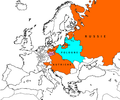
Intermarium.png 997 × 742; 128 KB
-
K0nigl+herzoglPreussen-2009-25-12.png 1,924 × 1,423; 983 KB
-
K0nigl+herzoglPreussen.png 1,036 × 756; 42 KB
-
Kampi.PNG 960 × 926; 144 KB
-
KARTE DER DEUTSCHEN SIEDLUNGEN IN MITTELPOLEN UM KALISCH 1938.jpg 3,132 × 3,304; 1.37 MB
-
KARTE DER DEUTSCHEN SIEDLUNGEN IN MITTELPOLEN UM LODZ 1938.jpg 5,362 × 3,597; 2.83 MB
-
Karte kongresspolen.png 896 × 766; 621 KB
-
Karte Polen (1945).png 533 × 513; 54 KB
-
Karte viertepolnischeteilung.png 1,344 × 1,149; 586 KB
-
KholmGovernorate1913Map.png 633 × 1,058; 144 KB
-
KholmGovernorate1913MapPOL.png 633 × 1,058; 150 KB
-
Kingdom of Galicia Volhynia Rus' Ukraine 1245 1349.jpg 2,301 × 2,856; 5.18 MB
-
Krainy-historyczne-Polski-na-terenie-woj.-lubuskiego.png 1,241 × 1,509; 1.5 MB
-
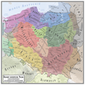
Krainy-historyczne-Polski.png 4,961 × 4,961; 13.65 MB
-
Krainy-historyczne-Polski1.png 4,961 × 4,961; 13.63 MB
-
Krainy-historyczne-WojŚl.png 948 × 1,296; 906 KB
-
Kresy Zachodnie (1900).png 349 × 464; 18 KB
-
Krolpolskie1918kzo.png 782 × 736; 33 KB
-
Księstwo siewierskie w drugiej połowie XVI wieku.jpg 1,536 × 1,418; 278 KB
-
Polen - historisches Kujawien, heutige Verwaltungsgrenzen.png 1,551 × 1,432; 1.29 MB
-
Kultura komornicka.jpg 746 × 536; 352 KB
-
Kultura zlocka mapa.jpg 373 × 370; 37 KB
-
Kurgan kultur.png 440 × 364; 272 KB
-
Kurt Lück German Settlements in Lublin-Chełm area.jpg 1,217 × 960; 173 KB
-
La Pologne-Lituanie face à la Russie, la Prusse & l'Autriche.png 1,962 × 1,631; 98 KB
-
Lemko Republic.png 940 × 421; 45 KB
-
Lemko.PNG 320 × 320; 139 KB
-
Lengyelorszag Vitez Boleszlav koraban.png 534 × 531; 127 KB
-
Linie A-F ang.png 1,000 × 1,100; 254 KB
-
Linie A-F pol.png 1,000 × 1,100; 252 KB
-
List of wars involving Poland since 1990.png 2,000 × 1,015; 236 KB
-
Map of Poland (1945) rus.png 527 × 509; 9 KB
-
Mapa Hermannshwalde 1938 r.png 3,024 × 3,024; 349 KB
-
Mapa Klucza Kobylańskiego 1.jpg 2,530 × 3,090; 1.43 MB
-
Mapa Klucza Kobylańskiego 2.jpg 2,530 × 3,090; 1.42 MB
-
Mazowsze w.png 3,130 × 3,071; 976 KB
-
Mazowsze-ru.png 1,800 × 1,766; 814 KB
-
Mazowsze.png 3,130 × 3,071; 912 KB
-
Mazowsze1381.png 3,130 × 3,071; 910 KB
-
Meyers b13 s0173a.jpg 2,048 × 1,718; 713 KB
-
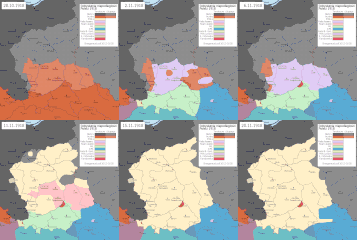
Niepodległość Polski dzień po dniu.gif 678 × 681; 67 KB
-
Number of inhabitants of the Polish-Lithuanian Commonwealth per voivodeship in 1790.png 2,981 × 3,103; 1.47 MB
-
OberOstMap-fr.png 1,196 × 2,000; 551 KB
-
OberOstMap.png 1,196 × 2,000; 609 KB
-
Oberschlesien 1921 Voten.png 411 × 323; 13 KB
-
Oberschlesien 1921.png 411 × 323; 13 KB
-
Oksywie Wielbark Przeworsk.gif 830 × 626; 21 KB
-
Osadnictwo i podboje niemieckie do 1300.gif 488 × 506; 10 KB
-
Osadnictwo i podboje niemieckie na wschodzie do 1400.png 1,012 × 872; 58 KB
-
Partition of Ukraine after the Truce of Andrusovo (1667).jpg 1,040 × 753; 174 KB
-
PL Szlak Bojowy 13 Samodzielnego Batalionu Saperów 1944-48.jpg 2,480 × 2,187; 483 KB
-
Plebiscyt na Górnym Śląsku-mapa.gif 815 × 807; 31 KB
-
Plemiona polskie.png 2,250 × 1,854; 640 KB
-
PLLLLL.png 1,024 × 1,038; 149 KB
-
PNG Grande Pologne.png 2,341 × 2,048; 271 KB
-
PNG Jagelon.png 1,268 × 1,054; 90 KB
-
Pocutia.png 2,192 × 1,519; 191 KB
-
Podział administracyjny województwa sandomierskiego.png 606 × 677; 74 KB
-
Podział terytorialny Rzeczypospolitej 1863.png 2,347 × 2,104; 1.59 MB
-
Polabian.png 536 × 617; 35 KB
-
Poland 1939.xcf 883 × 933; 783 KB
-
Polen im Jahr 1333 und Nachbarn.jpg 667 × 501; 379 KB
-
Polen Litauen.png 1,344 × 1,149; 550 KB
-
Polen-Karte-Heute-300x296.png 300 × 296; 122 KB
-
Polen960.png 520 × 513; 270 KB
-
Poleshuks.png 4,000 × 4,286; 238 KB
-
Polonha - Grand Ducat de Varsòvia.png 1,116 × 962; 193 KB
-
Polonha - Sègle XVII.png 1,209 × 1,047; 431 KB
-
POLSKA 01-04-1945.png 701 × 667; 182 KB
-
POLSKA 07-04-1945.png 701 × 667; 186 KB
-
POLSKA 09-08-1945.png 701 × 667; 185 KB
-
Polska 1370 - 1382.png 2,636 × 2,507; 1.94 MB
-
Polska 1386 - 1434a.png 2,977 × 2,929; 2.03 MB
-
POLSKA 14-03-1945.png 701 × 667; 180 KB
-
POLSKA 18-08-1945.png 701 × 667; 186 KB
-
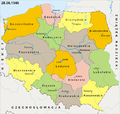
POLSKA 20-09-1944.png 701 × 667; 179 KB
-
POLSKA 28-06-1946.png 701 × 667; 190 KB
-
Polska dzis a kiedys.png 1,164 × 1,280; 257 KB
-
POLSKA-PODZIAŁ ADMINISTRACYJNY 25-09-1945.png 701 × 667; 188 KB
-
Polska22 wolynskie.jpg 244 × 267; 12 KB
-
Pomeraniamap.png 501 × 361; 12 KB
-
Pommerellen 1125 - 1386.jpg 1,818 × 1,152; 1.75 MB
-
Pommerellen Slavische Völker bis 1125.jpg 1,750 × 1,152; 1.59 MB
-
Pomorze 1244-1249.gif 800 × 913; 140 KB
-
Population density per voivodeships in the Polish-Lithuanian Commonwealth in 1790 1.PNG 2,946 × 3,060; 1.66 MB
-
Population density per voivodeships in the Polish-Lithuanian Commonwealth in 1790.PNG 2,981 × 3,103; 1.47 MB
-
Power grid of Eastern Prussia before 1945.png 878 × 713; 57 KB
-
Power grid of Poland 1939--1947.png 3,952 × 3,600; 326 KB
-
Preussen1410.png 502 × 430; 20 KB
-
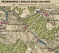
Przewodowice 1820 r..jpg 1,126 × 1,020; 1.41 MB
-
Przeworsk-kultúra.png 777 × 471; 36 KB
-
Przeworsk2.PNG 777 × 471; 26 KB
-
Rawskie.png 3,118 × 3,071; 995 KB
-
RBOostP1878.png 423 × 350; 12 KB
-
RegionyHistPolski.png 1,215 × 1,298; 472 KB
-
Republika-Tarnobrzeska.png 926 × 900; 162 KB
-
Riese.svg 941 × 454; 36 KB
-
Right-Bank Ukraine.png 632 × 322; 55 KB
-
Rus de Kiev-1237.png 552 × 599; 343 KB
-
Russian map of Poland in 1806-07.jpg 1,523 × 1,763; 268 KB
-
Rzeczpospolita 1922.xcf 2,000 × 1,534; 6.37 MB
-
Rzeczpospolita 1937 noname noriver.png 768 × 996; 123 KB
-
Rzeczpospolita.xcf 2,000 × 1,568; 7.36 MB
-
Spruner-Menke Handatlas 1880 Karte 71.jpg 3,487 × 2,890; 1.21 MB
-
Sytuacja wyznaniowa w I Rzeczypospolitej w XVI wieku przed zawarciem unii brzeskiej.png 1,259 × 1,050; 1,011 KB
-
Territorial changes of Poland 1920c.jpg 850 × 700; 214 KB
-
Territorial changes of Poland 1938b.jpg 850 × 700; 206 KB
-
Territorial changes of Poland 1940.jpg 850 × 700; 147 KB
-
Territorial changes of Poland 1942.jpg 850 × 700; 188 KB
-
Toeppen Preussen in der heidnischen Zeit.jpg 6,855 × 5,568; 3.77 MB
-
Toeppen Preussen und Nachbarlaender.jpg 6,916 × 5,627; 4.25 MB
-
Ukrainians in Poland 2002.PNG 1,281 × 878; 95 KB
-
Unemployment rate in Pomeranian Voivodeship End of 2006.png 1,636 × 1,432; 221 KB
-
West slavs 9th-10th c it.png 876 × 723; 392 KB
-
West slavs 9th-10th c..png 876 × 723; 419 KB
-
White serbia white croatia01.png 870 × 966; 49 KB
-
White serbia white croatia02.png 870 × 966; 48 KB
-
Wojewodztwo nowogrodzkie (Nowogrodek Voivodeship, II Rzeczpospolita).png 5,019 × 4,939; 4.39 MB
-
Wojna Polsko-Niemiecka 1109.png 1,170 × 953; 392 KB
-
WojnaPolskoNiemiecka11092CZ.png 1,170 × 953; 384 KB
-
Zabory na gminach.png 2,041 × 1,895; 302 KB
-
Zaolzie.jpg 247 × 423; 27 KB
-
Zarząd Cywilny Ziem Wołynia i Frontu Podolskiego.png 1,823 × 2,001; 362 KB
-
Zarząd Cywilny Ziem Wschodnich.png 2,367 × 2,735; 626 KB
-
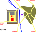
ZielGora-1400.png 1,684 × 1,488; 60 KB
-
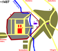
ZielGora-1487.png 1,684 × 1,488; 70 KB
-
Ziemia łukowska 1620.png 5,000 × 5,000; 5.05 MB
-
Západní Slované 9.-10. st.png 876 × 723; 489 KB
-
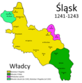
Śląsk 1241-1243.png 1,000 × 1,015; 146 KB
-
Славянские-племена-Силезии-и-их-соседи.png 700 × 864; 369 KB


