Category:Old maps of Serbia
Jump to navigation
Jump to search
Use the appropriate category for maps showing all or a large part of Serbia. See subcategories for smaller areas:
| If the map shows | Category to use |
|---|---|
| Serbia on a recently created map | Category:Maps of Serbia or its subcategories |
| Serbia on a map created more than 70 years ago | Category:Old maps of Serbia or its subcategories |
| the history of Serbia on a recently created map | Category:Maps of the history of Serbia or its subcategories |
| the history of Serbia on a map created more than 70 years ago | Category:Old maps of the history of Serbia or its subcategories |
Subcategories
This category has the following 14 subcategories, out of 14 total.
Media in category "Old maps of Serbia"
The following 24 files are in this category, out of 24 total.
-
 Constantinople conference west.jpg 2,000 × 3,804; 1.88 MB
-
 32-Rumänien und Nachbargebiete (1916).png 9,917 × 12,437; 192.79 MB
-

-
 Aleksinac. NYPL1227007.tiff 4,376 × 5,139; 64.35 MB
-

-
 Austohungarianserbiamontenegrooccupationzonesww1.jpg 1,808 × 1,397; 1.98 MB
-
 Bacs-Bodrog county map.jpg 1,697 × 2,125; 889 KB
-
 Balkans in 1350 according to Gustav Droysen from 19th century.jpg 1,367 × 1,268; 546 KB
-
 Cacak. NYPL1226992.tiff 4,320 × 5,147; 63.62 MB
-

-
 EB1911 Servia.jpg 1,169 × 1,104; 695 KB
-
 Ivanjica. NYPL1227004.tiff 4,360 × 5,195; 64.81 MB
-
 Meyers b9 s0067a.jpg 1,636 × 2,048; 518 KB
-
 Nis. NYPL1227016.tiff 4,376 × 5,179; 64.85 MB
-
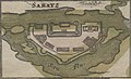
 SanStefano2.jpg 1,002 × 768; 41 KB
-
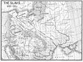 Slavic peoples 9c map.jpg 776 × 583; 144 KB
-
 Topo karta generalstab AR.jpg 5,199 × 4,486; 5.41 MB
-
 Topo karta generalstab GM.jpg 5,223 × 4,486; 4.51 MB
-
 Topo karta generalstab RA.jpg 5,199 × 4,470; 4.38 MB
-
 Valjevo. NYPL1226962.tiff 5,235 × 4,360; 65.34 MB
-
 Zagubica. NYPL1226980.tiff 4,360 × 5,115; 63.81 MB
-
 Zvornik. NYPL1226960.tiff 4,360 × 5,235; 65.31 MB
-
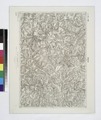
 Srbija - opis zemlje, naroda i drzave 1887 (143618680).jpg 7,936 × 6,940; 42.48 MB
-
 Šabac BV044698779.jpg 1,140 × 692; 512 KB

.png)
%27_(11286423506).jpg)
_(14593308328).jpg)


_(cropped).jpg)


.jpg)
