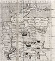
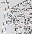
Category:Ptolemy's 4th European Map
Jump to navigation
Jump to search
Subcategories
This category has only the following subcategory.
C
Media in category "Ptolemy's 4th European Map"
The following 43 files are in this category, out of 43 total.
-
Map after Ptolemy's Geographia (Burney MS 111, f.28r).jpeg 5,207 × 6,832; 43.63 MB
-
Claudii Ptolomei Cosmographie IV.jpg 939 × 654; 579 KB
-
Ptolemy Cosmographia 1467 - Germany.jpg 1,140 × 1,042; 1.17 MB
-
Bodleian Libraries, Netherlands, Germany and Denmark.jpg 1,000 × 675; 103 KB
-
Quarta Europe Tabula.jpg 3,231 × 2,133; 1.03 MB
-
Tabula Quarta dEuropa.jpg 638 × 700; 137 KB
-
Quarta Europe Tabula (1490).jpg 720 × 536; 279 KB
-
Quarta Europae tabula (7537878198).jpg 2,000 × 1,518; 2.84 MB
-
1511 Claudii Ptholemaei FLEVVM.jpg 1,041 × 1,085; 725 KB
-
Quarta Europae Tabula.jpg 1,976 × 1,500; 640 KB
-
1513 Quarta Europae Tabula FLEVVM.jpg 554 × 405; 295 KB
-
Deutschlandkarte aus der Ausgabe der Cosmographia von 1538.jpg 1,543 × 1,325; 962 KB
-
Geographiae Claudii Ptolemaei Alexandrini (Münster, 1552) 09.jpg 10,475 × 6,567; 6 MB
-
Tabula Europae IV (Germany).jpg 800 × 600; 141 KB
-
Germaniae Magnae Tabula ex Mente Ptolemei.jpg 1,157 × 1,389; 494 KB
-
1700 New Map Ancient Germany FLEVVM.jpg 881 × 642; 448 KB
-
Karta på "Octava Tabula Europe" och "Qvarta Europae Tabula", 1750-tal - Skoklosters slott - 99655.tif 4,417 × 3,453, 2 pages; 43.66 MB
-
Germania Magna nach Ptolemaeus.jpg 666 × 748; 178 KB
-
Claudii Ptolemaei Tabulae geographicae Orbis Terrarum veteribus cogniti (1704) 28.jpg 9,897 × 7,334; 6.13 MB
-
Europ. IIII tab. - btv1b532386267 (2 of 3).jpg 11,241 × 8,505; 14.42 MB
-
Europae Tabula IIII - Germania magna - (Ptolémée) - btv1b5963809q (1 of 2).jpg 6,040 × 4,288; 3.28 MB
-
Europae Tabula IIII - Germania magna - (Ptolémée) - btv1b5963809q (2 of 2).jpg 6,008 × 3,976; 3.61 MB
-
Europae, IV tabula - continet Germaniam magnam - btv1b84908180 (1 of 2).jpg 6,683 × 5,663; 6.58 MB
-
Europae, IV tabula - continet Germaniam magnam - btv1b84908180 (2 of 2).jpg 6,660 × 5,639; 4.52 MB
-
Europe IV germany.jpg 1,600 × 1,200; 327 KB
-
Mercator's Orbis Antiqui Tabulae Geographicae Secundum Cl. Ptolemaeum (1730) 26.jpg 6,636 × 5,197; 4.5 MB
-
Ptolemy, QUARTA EUROPE TABULA (FL147394293 2566739).jpg 4,547 × 3,311; 13.8 MB
-
Ptolemy, Tabula Europae IIII (FL155329330 2608532).jpg 7,120 × 4,995; 38.67 MB
-
Quarta Europe Tabula - Rome Edition.jpg 11,936 × 9,507; 14.18 MB
-
Tab. IV Europae Germaniam et Galliam Belgicam Exhibens.jpg 10,862 × 9,446; 17.95 MB
-
Claudii Ptolemaei Tabulae geographicaei 1695 (102835503).jpg 14,531 × 10,350; 24.24 MB
Categories:
- Ptolemy's European maps
- Old maps of Denmark
- Poland in the 2nd century
- Podkarpackie in the 2nd century
- Pomerania in the 2nd century
- Maps of Vistula
- Maps of San
- Maps of the history of Denmark
- Maps of the history of Poland
- Ptolemaic Germany
- Old maps of Poland
- Old maps of Czechia
- Old maps of Austria
- Old maps of the Holy Roman Empire
- Maps of Germania magna


