Category:Old maps of the Polish-Lithuanian Commonwealth
Jump to navigation
Jump to search
Subcategories
This category has the following 6 subcategories, out of 6 total.
C
Media in category "Old maps of the Polish-Lithuanian Commonwealth"
The following 169 files are in this category, out of 169 total.
-
Poland Lithuania Commonwealth map.jpg 606 × 463; 65 KB
-
Wschod rzeczpospolita.jpg 4,500 × 5,296; 2.34 MB
-
Poloniae et Ungariae zMünstera.jpg 2,328 × 1,840; 1.49 MB
-
Map of Poland and Lithuania after the Union of Lublin (1569).jpg 1,660 × 1,027; 984 KB
-
Poland 1569 map.jpg 812 × 641; 109 KB
-
Polen nach der Lubliner Union.jpg 604 × 520; 116 KB
-
1570-Poloniae Lituaniae-Rus.jpg 5,252 × 4,156; 4.4 MB
-
Ortelius Lithuania.jpg 2,220 × 1,682; 822 KB
-
Vepriai old map.jpg 360 × 252; 88 KB
-
Kart425(0239).jpg 4,000 × 2,929; 1.72 MB
-
Poloniae desciptio 1592 Wenceslao Godreccio.png 3,750 × 2,830; 28.58 MB
-
CHODZKO(1861) CARTE DES ÉTATS DE LA REPUBLIQUE DE POLOGNE AUX XVI ET XVII SIECLES.jpg 3,167 × 3,953; 3.85 MB
-
Kyivstar vkraina 1613 1.jpg 4,000 × 4,155; 2.28 MB
-
Blaeu 1645 - Prussia.jpg 3,000 × 2,300; 2.23 MB
-
Polen in den Grenzen vor 1660.jpg 731 × 561; 409 KB
-
Kurlandyja-Žamojć. Курляндыя-Жамойць (1667).jpg 5,232 × 3,649; 2.67 MB
-
Tabula nova totius regni Poloniae Amsterdam, Visscher Nicolas (Amsterdam, 1690).jpg 5,531 × 4,263; 5.36 MB
-
Estats De La Couronne De Pologne.jpg 1,593 × 1,300; 3.07 MB
-
Poland and Lit.jpg 7,600 × 6,400; 79.72 MB
-
Poland and Lithuania - by Carolo Allard - 1696 AD.jpg 7,089 × 6,039; 11.16 MB
-
Regni Poloniae Magni Ducatus Lithuaniae Tabula Carolo Allard.jpg 2,093 × 1,792; 4.6 MB
-
Regni Poloniae Magni Ducatus Lithuaniae.jpg 7,600 × 6,400; 37.18 MB
-
Polen BV039925754.jpg 10,096 × 8,731; 10.87 MB
-
1700 Nicolás de Fer (París).jpg 1,500 × 2,304; 1.69 MB
-
Carte des Estats de Suede, de Dannemarq, et de Pologne; sur la Mer Baltique.jpg 2,882 × 3,576; 5.12 MB
-
Map - Special Collections University of Amsterdam - OTM- HB-KZL 31-09-10.tif 8,690 × 6,343; 157.7 MB
-
Poland und Moscovia Abrahamum Allard 1710.jpeg 6,282 × 3,988; 7.54 MB
-
Map of Poland, 1719.jpg 425 × 612; 90 KB
-
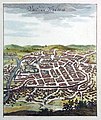
Vilnia. Вільня (1719).jpg 978 × 1,165; 346 KB
-
Ukraine-Russie.png 814 × 580; 1.19 MB
-
Map of Moscovy, Poland, Little Tartary, and ye Black Sea etc NYPL1630438.tiff 7,070 × 5,084; 102.84 MB
-
Poland1739old.jpg 1,668 × 1,457; 1.46 MB
-
Polen BV022294147.jpg 10,369 × 8,858; 11.91 MB
-
Regni map.jpg 750 × 647; 213 KB
-
Lithuanian language in European language map 1741.jpg 400 × 299; 77 KB
-
Polish-Lithuanian Commonwealth (Pologne) (Vaugondy, 1748).jpg 2,392 × 1,870; 1.28 MB
-
Partie Occidentale de la Russie Polonoise.jpg 1,142 × 785; 364 KB
-
Polish-Lithuanian Commonwealth (Pologne) (Vaugondy, 1749).jpg 3,493 × 3,042; 3.61 MB
-
1750 – G. R. Vaugondy – Pologne.jpg 2,169 × 2,113; 2.78 MB
-
Polish-Lithuanian Commonwealth (Pologne) (Vaugondy, 1750).jpg 2,306 × 2,064; 2.47 MB
-
Lithuania on John Cowley map, 1742.jpg 1,255 × 1,065; 420 KB
-
Polish-Lithuanian Commonwealth (Pologne) (Vaugondy, 1756).jpg 1,039 × 909; 401 KB
-
Tobias Mayer Carte de la Pologne 1757.jpg 1,789 × 1,570; 1.79 MB
-
Карта воеводств Речи Посполитой с гербами.jpg 1,119 × 1,200; 466 KB
-
Mayer - Les royaumes de Pologne et de Prusse.jpg 1,684 × 1,330; 2.48 MB
-
1771 Zannoni Map of Poland and Lithuania - Geographicus - Poland-zannoni-1771.jpg 3,000 × 2,025; 2.11 MB
-
Poland 1772 map.jpg 775 × 568; 117 KB
-
Poland partitions 1772.jpg 1,767 × 1,360; 448 KB
-
Polens första delning.jpg 764 × 721; 320 KB
-
Tobias Mayer Carte des États de la couronne de Pologne.jpg 1,024 × 835; 323 KB
-
Map of Lithuania in 1791 by Reilly 047.jpg 640 × 480; 144 KB
-
Map of Poland and Prussia in 1791 by Reilly 034.jpg 1,281 × 862; 506 KB
-
Polen-Litauen BV036731760.jpg 16,021 × 13,856; 30 MB
-
Polens andra delning.jpg 766 × 719; 321 KB
-
Polen bis zu seinem Untergang 1795.jpg 5,008 × 3,499; 12.16 MB
-
Polens tredje delning.jpg 755 × 723; 315 KB
-
Polen Litauen und Kurland im Jahr 1796.jpg 7,331 × 5,986; 13.85 MB
-
English map of Poland XVIII century.png 928 × 796; 1.7 MB
-
CHODZKO(1839) p123 CARTE GENERALE POLONAISE.jpg 2,879 × 3,561; 4.81 MB
-
Poland in 1770s-1790s (partitions).jpg 1,200 × 1,019; 147 KB
-
2013 The cellars of the castle in Tykocin (museum) - 07.jpg 4,000 × 3,000; 2.08 MB
-
2013 The cellars of the castle in Tykocin (museum) - 24.jpg 3,200 × 3,200; 1.75 MB
-
Carte topografique Palatinats de Gnesen, Inowrozlaw et Brzestz.jpg 3,609 × 3,049; 3.74 MB
-
Aršanski paviet. Аршанскі павет (1708).jpg 1,988 × 1,200; 438 KB
-
Beauplan Poland XVII map.jpg 6,674 × 5,244; 25.99 MB
-
Blaeu 1645 - Ducatus Silesiæ Glogani.jpg 3,720 × 3,120; 1.43 MB
-
Blaeu 1645 - Polonia Regnum et Silesia Ducatus.jpg 3,678 × 3,065; 1.45 MB
-
Busza-1648.jpg 400 × 292; 26 KB
-
Carte pour l´Intelligence de la Guerre de Pologne en 1831 (A. Zakrzewski, 1832).jpg 3,258 × 3,861; 3.62 MB
-
Cercle de Samland (D. Vaugondy, 1748).jpg 705 × 744; 402 KB
-
Drucak. Друцак (E. Danti, 1565).jpg 236 × 72; 13 KB
-
Drucak. Друцак (G. Mercator, 1554).jpg 236 × 219; 40 KB
-
Grodecki Poloniae finitimarumque.jpg 700 × 519; 84 KB
-
Howtwa-1650.png 1,594 × 1,399; 93 KB
-
Image-Prussia ethnicity.JPG 395 × 343; 30 KB
-
Inflanty-Kurlandyja-Žamojć. Інфлянты-Курляндыя-Жамойць (G. Delisle, 1711) (2).jpg 2,504 × 2,111; 8.3 MB
-
Inflanty-Kurlandyja-Žamojć. Інфлянты-Курляндыя-Жамойць (G. Delisle, 1711).jpg 4,959 × 4,228; 5.4 MB
-
Kingdom of Poland 1400.jpg 425 × 356; 56 KB
-
Kojdanaŭ. Койданаў (1751-1800).jpg 468 × 155; 48 KB
-
Kojdanaŭ. Койданаў (E. Danti, 1565).jpg 249 × 57; 11 KB
-
Kojdanaŭ. Койданаў (G. Mercator, 1554).jpg 254 × 72; 17 KB
-
Lithauen oder Weis Reussen.jpg 1,689 × 1,120; 1.12 MB
-
Litwa i Białoruś (J. Bazewicz, 1916).jpg 6,495 × 5,058; 29.82 MB
-
Map of Lithuania in 1791 by Reilly 048.jpg 640 × 480; 142 KB
-
Map of Lithuania in 1791 by Reilly 049.jpg 606 × 480; 121 KB
-
Map of Lithuania in 1791 by Reilly 050.jpg 1,276 × 1,037; 554 KB
-
Map of Poland and Lithuania in 1791 by Reilly 038.jpg 640 × 480; 161 KB
-
Map of Poland- Outlining Its Provinces and Voivodeships, 1772 WDL11294.pdf 2,883 × 3,750, 59 pages; 40.52 MB
-
Map of the partition of the Kingdom of Poland and the Grand Duchy of Lithuania from 1799.jpg 6,330 × 5,677; 6.83 MB
-
Mapa Europy Środkowej (J. Bazewicz, 1916).jpg 12,857 × 17,104; 46.58 MB
-
Mapa Polski (1920).jpg 2,049 × 2,676; 2.13 MB
-
Mazovian Voievodship in XVII century.PNG 834 × 702; 1.15 MB
-
Miensk. Менск (1751-1800).jpg 505 × 224; 48 KB
-
Miensk. Менск (E. Danti, 1565).jpg 261 × 78; 14 KB
-
Miensk. Менск (G. Gastaldi, 1562).jpg 244 × 144; 19 KB
-
Miensk. Менск (G. Gastaldi, 1568).jpg 501 × 195; 35 KB
-
Miensk. Менск (G. Mercator, 1554).jpg 273 × 126; 31 KB
-
Mienski paviet. Менскі павет (Vaugondy, 1756).jpg 231 × 190; 66 KB
-
PALATINATVS POSNANIENSIS, IN MAIORI POLONIA PRIMARII NOVA DELINEATIO.PNG 5,500 × 4,348; 41.82 MB
-
Part of map of Grand Dutchy of Lithuania including Samogitia, 1799.png 1,622 × 780; 2.82 MB
-
Poland - claims of the partitioners.jpg 897 × 754; 176 KB
-
Poland 1634-1660 map.jpg 695 × 600; 84 KB
-
Poland 1793 map.jpg 768 × 560; 100 KB
-
Poland 1795 map.jpg 777 × 571; 146 KB
-
Poland in 1570s-1580s (reign of Batory).jpg 1,200 × 1,027; 156 KB
-
Polen und Litauen unter den Jagiellonen 1386 - 1572.jpg 5,008 × 3,499; 11.92 MB
-
Polish-Lithuanian Commonwealth (Pohlen).jpg 3,868 × 2,919; 1.13 MB
-
Polish-Lithuanian Commonwealth (Pologne) (Vaugondy, 1767).jpg 18,496 × 13,439; 44.98 MB
-
Polish-Lithuanian Commonwealth (Polonia) (1770) (2).jpg 6,862 × 5,316; 9.44 MB
-
Polish-Lithuanian Commonwealth (Polonia) (1770).jpg 16,574 × 14,184; 37.68 MB
-
Polish-Lithuanian Commonwealth (Polonia) (G. Albrizzi, I. Tirion, 1740).jpg 3,000 × 2,567; 2.56 MB
-
Polish-Lithuanian Commonwealth (Poolen) (I. Tirion, 1733).jpg 1,071 × 900; 314 KB
-
Poloniae Amplissimi Regni Typus Geographicus.jpg 3,023 × 2,210; 2.52 MB
-
Poloniae et Ungariae Münstera.jpg 1,000 × 786; 324 KB
-
Poloniae, Litvaniaeq. descriptio (A. Ortelius, 1595).jpg 800 × 610; 280 KB
-
Pommerellen 1572 - 1795.jpg 1,962 × 1,324; 2.13 MB
-
Porazaŭ. Поразаў (E. Danti, 1565).jpg 238 × 81; 14 KB
-
Porazaŭ. Поразаў (G. Mercator, 1554).jpg 180 × 53; 10 KB
-
Počap. Почап (E. Danti, 1565).jpg 234 × 67; 12 KB
-
Počap. Почап (G. Mercator, 1554).jpg 192 × 107; 22 KB
-
Prefettura di Szamland (G. Vignola, 1689).jpg 3,283 × 2,522; 8.89 MB
-
Prussian Lithuania (A. Dury, 1763).jpg 1,374 × 1,675; 1.87 MB
-
Puck Bay in 1655.png 2,745 × 2,210; 4.3 MB
-
Rossya Południowo-Zachodnia (1904).jpg 14,028 × 11,559; 28.54 MB
-
Samagithia-Samatini-Samaiden (C. Vopel, 1566).jpg 919 × 730; 483 KB
-
Samaiten (1593).jpg 964 × 405; 664 KB
-
Samauin-Samaiden (H. Zell, 1542, 1573).jpg 1,731 × 770; 928 KB
-
Samland-Litauen (L. Euler, 1753).jpg 2,394 × 1,818; 3.83 MB
-
Samland-Samogitie-Semigallo (1768).jpg 1,112 × 720; 635 KB
-
Samogesthia-Samaitin-Samaiden (G. Gastaldi, 1562).jpg 2,721 × 1,204; 2 MB
-
Samogesthia-Samaitin-Sumaidem (G. Gastaldi, 1545-97).jpg 1,943 × 877; 1.1 MB
-
Samogita-Samaide (W. Godreccio, 1592).jpg 1,276 × 580; 772 KB
-
Samogitia, Lituania-Russia Bianca, Moscovia (G. Albrizzi, I. Tirion, 1740).jpg 1,980 × 1,414; 2.8 MB
-
Samogitia-Samaidae (A. Pograbski, 1570).jpg 1,908 × 546; 644 KB
-
Samogitia-Samaidae (W. Grodecki, 1558, 1570).jpg 1,427 × 614; 1.23 MB
-
Samogitia-Samaidae (W. Grodecki, 1589).jpg 2,954 × 1,189; 2.81 MB
-
Samogitia-Samaide (A. Ortelius, 1570).jpg 1,051 × 443; 513 KB
-
Samogitia-Samaide (G. Magini, 1596).jpg 674 × 179; 169 KB
-
Samogitia-Samaide (S. Sarnicki, 1584-86).jpg 980 × 477; 497 KB
-
Samogitia-Semigallia (A. Gudicanus, 1658).jpg 771 × 497; 391 KB
-
Samogitie, Litthauwen-Wit Rusland, Moscovie (I. Tirion, 1733).jpg 751 × 537; 467 KB
-
Samogitie-Curlande-Lithuanie-Russie (1767).jpg 1,568 × 3,505; 3.31 MB
-
Samogitie-Samland (1735).jpg 521 × 350; 142 KB
-
Sarmatia (J. Thomas, 1835).jpg 2,398 × 1,914; 3.91 MB
-
Sarmatiae Europaeae Delineatio (P. Briet, 1649).jpg 2,560 × 1,917; 850 KB
-
Sigismunds truppförflyttningar under Kriget mot Sigismund.gif 375 × 536; 122 KB
-
Vilnia. Вільня (1659).jpg 4,000 × 3,420; 8.11 MB
-
Vilnia. Вільня (1729).jpg 1,256 × 961; 419 KB
-
Vorša. Ворша (G. Gastaldi, 1562).jpg 243 × 127; 21 KB
-
Vorša. Ворша (G. Gastaldi, 1568).jpg 548 × 300; 60 KB
-
Šarašoŭ. Шарашоў (E. Danti, 1565).jpg 229 × 78; 13 KB
-
Пруссия Польская, Пруссия, Самогития Польская (А. Нагаев, 1757).jpg 1,629 × 2,145; 2.85 MB


