Category:Old maps of Malaysia
Jump to navigation
Jump to search
Use the appropriate category for maps showing all or a large part of Malaysia. See subcategories for smaller areas:
| If the map shows | Category to use |
|---|---|
| Malaysia on a recently created map | Category:Maps of Malaysia or its subcategories |
| Malaysia on a map created more than 70 years ago | Category:Old maps of Malaysia or its subcategories |
| the history of Malaysia on a recently created map | Category:Maps of the history of Malaysia or its subcategories |
| the history of Malaysia on a map created more than 70 years ago | Category:Old maps of the history of Malaysia or its subcategories |
Subcategories
This category has the following 6 subcategories, out of 6 total.
Media in category "Old maps of Malaysia"
The following 34 files are in this category, out of 34 total.
-
Egnazio Danti - Indochinese Peninsula and major islands of Indonesia - Google Art Project.jpg 4,299 × 7,432; 14.33 MB
-
Map of Singapore, Sumatra, Malaysia, Straits of Malacca by Sebastian Münster.jpg 8,922 × 7,669; 16.33 MB
-
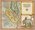
Sumatra ein grosse Insel, so von den alten Geographen Taprobana genennet worden.jpg 9,796 × 8,320; 17.85 MB
-
Sumatra ein grosse Insel- so von den alten Geographen Taprobana genennet worden.jpg 9,367 × 8,246; 16.15 MB
-
1926-1938士姑来地图.png 1,570 × 999; 3.73 MB
-
A geography of the Malay Peninsula and surrounding countries BHL47192746.jpg 2,568 × 3,987; 755 KB
-
Admiralty Chart No 1681 Sibuko Bay, Published 1893, New Edition 1914.jpg 19,008 × 11,227; 67.07 MB
-
Admiralty Chart No 948 Balabac Strait, Published 1870.jpg 10,888 × 16,454; 53.98 MB
-
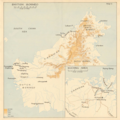
British Borneo 1941 Sarawak Sabah Map.png 1,294 × 1,292; 1.86 MB
-
Chilleurs-aux-Bois - château de Chamerolles, promenade des parfums 39.jpg 5,472 × 3,648; 9.39 MB
-
D180- N° 454. Manche de Malacca. - Liv3-Ch18.png 1,440 × 1,772; 235 KB
-
D234- Les deux Java -liv2-ch13.png 1,436 × 1,658; 323 KB
-
Distribution of population in Malaya vintage map (1945).png 1,300 × 592; 890 KB
-
EB1911 Malay Peninsula - map.jpg 1,102 × 1,692; 577 KB
-
GEORGETOWN.png 3,652 × 2,657; 13.08 MB
-
IPOH TOWN.png 3,672 × 2,672; 13.12 MB
-
KLmap1889.jpg 719 × 1,023; 235 KB
-
LA2-NSRW-1-0148 malaysia.jpg 1,280 × 720; 236 KB
-
Large-scale-old-political-map-of-china-indochina-and-part-of-malasysia-1897.jpg 5,980 × 8,510; 18.41 MB
-
Malaysia. LOC 91686550.jpg 3,286 × 2,538; 640 KB
-
Malaysia. LOC 91686550.tif 3,286 × 2,538; 23.86 MB
-
Malaysia. LOC 91686551.tif 3,208 × 2,546; 23.37 MB
-
Pagan races of the Malay Peninsula (1906) (14758563736).jpg 1,548 × 1,844; 337 KB
-
Petaling Jaya map 1964 December - Shell.jpg 1,501 × 1,365; 661 KB
-
Selden map.jpg 1,353 × 2,199; 1,008 KB
-
The sportsman's book for India (1904) (14781937485).jpg 2,157 × 1,489; 744 KB


