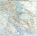
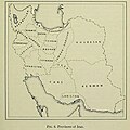
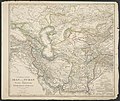
Category:Old maps of Iran
Jump to navigation
Jump to search
Use the appropriate category for maps showing all or a large part of Iran. See subcategories for smaller areas:
| If the map shows | Category to use |
|---|---|
| Iran on a recently created map | Category:Maps of Iran or its subcategories |
| Iran on a map created more than 70 years ago | Category:Old maps of Iran or its subcategories |
| the history of Iran on a recently created map | Category:Maps of the history of Iran or its subcategories |
| the history of Iran on a map created more than 70 years ago | Category:Old maps of the history of Iran or its subcategories |
Subcategories
This category has the following 14 subcategories, out of 14 total.
Media in category "Old maps of Iran"
The following 84 files are in this category, out of 84 total.
-
"FIGHTING CLANS" of the British Indian Empire, 1918 — North East.jpg 1,996 × 1,430; 767 KB
-
"FIGHTING CLANS" of the British Indian Empire, 1918 — North West.jpg 2,012 × 1,372; 482 KB
-
"FIGHTING CLANS" of the British Indian Empire, 1918 — South East.jpg 1,988 × 1,280; 423 KB
-
"FIGHTING CLANS" of the British Indian Empire, 1918 — South West.jpg 2,008 × 1,296; 226 KB
-
A.K. Johnston -1850-Edinburg.jpg 723 × 600; 94 KB
-
Armenian SSR borders in November 1920 - July 1921~~.jpg 1,078 × 1,810; 1.1 MB
-
Arrowsmith's Map of Persia, 1819.jpg 1,600 × 1,301; 479 KB
-
ARTAZ L' EMPIRE De PERSE 1779 d’Anville P.Santini ~3.jpg 503 × 692; 177 KB
-
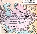
Aryan Tribes Original Home and migration routes.jpg 851 × 790; 378 KB
-
Bartholomew's map of Asia Minor, Egypt, Mesopotamia and Persia (5007987).jpg 5,000 × 3,222; 2.59 MB
-
Bokhara, Kabool, Beloochistan, etc. LOC 2004629035.tif 4,042 × 4,980; 57.59 MB
-
CAUCASIA~Vegetation Land Cover with ethnic borders~2.jpg 1,080 × 1,799; 1.14 MB
-
George Rollos ,1770 published in london.jpg 717 × 600; 81 KB
-
George Rollos 1770 London.jpg 705 × 600; 77 KB
-
Ghasr-e Shirin map (1330).jpg 695 × 865; 213 KB
-
Iran et Touran.jpg 2,726 × 4,030; 1.77 MB
-
Iran historique Exode des Iraniens.jpg 2,743 × 4,044; 1.57 MB
-
Iran Pakistan boundary.png 845 × 1,132; 330 KB
-
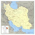
Iran. LOC 2011588108.jpg 2,980 × 3,894; 1.55 MB
-
Iran. LOC 2011588108.tif 2,980 × 3,894; 33.2 MB
-
Iran. LOC 2011588109.jpg 3,279 × 3,898; 1.44 MB
-
Iran. LOC 2011588109.tif 3,279 × 3,898; 36.57 MB
-
Iran. LOC 91684730.jpg 6,694 × 6,707; 5.14 MB
-
Iran. LOC 91684730.tif 6,694 × 6,707; 128.45 MB
-
Iran. LOC 91684731.jpg 6,695 × 6,698; 6.09 MB
-
Iran. LOC 91684731.tif 6,695 × 6,698; 128.3 MB
-
Iran. LOC 96686654.jpg 2,525 × 3,269; 706 KB
-
Iran. LOC 96686654.tif 2,525 × 3,269; 23.62 MB
-
Iran. LOC 96686655.jpg 2,530 × 3,281; 753 KB
-
Iran. LOC 96686655.tif 2,530 × 3,281; 23.75 MB
-
Iran. LOC 97683501.jpg 6,684 × 6,661; 5.58 MB
-
Iran. LOC 97683501.tif 6,684 × 6,661; 127.38 MB
-
Iran. LOC 97683502.jpg 6,666 × 6,659; 5.35 MB
-
Iran. LOC 97683502.tif 6,666 × 6,659; 127 MB
-
Kaart van Perzië, objectnr A 16211.jpg 11,500 × 6,769; 58.17 MB
-
Khalili Collection Islamic Art mss 0972 fol 40b.jpg 2,500 × 3,947; 779 KB
-
Le Tour du monde-04-p275.png 875 × 655; 51 KB
-
Map Iran 1900-fr.png 1,098 × 911; 367 KB
-
Map of persia published in London 1847.jpg 970 × 680; 143 KB
-
Map of Persia, Turkey in Asia - Afghanistan, Beloochistan. LOC 2013593018.jpg 4,636 × 3,630; 2.67 MB
-
Map of Persia, Turkey in Asia - Afghanistan, Beloochistan. LOC 2013593018.tif 4,636 × 3,630; 48.15 MB
-
Map of Persian Gulf - Amsterdam -1640.jpg 3,037 × 2,320; 1.76 MB
-
Map of the region bounded by the Saudi Peninsula, Red Sea.jpg 2,749 × 2,376; 7.69 MB
-
Map of the Sayfo in Urmia.png 994 × 1,370; 284 KB
-
Mashhad and merw on tabula Peutingeriana.png 1,032 × 712; 1.11 MB
-
Middle East Antique map Babylon Assyriens Philippe 1787.jpg 1,181 × 769; 1.09 MB
-
NI 38-7 Khanaqin.jpg 4,185 × 3,279; 4.98 MB
-
NI 38-8 Kermanshah.jpg 4,263 × 3,269; 4.84 MB
-
NJ 40-10 Kuh-e-Kurkhud.jpg 4,256 × 3,264; 3.39 MB
-
NJ 40-11 Ashkhabad.jpg 4,225 × 3,257; 3.58 MB
-
Old map of Shiraz.jpg 503 × 769; 103 KB
-
P. Santini- 1779-Venice.jpg 800 × 596; 105 KB
-
Perse Turquie Asiatique et Arabie old map Desnos 1766.jpg 2,992 × 2,319; 7.88 MB
-
Persia 1909.jpg 1,725 × 1,712; 982 KB
-
PERSIA in EUROPE and ASIA ~ North-West of IRAN.jpg 720 × 1,334; 643 KB
-
Persia RMG F1728.tiff 7,381 × 4,799; 101.34 MB
-
Persia Sive Sophorum regnum Old map Persia Merian 1638.jpg 3,150 × 2,601; 3.8 MB
-
Persia, Caspian Sea, done by ye Czar, and Part of Independent Tartary.jpg 8,931 × 7,187; 2.25 MB
-
Persia-and-map-of-ancient-iran.jpg 7,578 × 6,111; 14.19 MB
-
Persian Gulf antique map La Perse Bellin 1764.jpg 3,150 × 2,287; 1.78 MB
-
Persian Gulf western sheet.jpg 1,978 × 3,000; 1.1 MB
-
Persian southern coast of the Caspian ~1014.jpg 1,158 × 513; 229 KB
-
Provinces of Iran in 1939 by Erwin Raisz.jpg 750 × 750; 69 KB
-
Rigobert Bonne- 1771 Paris.jpg 1,080 × 828; 190 KB
-
Robert- 1760- Paris.jpg 1,019 × 711; 139 KB
-
Shahabad-e gharb map (1330).jpg 665 × 770; 179 KB
-
South East Iraq , 586 B.C..png 1,338 × 1,619; 4.94 MB
-
Soviet Theater Forces in Areas Adjacent to Iran, November 1986.png 2,133 × 1,377; 805 KB
-
The Helmund River WDL12995.png 1,024 × 1,235; 2.59 MB
-
V. Levasseur - Paris- 1838.jpg 1,080 × 803; 400 KB
-
Vorder-Asien. LOC 2013593006.jpg 7,120 × 5,707; 5.56 MB
-
Vorder-Asien.jpg 5,351 × 4,501; 9.16 MB
-
Le Tour du monde - 13 (page 255 crop).jpg 1,956 × 1,566; 749 KB


