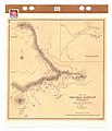
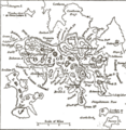
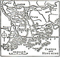
Category:Old maps of Hong Kong
Jump to navigation
Jump to search
Use the appropriate category for maps showing all or a large part of Hong Kong. See subcategories for smaller areas:
| If the map shows | Category to use |
|---|---|
| Hong Kong on a recently created map | Category:Maps of Hong Kong or its subcategories |
| Hong Kong on a map created more than 70 years ago | Category:Old maps of Hong Kong or its subcategories |
| the history of Hong Kong on a recently created map | Category:Maps of the history of Hong Kong or its subcategories |
| the history of Hong Kong on a map created more than 70 years ago | Category:Old maps of the history of Hong Kong or its subcategories |
Subcategories
This category has the following 2 subcategories, out of 2 total.
O
- Old maps of Pearl River (22 F)
Media in category "Old maps of Hong Kong"
The following 191 files are in this category, out of 191 total.
-
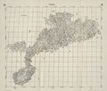
Da Ming yu di tu LOC 2002626776-15.jpg 9,580 × 9,042; 13.84 MB
-
Da Ming yu di tu LOC 2002626776-15.tif 9,580 × 9,042; 247.83 MB
-
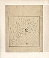
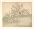
Guang Yutu 1558 Vol 1 Pg 47 Guangdong 1.jpg 4,380 × 4,658; 4.04 MB
-
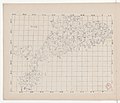
Fen ye yu tu. LOC 2002626777-16.jpg 4,272 × 5,080; 1.9 MB
-
Fen ye yu tu. LOC 2002626777-16.tif 4,272 × 5,080; 62.09 MB
-
Kowloon Hill yuettaikei.png 1,084 × 657; 64 KB
-
Tsim Sha Tsui from Yuet Tai Kei.png 701 × 550; 37 KB
-
Tsing Yi Island in Yuet Tai Kei.png 708 × 820; 76 KB
-
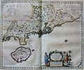
"Quantung, Imperii Sinarum provincia duodecima" (22240445622).jpg 3,598 × 3,006; 2.12 MB
-
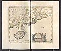
Qvantvng - Atlas Maior, vol 11, map 24 - Joan Blaeu, 1667 - BL 114.h(star).11.(24).jpg 4,000 × 3,351; 1.93 MB
-
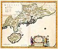
Atlas Van der Hagen-KW1049B13 048-QVANTVNG, IMPERII SINARVM PROVINCIA DVODECIMA.jpeg 5,500 × 4,620; 3.12 MB
-
Quantung,Fokien (Coronelli Map of Hong Kong, Formosa).jpg 2,015 × 1,428; 686 KB
-
Der Jesuiten-Atlas der Kanghsi-Zeit - China und die Aussenlaender LOC 74650033-31.jpg 9,669 × 8,228; 8.69 MB
-
Der Jesuiten-Atlas der Kanghsi-Zeit - China und die Aussenlaender LOC 74650033-31.tif 9,669 × 8,228; 227.61 MB
-
Kouang-Toung - par Jean-Baptiste d'Anville - btv1b53009299t.jpg 6,495 × 5,141; 5.62 MB
-
Province de Quang-Tong - (tirée du P. Duhalde) - btv1b85951154.jpg 10,496 × 7,978; 12.95 MB
-
Province du Quang-tong (French map of Guangdong Province, China, 1735).jpg 5,700 × 4,308; 3.41 MB
-
Anville Nouvel atlas de la Chine - Page46 quang tong.jpg 4,600 × 3,720; 5.83 MB
-
Pas-Kaart van het in- en opkomen van de Rivier van Quantong.jpg 3,549 × 3,095; 4.92 MB
-
Da Qing fen sheng yu tu LOC 2002626726-16.jpg 5,296 × 4,515; 2.26 MB
-
Da Qing fen sheng yu tu LOC 2002626726-16.tif 5,296 × 4,515; 68.41 MB
-
Map of Hong Kong and Macau 1760.JPG 1,632 × 1,224; 427 KB
-
Zhi li ge sheng yu di quan tu - Zhang Zongjing - btv1b53103898v (33 of 69).jpg 5,137 × 4,427; 2.83 MB
-
BOELEN(1836) T3 p218 DE RIVIER TIGRIS AN DE STAD CANTON.jpg 4,789 × 2,143; 4.92 MB
-
Admiralty Chart No 1263 Entrance to the Canton River, Published 1840.jpg 15,068 × 11,389; 18.94 MB
-
Hong Kong Map made by Edward Belcher in 1841.jpg 2,000 × 1,488; 623 KB
-
Cape Collinson - highlight.png 373 × 225; 86 KB
-
Old Map of Hong Kong.jpg 3,168 × 2,526; 1.17 MB
-
Tsim Sha Tsui and Kwun Chung 1845.png 622 × 808; 777 KB
-
Admiralty Chart No 2660 China Sea Sheet III (North West) Cam Ranh Bay to Hong Kong, Published 1859.jpg 15,585 × 23,512; 75.64 MB
-
Map in Treaty of Peking 1860.jpg 600 × 416; 83 KB
-
Map of Hong Kong in First Convention of Peking in 1860.jpg 1,680 × 1,200; 763 KB
-
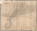
Guangdong quan tu LOC gm71005120.jpg 13,026 × 10,962; 17.63 MB
-
Hunan Guangdong he tu. LOC gm71005129.jpg 9,297 × 9,186; 8.78 MB
-
Hunan Guangdong he tu. LOC gm71005129.tif 9,297 × 9,186; 244.34 MB
-
Kwangtung and Canton 1878.jpg 1,716 × 2,809; 961 KB
-
Sanon.png 649 × 530; 758 KB
-
Huang chao zhi sheng di yu quan tu - btv1b531099218 (21 of 38).jpg 6,177 × 4,548; 3.81 MB
-
《清朝柔遠記》香港地圖.jpg 1,143 × 786; 185 KB
-
Guangdong quan sheng shui lu yu tu LOC gm71005159.jpg 14,152 × 11,530; 22.07 MB
-
Guangdong quan sheng shui lu yu tu LOC gm71005159.tif 14,152 × 11,530; 466.84 MB
-
The Peak Map.jpg 800 × 929; 81 KB
-
Map of Hong Kong Island East 港島東區地圖, 1890.jpg 1,312 × 923; 504 KB
-
Situationskärtchen von Kanton, Makao, Hongkong.jpg 966 × 1,233; 207 KB
-
Tian xia zong yu tu. LOC 2002626780-17.jpg 3,865 × 3,150; 1.15 MB
-
Tian xia zong yu tu. LOC 2002626780-17.tif 3,865 × 3,150; 34.83 MB
-
HURLEY(1897) p031 Map of Hong Kong and Victoria Bay.jpg 5,635 × 4,489; 11.72 MB
-
HURLEY(1897) p044 Map of the RICHMOND ESTATE Property.jpg 2,369 × 2,161; 2.45 MB
-
HURLEY(1897) p060 Plan of Central District.jpg 2,349 × 1,511; 1.9 MB
-
HURLEY(1897) p165 Map of the Vicinity of Hong Kong.jpg 4,502 × 3,321; 4.77 MB
-
HURLEY(1897) p172 Map of the KOWLOON ESTATE Property.jpg 5,079 × 4,285; 6.8 MB
-
164 of 'A School Geography' (11150219535).jpg 958 × 863; 209 KB
-
330 of 'China in Transformation ... With ... maps and diagrams' (11294763595).jpg 1,380 × 1,307; 462 KB
-
Map of The Convention for the Extension of Hong Kong Territory in 1898 - 1.jpg 1,680 × 1,310; 478 KB
-
Map of The Convention for the Extension of Hong Kong Territory in 1898 - 2.jpg 1,670 × 1,020; 449 KB
-
Tcitp d152 Hong Kong Kowloon and adjacent territories.jpg 2,776 × 2,076; 818 KB
-
Third Salisbury administration, 1895-1900 (1900) (14776769841).jpg 5,408 × 3,344; 2.12 MB
-
1900 Map of the Colony of Hong Kong.jpg 5,000 × 4,066; 1.71 MB
-
Admiralty Chart No 1962 Hong Kong to the Brothers, Published 1966.jpg 21,661 × 11,213; 66.78 MB
-
Map of Canton and vicinity, 1904.png 2,881 × 2,272; 9.8 MB
-
Tcitp d154 city of victoria.jpg 2,215 × 1,338; 414 KB
-
Tcitp d154 hong kong harbour.jpg 2,347 × 1,339; 454 KB
-
Dkbkpl12.jpg 1,165 × 711; 178 KB
-
Dkbkpl18.jpg 1,131 × 675; 148 KB
-
Dkbkpl19.jpg 1,134 × 681; 134 KB
-
The Macao - Bocca Tigris - Canton approach.jpg 898 × 1,046; 773 KB
-
Central map1911.gif 980 × 594; 292 KB
-
Victoria City and Kowloon 1915.jpg 1,120 × 960; 175 KB
-
STANFORD(1917) p15-16 PLATE 1. KWANGTUNG (14597113490).jpg 4,790 × 3,795; 8.54 MB
-
1920 map of the Chinese Republic & Japan.jpg 10,647 × 7,971; 21.49 MB
-
Pearl River Entrance 1922.jpg 13,216 × 12,000; 18.01 MB
-
ResidenciesAtPeak 1924.jpg 3,538 × 2,588; 1.36 MB
-
The Falls Site transformation 1927 b.jpg 2,000 × 1,938; 686 KB
-
Admiralty Chart No 3280 Hongkong Waters West, Published 1903, Corrections to 1932.jpg 24,215 × 16,204; 62.99 MB
-
1935 Guangdong sheng you.png 1,444 × 2,004; 6.48 MB
-
1935 Guangdong sheng zuo.png 1,444 × 1,948; 6.94 MB
-
1936 map of Hong Kong and Kowloon by the British War Office (cropped).jpg 2,076 × 1,556; 928 KB
-
1936 map of Hong Kong and the New Territories by the British War Office.jpg 16,815 × 12,372; 36.87 MB
-
Tsing Yi Island 1936.jpg 640 × 768; 237 KB
-
Asian places in Brockhaus 1937.jpg 1,600 × 2,601; 2.4 MB
-
KWC map1940s.jpg 640 × 476; 131 KB
-
HK CAN MO 1945.jpg 10,096 × 7,984; 12.13 MB
-
1945 香港 HK 北角 North Point 七姊妹 Tsat Tsz Mui.png 976 × 604; 1.08 MB
-
1949 map of Hong Kong and the New Territories by the British War Office.jpg 12,100 × 8,592; 20.12 MB
-
1950 Royal Naval Dockyard and Armament Depot, Hong Kong.jpg 6,347 × 4,100; 6.66 MB
-
1951 H.M. Dockyard, Hong Kong, B.C.C.jpg 8,699 × 4,057; 5.75 MB
-
1951 Hong Kong & Whampoa Dock Company.jpg 7,637 × 4,069; 7.38 MB
-
HK Central Map 1952.gif 927 × 990; 66 KB
-
1957 map of Hong Kong and the New Territories by the British War Office.jpg 23,899 × 17,761; 95.41 MB
-
1957 map of Victoria Harbour by the British War Office.jpg 16,570 × 12,629; 34.48 MB
-
1960 map of Kowloon & The New Territories by the British War Office.jpg 17,650 × 22,581; 74.96 MB
-
Dhch 1960.png 1,188 × 1,788; 499 KB
-
HK1964KLN JORDAN VALLEY map1.JPG 1,978 × 1,440; 1.18 MB
-
Hong Kong, Pergamon World Atlas 1967.jpg 695 × 638; 115 KB
-
64th Engineer Base Topographic Battalion - Victoria (1945).jpg 8,952 × 7,792; 19.97 MB
-
A Map of Hong-Kong, with british Kowloon - btv1b530292768.jpg 8,983 × 6,881; 6.5 MB
-
Admiralty Chart No 1222 Toong-Koo or Urmstone Bay, Published 1839.jpg 7,845 × 5,904; 10.3 MB
-
Admiralty Chart No 1962 Hongkong to the Brothers, Published 1890 webp.webp 15,719 × 4,094; 159.87 MB
-
Admiralty Chart No 3279 (half) Hong Kong Waters East, Published 1903.jpg 6,579 × 8,292; 16.15 MB
-
Canton estuary.jpg 3,595 × 3,181; 1.14 MB
-
CANTON RIVER AND ADJACENT ISLANDS from Google Book.jpg 4,887 × 4,661; 2.24 MB
-
CANTON RIVER AND ADJACENT ISLANDS, 2nd ed.jpg 2,468 × 2,355; 963 KB
-
Canton River and adjacent islands.jpg 4,952 × 4,695; 5.44 MB
-
Carte des îles Formose (34167570590).jpg 1,200 × 1,028; 624 KB
-
Coastal defense map of Humen including Kowloon Battery in 1838.jpg 2,143 × 1,418; 278 KB
-
Drawing of nga tsin wai from sha tin pass in 1846.jpg 2,338 × 1,653; 1.77 MB
-
EB9 Hong-Kong.png 3,893 × 4,000; 9.18 MB
-
HK CWFE 柴灣工廠大廈 Chai Wan Factory Estate sign Feb 2017 IX1 09.jpg 1,368 × 2,048; 996 KB
-
HK CWFE 柴灣工廠大廈 Chai Wan Factory Estate sign Feb 2017 IX1 18.jpg 1,368 × 2,048; 947 KB
-
Hong Kong - Kowloon-Victoria - DPLA - 0b6aeb886de54e41d1e1f56fcb8f5644.jpg 4,074 × 3,314; 2.04 MB
-
Hong Kong and the New Territories - btv1b53266563d.jpg 12,032 × 9,144; 15.56 MB
-
Hong Kong and vicinity. LOC 99443749.jpg 2,199 × 2,424; 1 MB
-
Hong Kong and vicinity. LOC 99443749.tif 2,199 × 2,424; 15.25 MB
-
Hong Kong Historic Maps - Reference 1922.1.png 651 × 637; 491 KB
-
Karte Kayintschu Hongkong.png 980 × 500; 886 KB
-
Kowloon Tong Service Reservoir, 1947 HK Map.png 2,384 × 1,766; 4.59 MB
-
LA2-NSRW Hong Kong.jpg 688 × 659; 295 KB
-
Map about Hong Kong - Drawn between 1577 and 1595.jpg 722 × 765; 531 KB
-
Map of Hong Kong with British Kowloon 1888 24727376.jpg 10,178 × 6,754; 9.22 MB
-
Meyers b9 s0474 b2.png 383 × 494; 102 KB
-
Mission du Kouang-tong.jpg 2,362 × 1,473; 3.6 MB
-
Nationalist China, Hong Kong, and Macao. LOC 2013591164.jpg 5,854 × 5,406; 3.1 MB
-
Nationalist China, Hong Kong, and Macao. LOC 2013591164.tif 5,854 × 5,406; 90.54 MB
-
Nga tsin wai plan 1902.jpg 1,653 × 2,338; 843 KB
-
Nga tsin wai surroundings plan 1905.jpg 2,338 × 1,653; 1.14 MB
-
Nicholas Belfield Dennys - Map of Hong Kong (1867).jpg 10,180 × 4,625; 19.05 MB
-
Plan of the City of Victoria Hong Kong (Corrected to 1905).tif 9,159 × 2,735; 38.55 MB
-
Plan of Victoria, Hong Kong 1866.jpg 11,000 × 5,200; 10.23 MB
-
San On Chi.jpg 643 × 831; 221 KB
-
Sha Tau Kok Railway alignment in 1915.JPG 864 × 648; 576 KB
-
Simeone Volonteri - Topographic Map of Hong Kong (1874).jpg 5,168 × 3,645; 5.07 MB
-
Streets in Kowloon Walled City.jpg 2,337 × 1,525; 1.21 MB
-
Tai Ping Shan 1913.png 1,082 × 734; 1.28 MB
-
Taikoo Dockyard & Engineering, Co., Hong Kong, B.C.C.jpg 7,568 × 4,061; 4.35 MB
-
This chart of the different passages leading to Macao Roads LOC 88691655.jpg 11,162 × 8,337; 8.85 MB
-
七省沿海圖-新安至陽江.png 2,748 × 1,024; 4.17 MB
-
廣東.png 2,888 × 2,016; 14.08 MB
-
投影片1.jpg 1,280 × 720; 223 KB
-
新九龍地界圖 New Kowloon Map, 1937.jpg 1,200 × 1,699; 793 KB
-
新安縣志香港海防圖, 1819.png 1,000 × 694; 1.27 MB
-
普陀山 - 竟源記題 - btv1b7200227q (1 of 5).jpg 7,159 × 5,403; 5.71 MB
-
普陀山 - 竟源記題 - btv1b7200227q (2 of 5).jpg 7,216 × 5,374; 5.9 MB
-
普陀山 - 竟源記題 - btv1b7200227q (3 of 5).jpg 7,216 × 5,374; 5.92 MB
-
普陀山 - 竟源記題 - btv1b7200227q (4 of 5).jpg 7,216 × 5,374; 5.95 MB
-
普陀山 - 竟源記題 - btv1b7200227q (5 of 5).jpg 6,932 × 4,267; 4.65 MB
-
普陀山 - 竟源記題 - btv1b7200251c (1 of 4).jpg 5,284 × 7,035; 5.12 MB
-
普陀山 - 竟源記題 - btv1b7200251c (2 of 4).jpg 5,412 × 7,035; 5.32 MB
-
普陀山 - 竟源記題 - btv1b7200251c (3 of 4).jpg 5,412 × 7,103; 5.25 MB
-
普陀山 - 竟源記題 - btv1b7200251c (4 of 4).jpg 6,119 × 3,595; 2.75 MB
-
澳門香港航海圖(香港部份)Macau Nautical Chart (Hong Kong), 1810.jpg 720 × 559; 69 KB
-
皇清地理圖八十一及八十二.jpg 4,096 × 3,463; 2.68 MB
-
美利炮臺.jpg 1,854 × 1,272; 1.93 MB
-
香港島及九龍海域航道水深圖 Hong Kong and Kowloon Sea Bathymetric Chart, 1861.jpg 709 × 447; 166 KB


