Category:Old maps of Jerusalem
Jump to navigation
Jump to search
Wikimedia category | |||||
| Upload media | |||||
| Instance of | |||||
|---|---|---|---|---|---|
| Category combines topics | |||||
| |||||
See Cartography of Jerusalem, which covers historical of maps of Jerusalem, for the main article on this topic.
| Category Old maps of Jerusalem on sister projects: | |||||||||
|---|---|---|---|---|---|---|---|---|---|
en:Cartography of Jerusalem | |||||||||
Use the appropriate category for maps showing all or a large part of Jerusalem. See subcategories for smaller areas:
| If the map shows | Category to use |
|---|---|
| Jerusalem on a recently created map | Category:Maps of Jerusalem or its subcategories |
| Jerusalem on a map created more than 70 years ago | Category:Old maps of Jerusalem or its subcategories |
| the history of Jerusalem on a recently created map | Category:Maps of the history of Jerusalem or its subcategories |
| the history of Jerusalem on a map created more than 70 years ago | Category:Old maps of the history of Jerusalem or its subcategories |
Subcategories
This category has the following 12 subcategories, out of 12 total.
Media in category "Old maps of Jerusalem"
The following 192 files are in this category, out of 192 total.
-
 111 of 'Class-book of Elementary Geography' (11236907766).jpg 1,163 × 1,070; 315 KB
-
 124 of 'Chevauchée en Palestine. Illustrations par l'auteur' (11198375674).jpg 1,585 × 2,263; 652 KB
-
 Palestine (1889 book) 01.jpg 2,117 × 3,434; 764 KB
-
 Iherusalem Turcis Cusembareich. Nazareth. Ramma.jpg 2,870 × 2,165; 4.11 MB
-
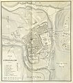
 1841 Aldrich and Symonds map of Jerusalem.jpg 7,488 × 6,922; 8.99 MB
-
 185 of 'The Holy Places of Jerusalem ... With illustrations, etc' (11195462404).jpg 1,541 × 2,849; 718 KB
-

-

-
 ETH-BIB-Jerusalem 1948 mit Partition nach Parkus-Dia 247-Z-00441.tif 3,546 × 2,894; 29.47 MB
-

-
 300 of 'The East. Sketches of Travels in Egypt and the Holy Land' (11033294044).jpg 1,309 × 2,277; 793 KB
-
 391 of 'The Fifth Gospel, the land where Jesus lived' (11224846563).jpg 1,263 × 1,585; 492 KB
-

-
 602 of 'Journal d'un voyage en Orient' (11023074016).jpg 1,760 × 2,694; 318 KB
-
 603 of 'Journal d'un voyage en Orient' (11022039645).jpg 1,717 × 2,884; 371 KB
-
-

-
 Arculf De Locis Sanctis Jerusalem.jpg 581 × 798; 491 KB
-
 Brockhaus and Efron Encyclopedic Dictionary b26 656-0 (cropped).jpg 1,382 × 1,228; 951 KB
-
 Brockhaus and Efron Encyclopedic Dictionary b26 656-0.jpg 1,498 × 2,882; 1.79 MB
-
 Brockhaus and Efron Jewish Encyclopedia e5 667-0.jpg 492 × 876; 186 KB
-
 Brockhaus and Efron Jewish Encyclopedia e8 651-1.jpg 1,115 × 1,632; 532 KB
-
 Brockhaus and Efron Jewish Encyclopedia e8 651-2.jpg 1,114 × 1,626; 713 KB
-
 Brockhaus and Efron Jewish Encyclopedia e8 653-1.jpg 1,103 × 1,632; 733 KB
-
 Brockhaus and Efron Jewish Encyclopedia e8 653-2.jpg 1,109 × 1,663; 813 KB
-
 Brockhaus and Efron Jewish Encyclopedia e8 693-0.jpg 1,105 × 816; 435 KB
-
 C+B-Jerusalem-Map1-Terrain.PNG 468 × 586; 235 KB
-
 Cambrai map.jpg 1,774 × 2,487; 3.85 MB
-
 De Angelis map of Jerusalem.png 1,202 × 821; 1.94 MB
-
 De Stadt Jerusalem - Peeters Jacob - 1690.jpg 1,500 × 1,323; 1.33 MB
-
 Der Oël berg.jpg 1,657 × 1,736; 1.38 MB
-

-
 Dictionnaire de la Bible (1912) (14597292408).jpg 1,728 × 2,374; 806 KB
-
 Découverte de la Terre 024.jpg 489 × 700; 149 KB
-
 Edmond Halley, Vera Hierosolymae veteris imago (FL81913845 2368070).jpg 4,565 × 2,956; 17.54 MB
-

-

-

-
 Henry Kendall plan for East Jerusalem 1964.jpg 6,562 × 10,000; 9.96 MB
-
 Hierusalem-Venice.jpg 355 × 459; 84 KB
-
 Hierusalem.jpg 344 × 444; 90 KB
-
 Brockhaus and Efron Jewish Encyclopedia e8 666-0.jpg 556 × 437; 76 KB
-
 Hirusalem.jpg 2,000 × 3,034; 2.88 MB
-

-
 Historical map series for the area of Lifta (1870s).jpg 738 × 742; 229 KB
-

-
 Historical map series for the area of Lifta (1940s).jpg 738 × 742; 298 KB
-

-
 Historical map series for the area of Sheikh Badr (1870s).jpg 738 × 742; 231 KB
-
 Historical map series for the area of Sheikh Badr (1940s).jpg 738 × 742; 291 KB
-
 History von Jerusalem.jpg 556 × 409; 112 KB
-
 HOLY LAND Gerard de Jode. Speculum Orbis Terrarum.jpg 800 × 588; 269 KB
-
 Ierosolymae, cura Nehemiae ducis instavratae, descriptio.jpg 3,220 × 1,932; 3.47 MB
-
 Ierusalem - Dedicated by Richard Blome. J. Kip sculp.jpg 2,850 × 2,162; 3.91 MB
-
-
 Ierusalem - Ioan- Peeters delin- ex. Gasper Bouttats fecit aqûa forti.jpg 3,500 × 1,649; 3.46 MB
-
 Ierusalem - Ioh. Frid. Probst, Haeres Ieremiae Wolff exc.jpg 4,100 × 1,482; 3.48 MB
-
 Ierusalem - Sold by Rich.d Ware and Will. Taylor.jpg 2,722 × 2,250; 3.53 MB
-

-
 Ierusalem Noua.jpg 3,200 × 1,906; 2.84 MB
-
-

-

-
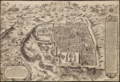
 Ierusalem. LOC 2009579460.jpg 7,315 × 4,978; 7.81 MB
-
 Ierusalema hodierna - F.I.S. delin.jpg 4,000 × 1,558; 4.45 MB
-
 Israel Batch 2 (56).JPG 3,648 × 2,736; 3.51 MB
-
 Jerusalem - Bearbeitet u gezeichnet von Lionnet.jpg 4,160 × 2,644; 1.52 MB
-
 Jerusalem - Stackhouse bible history 1796.png 5,646 × 4,260; 61.41 MB
-
 Jerusalem 1845.jpg 1,251 × 1,674; 500 KB
-
 Jerusalem area and the holy sites - Numerical Synchronicity.jpg 1,500 × 1,964; 1.35 MB
-
 Jerusalem at different periods.jpg 2,180 × 2,847; 2.21 MB
-
 Jerusalem aus der Vogelschau - Verlag und Eigenthum von Stephan Jlles in Jerusalem.jpg 1,712 × 1,264; 633 KB
-
 Jerusalem aus der Vogelschau.jpg 9,920 × 7,264; 14.47 MB
-
 Jerusalem by Garpatch.jpg 5,233 × 6,221; 5.81 MB
-
 Jerusalem die Heilige Stadt und Umgebung Rundschau vom Turm der Dormitio.jpg 8,741 × 858; 1.48 MB
-

-
 Jerusalem Engraved (2628127797) negative.jpg 2,240 × 2,280; 1.04 MB
-
 Jerusalem Engraved (2628127797).jpg 2,240 × 2,280; 3.14 MB
-

-
 Jerusalem map.jpg 348 × 348; 50 KB
-
 Jerusalem Meisner.jpg 2,800 × 2,146; 2.39 MB
-
 Jerusalem Reproduced and printed by survey of Palestine.jpg 2,347 × 4,388; 2.61 MB
-
 Jerusalem Reproduced by the Survey of Egypt.jpg 812 × 694; 178 KB
-
 Jerusalem von Suedost - Lith. Anst. v. Ant Lippenberger.jpg 3,120 × 1,971; 3.12 MB
-

-

-

-
 Jerusalem, zoo als het tegenwoordig is.jpg 2,700 × 2,288; 2.94 MB
-
 Jerusalem- Gr. Tarasenkov; Jurij Wipper, G.Fingerer & Göschl.jpg 2,200 × 2,825; 3.29 MB
-

-
 Jerusalem-Baedeker.jpg 1,006 × 882; 257 KB
-
 Jerusalem-J.M.T.jpg 2,180 × 2,855; 2.43 MB
-
 Jerusalem. Max Blanckenhorn, Geologische Karte von Palaestina (FL33249904 2366975) (cropped).jpg 2,739 × 4,110; 19.24 MB
-
 Jerusalem985-1052.jpg 1,380 × 948; 523 KB
-
 Jerusalem; חברת הכשרת הישוב בא"י בע"מ.jpg 892 × 1,100; 279 KB
-
 Jérusalem - (par J.-B. d'Anville) - btv1b8469087f.jpg 2,706 × 2,821; 1.25 MB
-
 Jérusalem - (par J.-B. d'Anville) - btv1b8469300j.jpg 2,328 × 2,320; 986 KB
-
 Jérusalem - (par Jean-Baptiste d'Anville) - btv1b53009179m.jpg 1,924 × 1,965; 639 KB
-
 Jérusalem - btv1b8592928k.jpg 2,521 × 2,469; 1.1 MB
-

-

-

-
 Kiepert Jerusalem 1880.jpg 2,427 × 1,895; 993 KB
-
 Kiepert Jerusalem surrounds 1880.jpg 2,480 × 1,989; 1.02 MB
-
 Korte beschryvinge van de landschappen des werelts enz. LOC 75572478.jpg 6,365 × 4,793; 6.29 MB
-
 Korte beschryvinge van de landschappen des werelts enz. LOC 75572478.tif 6,365 × 4,793; 87.28 MB
-
 L'ancienne ville de Hierusalem Langlois.jpg 2,950 × 2,113; 4.27 MB
-
 L'ancienne ville de Hierusalem.jpg 2,820 × 2,177; 3.21 MB
-
 L'ancienne ville de Jerusalem & ses environs-1699.jpg 3,800 × 2,913; 1.89 MB
-

-
 La figure de la Ville de Ierusalem.jpg 2,750 × 2,267; 4.55 MB
-
 La vera e reale cita di Gierusalem come si trova ogi.jpg 2,020 × 1,587; 3.04 MB
-
 Map illustrating Jewish proposals for Jerusalem Survey of Palestine.jpg 1,542 × 1,466; 516 KB
-
 Map of Jerusalem at the Time of Christ.png 1,715 × 2,545; 2.74 MB
-
 Map of Jerusalem- grounded on Tobler's map.jpg 2,280 × 2,731; 2.43 MB
-

-

-
 Map-Jerusalem.jpg 758 × 490; 535 KB
-
 Mappa di Gerusalemme e Mantova.JPG 3,043 × 1,806; 3.29 MB
-
 Maps of Jerusalem IMG 1156.JPG 3,648 × 2,736; 7.35 MB
-
 MeaShearim.png 1,083 × 907; 209 KB
-

-

-
 Meyers b9 s0200.jpg 800 × 1,275; 492 KB
-
 Meyers b9 s0201a.jpg 3,525 × 2,265; 5.23 MB
-
 Montpellier Crusader map of Jerusalem.png 683 × 877; 1.25 MB
-
 National Library of Israel - Carel Willem Meredith van de Velde Plan of Jerusalem.jpg 2,366 × 2,193; 868 KB
-

-
 Novae Ierosolymae et locorum circumiacentium accurata imago.jpg 2,860 × 2,133; 4.02 MB
-
 Novae Urbis Hierosolymitanae topographica delineatio - G I opera hac tabula depicta.jpg 2,850 × 2,185; 4.4 MB
-
 Novus conspectus Veteris Ierusalem ex authoris mente.jpg 2,983 × 2,080; 3.07 MB
-
 Nuremberg chronicles f 63v 1.png 2,060 × 1,040; 4.83 MB
-
 Ofrandes des Prémices Portées au Temple de Jérusalem I.B. Martin In.jpg 1,714 × 1,218; 984 KB
-
 Old Jerusalem map.jpg 749 × 1,441; 162 KB
-
 Opdracht Parool, opening tentoonstelling in Galerie Israel, Bestanddeelnr 924-8925.jpg 3,680 × 2,456; 1.78 MB
-
 Ordnance Survey of Jerusalem 1865.pdf 1,497 × 1,912, 206 pages; 45.01 MB
-
 Palestine, land of strife (1945).jpg 1,547 × 2,187; 771 KB
-
 Panorama de Jérusalem - Muller lith. ;Imp.Becquet.jpg 3,050 × 2,018; 3.16 MB
-
 Panorama des heiligen Landes (FL44263171 2369614) (cropped1).jpg 5,968 × 2,723; 31.07 MB
-

-
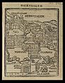
 Philippe Briet. Hiervsalem.jpg 2,228 × 1,807; 1.07 MB
-
 Pianta di Gerusalemme antica e moderna.jpg 2,100 × 2,942; 2.81 MB
-
 Plan ancien & moderne de Jérusalem - Par le Dr. Ermete Pierotti ; Lith. Duc, à Genève.jpg 1,800 × 2,863; 2.09 MB
-

-
 Plan de Jerusalem ancienne et moderne - par le Docteur Ermete Pierotti.jpg 2,150 × 2,847; 2.21 MB
-
 Plan de Jérusalem Francesco Amati in.jpg 5,784 × 4,231; 11.18 MB
-
 Plan de Jérusalem. R. Hausermann, Carte de la Terre Sainte (FL6881904 2367015) (cropped).jpg 3,620 × 4,014; 20.22 MB
-

-
 Plan de la Jérusalem Hébraique et Chrétienne- D'apres les Etudes les plus récentes.jpg 2,100 × 2,815; 1.87 MB
-
 Plan de la Montagne des Olives.jpg 2,728 × 2,060; 5.13 MB
-

-
 Plan nouveau de l'Ancienne Jérusalem.jpg 2,200 × 2,778; 3.04 MB
-
 Plan of Jerus. (i.e. Jerusalem) by Dr. Titus Tobler c. 1858 LOC matpc.07177.tif 7,235 × 5,868; 40.49 MB
-
 Plan of Jerusalem (FL45610894 3948428).jpg 4,236 × 1,947; 2.3 MB
-

-

-
 Plan of Jerusalem John Bartholomew & Co. Edinbr.jpg 1,241 × 647; 284 KB
-
 Plan of Jerusalem LOC 2009579461.jpg 3,824 × 4,978; 3.15 MB
-
 Plan of Jerusalem LOC 2009579461.tif 3,824 × 4,978; 54.46 MB
-
 Plattegrond van Jeruzalem Ierusalem (titel op object), RP-P-1896-A-19368-303.jpg 4,700 × 3,682; 3.74 MB
-

-

-
-
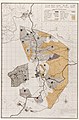
 Relief map of Jerusalem with barbed wire demarcation line as in 1953. matpc.12991.jpg 2,857 × 3,599; 4.88 MB
-
 Siloam Tunnel sketch 1884.png 362 × 588; 203 KB
-
 Siur wikipedia in Jerusalem 080608 82.JPG 2,736 × 3,648; 1.86 MB
-
 Spätgotik exhibition Peregrinatio in terram sanctam 9782.jpg 8,256 × 5,504; 38.65 MB
-

-
 Terra Sancta Building on YMCA Map (3597266831).jpg 2,560 × 1,920; 1.02 MB
-
 The description of the Citie and the territorie - Moryson Fynes - 1617.jpg 1,500 × 1,266; 1.2 MB
-
 The Jewish tabernacle and priesthood (1874) (14782003155).jpg 3,136 × 2,802; 2.04 MB
-
 The student's Old Testament (1904) (14576777009).jpg 1,604 × 2,074; 411 KB
-
 The taking of Ierusalem by Nebuchadnezzar - K. De Putter fecit 1730.jpg 2,700 × 2,263; 3.82 MB
-
 Tournai map of Palestine and Syria, after Eusebius and Jerome 01.jpg 3,764 × 2,474; 5.32 MB
-
 Venice Haggadah View of Jerusalem.jpg 3,443 × 2,458; 384 KB
-
 View of the Holy city of Jerusalem in ancient times - Lit. I.D. Sytin.jpg 2,970 × 2,073; 3.37 MB
-
 Villalpando 03.jpg 1,536 × 1,024; 580 KB
-
 Villalpando 06.jpg 2,680 × 2,306; 1.33 MB
-
 Villalpando 07.jpg 2,800 × 2,197; 1.78 MB
-
 Vue genérale de Jérusalem historique et moderne - par M.Adolphe Elzzner.jpg 2,920 × 2,095; 4.84 MB
-

-
 Wartensleben-Schwirsen map legend.jpg 4,851 × 550; 2.2 MB
-
 YMCA Jerusalem Map- Windmill of Yemin Moshe (3604010456).jpg 752 × 427; 68 KB
-
 YMCA Map of the View of Jerusalem-1 (3597265539).jpg 2,560 × 1,920; 916 KB
-
 YMCA View of Jerusalem Map (3597286267).jpg 1,920 × 2,560; 1.54 MB
-

-

-

-
 ירושלים. Samuel Klein, מפת ארץ-ישראל 04-title (FL25553967 2366963) (cropped).jpg 5,511 × 6,902; 57.58 MB
-

-
 תבליט ירושלים - מוזיאון הרצל.jpg 3,264 × 1,836; 1.87 MB
-
 耶路撒冷全景图.jpg 7,148 × 3,169; 3.69 MB
.jpg)
.jpg)
_01.jpg)


.jpg)
%27_(11254072846).jpg)
%27_(11022988554).jpg)
.jpg)
.jpg)
.jpg)
%27_(11240268355).jpg)
.jpg)
.jpg)
.jpg)
.jpg)

.jpg)


.jpg)
_(14597292408).jpg)

.jpg)
_(14593367378).jpg)


.jpg)
.jpg)
.jpg)
.jpg)
.jpg)
.jpg)
.jpg)


.JPG)


_negative.jpg)
.jpg)


_(cropped).jpg)


_-_btv1b8469087f.jpg)
_-_btv1b8469300j.jpg)
_-_btv1b53009179m.jpg)


_(titel_op_object),_RP-P-1905-6615.jpg)


.jpg)
.jpg)


.jpg)

_(cropped1).jpg)


_(cropped).jpg)


.jpg)

_(cropped).jpg)


,_RP-P-1896-A-19368-303.jpg)
,_RP-P-OB-67.861.jpg)


.jpg)

_(14782003155).jpg)
_(14576777009).jpg)


.jpg)
.jpg)
.jpg)


_(FL199992287_2369250)_(cropped).jpg)
_(cropped).jpg)


.jpg)