Category:Maps of the history of Maryland
Jump to navigation
Jump to search
States of the United States: Alabama · Alaska · Arizona · Arkansas · California · Colorado · Connecticut · Delaware · Florida · Georgia · Hawaii · Idaho · Illinois · Indiana · Iowa · Kansas · Kentucky · Louisiana · Maine · Maryland · Massachusetts · Michigan · Minnesota · Mississippi · Missouri · Montana · Nebraska · Nevada · New Hampshire · New Jersey · New Mexico · New York · North Carolina · North Dakota · Ohio · Oklahoma · Oregon · Pennsylvania · Rhode Island · South Carolina · South Dakota · Tennessee · Texas · Utah · Vermont · Virginia · Washington · West Virginia · Wisconsin · Wyoming – Washington, D.C.
Puerto Rico
Puerto Rico
Subcategories
This category has the following 5 subcategories, out of 5 total.
M
- Maps of the Maryland Campaign (10 F)
O
Media in category "Maps of the history of Maryland"
The following 11 files are in this category, out of 11 total.
-
 Baltimore City Historical Growth (1977).jpg 1,650 × 2,550; 1.41 MB
-
 Baltimore City Historical Growth (1977).pdf 1,650 × 2,550; 1.13 MB
-
 Battle of St Michaels troop positions 11 barges.png 913 × 703; 175 KB
-
 British Advance on Washington, August 1814.png 639 × 584; 112 KB
-
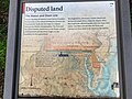 Disputed Land (50120993901).jpg 4,032 × 3,024; 2.93 MB
-
 Fort Ancient Monongahela cultures HRoe 2010.jpg 700 × 496; 312 KB
-
 French British Forts 1753 1758.png 328 × 423; 32 KB
-
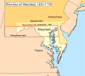 Marycolony.png 483 × 433; 28 KB
-
 Maryland Indigenous Tribes.svg 1,200 × 764; 461 KB
-
 Native Languages of Maryland.svg 860 × 393; 9 KB
-
 The War of 1812 in the Chesapeake.jpg 564 × 684; 84 KB
.jpg)


.jpg)


