Category:Maps of the history of Texas
Jump to navigation
Jump to search
States of the United States: Alabama · Alaska · Arizona · Arkansas · California · Colorado · Connecticut · Delaware · Florida · Georgia · Hawaii · Idaho · Illinois · Indiana · Iowa · Kansas · Kentucky · Louisiana · Maine · Maryland · Massachusetts · Michigan · Minnesota · Mississippi · Missouri · Montana · Nebraska · Nevada · New Hampshire · New Jersey · New Mexico · New York · North Carolina · North Dakota · Ohio · Oklahoma · Oregon · Pennsylvania · Rhode Island · South Carolina · South Dakota · Tennessee · Texas · Utah · Vermont · Virginia · Washington · West Virginia · Wisconsin · Wyoming – Washington, D.C.
Puerto Rico
Puerto Rico
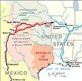
English: Maps of the History of Texas.
Subcategories
This category has the following 6 subcategories, out of 6 total.
O
R
- Maps of the Texas Revolution (26 F)
Media in category "Maps of the history of Texas"
The following 45 files are in this category, out of 45 total.
-
Map of Territorio de Nuevo Mexico.PNG 1,098 × 1,001; 41 KB
-
Political divisions of Mexico 1824 (location map scheme).svg 649 × 617; 509 KB
-
Santa Fe of New Mexico (location map scheme).svg 500 × 475; 565 KB
-
SantaFeTrail~1845.jpg 592 × 584; 217 KB
-
1920 Locust yearbook p. 218 (Commerce, Texas map).jpg 1,900 × 1,844; 1.52 MB
-
1933 cuba-brownsville map.png 949 × 1,164; 675 KB
-
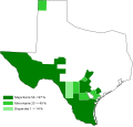
1998 South Central Texas Flood 3.png 723 × 715; 58 KB
-
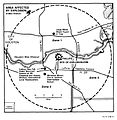
Apdx A Map of Area Affected.jpg 811 × 834; 57 KB
-
Apdx A Site Plan and Map.jpg 594 × 879; 34 KB
-
Arbuckle Bros. Coffee Company (3093000935).jpg 799 × 479; 342 KB
-
Battle of Mouth of Sabine River, September 8th, 1863. - NARA - 305664.jpg 767 × 1,200; 132 KB
-
Book of Texas (1916) (14750507446).jpg 2,048 × 1,878; 1.48 MB
-
CampañasTexas.jpg 2,292 × 3,056; 895 KB
-
Coahuila y texas.jpg 687 × 576; 89 KB
-
Cooperative economic insect report (1957) (20698078925).jpg 3,442 × 2,206; 2.07 MB
-
EB9 United States - historical maps (bottom).jpg 2,501 × 2,000; 942 KB
-
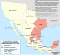
File-Mexico 1835-1846 administrative map-en-2.svg 1,241 × 1,138; 426 KB
-
File-Mexico 1835-1846 administrative map-ru-2.svg 1,241 × 1,138; 421 KB
-
French Texas 1685-en.svg 2,164 × 2,000; 3.11 MB
-
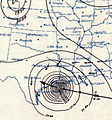
Galveston Hurricane (1900) SWA.JPG 356 × 382; 80 KB
-
Map of Chisholm Trail Picture 096.jpg 2,592 × 1,944; 978 KB
-
Map of Indians Texas 1500.png 2,308 × 1,584; 521 KB
-
Map of Texas Spanish 1900.svg 644 × 612; 39 KB
-
Mexican map en 1838.PNG 1,478 × 1,315; 93 KB
-
Mexican Texas 1833-en.svg 2,164 × 2,000; 3.08 MB
-
Mexico 1824 (equirectangular projection).png 1,400 × 1,047; 405 KB
-
Mexico 1835-1846 administrative map-de.svg 1,241 × 1,138; 162 KB
-
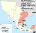
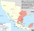
Mexico 1835-1846 administrative map-en-2.svg 1,241 × 1,138; 181 KB
-
Mexico 1835-1846 administrative map-en.svg 1,241 × 1,138; 426 KB
-
Mexico 1835-1846 administrative map-es.svg 1,518 × 1,138; 1.18 MB
-
Mexico 1835-1846 administrative map-fr.svg 1,241 × 1,138; 416 KB
-
Mexico 1835-1846 administrative map-it.svg 1,241 × 1,138; 191 KB
-
México División Política-República Central.png 1,098 × 1,181; 319 KB
-
Pg-25a.jpg 1,080 × 526; 312 KB
-
Spanish Texas 1794-en.svg 2,164 × 2,000; 2.86 MB
-
Spanish-texas.jpg 940 × 640; 64 KB
-
Texas 1718.jpg 1,282 × 1,059; 722 KB
-
Texas 2002.jpg 2,069 × 2,074; 837 KB
-
Texas Historical Borders Controversy.jpg 761 × 1,150; 54 KB
-
The essential facts of Oklahoma history and civics (1914) (14773774595).jpg 2,992 × 1,996; 820 KB
-
West Texas Indian Tribes -- 1600.jpg 654 × 536; 25 KB
-
West Texas Indian Tribes1 -- 1600.jpg 621 × 536; 25 KB
-
Wohngebiet Karankawa.png 710 × 934; 924 KB
-
Wpdms republic of texas-2008-19-11.svg 333 × 410; 107 KB


