Category:Maps of the history of New Hampshire
Jump to navigation
Jump to search
States of the United States: Alabama · Alaska · Arizona · Arkansas · California · Colorado · Connecticut · Delaware · Florida · Georgia · Hawaii · Idaho · Illinois · Indiana · Iowa · Kansas · Kentucky · Louisiana · Maine · Maryland · Massachusetts · Michigan · Minnesota · Mississippi · Missouri · Montana · Nebraska · Nevada · New Hampshire · New Jersey · New Mexico · New York · North Carolina · North Dakota · Ohio · Oklahoma · Oregon · Pennsylvania · Rhode Island · South Carolina · South Dakota · Tennessee · Texas · Utah · Vermont · Virginia · Washington · West Virginia · Wisconsin · Wyoming – Washington, D.C.
Puerto Rico
Puerto Rico
[[Category:Maps of New Hampshire|history]
Media in category "Maps of the history of New Hampshire"
The following 6 files are in this category, out of 6 total.
-
 Disputed Border in the East.jpg 3,813 × 3,072; 3.21 MB
-
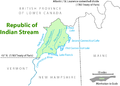 Indian stream map.png 1,617 × 1,162; 147 KB
-
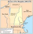 Nhcolony 2.png 480 × 500; 55 KB
-
 Nhcolony.png 480 × 500; 39 KB
-
 NHMedianHouseholdIncome1519.png 640 × 1,207; 247 KB
-
 Wpdms province of maine 1622.png 347 × 393; 73 KB


