Category:Maps of ethnic groups in Europe
Jump to navigation
Jump to search
Subcategories
This category has the following 28 subcategories, out of 28 total.
*
+
B
- Maps of the Bashkirs (44 F)
C
- Maps of the Crimean Tatars (14 F)
G
H
I
M
- Maps of the Moldovans (4 F)
P
R
S
- Maps of the Székelys (4 F)
U
Media in category "Maps of ethnic groups in Europe"
The following 157 files are in this category, out of 157 total.
-
1941 map - Caucasian peoples.jpg 6,641 × 5,177; 5.18 MB
-
Alba County ethnic map.png 607 × 599; 78 KB
-
Alba County Hungarians.png 400 × 395; 17 KB
-
Albania, hartă etnică 2011.png 2,362 × 3,389; 1.41 MB
-
Anatolians.png 948 × 578; 497 KB
-
Aquitani peoples.PNG 687 × 445; 162 KB
-
Arad County Hungarians.png 800 × 515; 90 KB
-
Arad ethnic map.png 803 × 603; 107 KB
-
Aromanii din Albania.png 2,480 × 3,507; 1.04 MB
-
Arpitancommunity.png 1,268 × 1,120; 1.56 MB
-
Bacau County Hungarians.png 776 × 600; 163 KB
-
Balkans ethnic map (1992).jpg 1,639 × 1,456; 252 KB
-
Bessarabia ethnographical map 1919.jpg 784 × 950; 148 KB
-
Bihor County ethnic map.png 452 × 756; 92 KB
-
Bihor County Hungarians.png 435 × 599; 77 KB
-
Bistrita-Nasaud County Hungarians.png 400 × 378; 28 KB
-
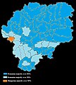
Bistrita-Nasaud ethnic map.jpg 631 × 700; 147 KB
-
Brasov ethnic map.png 785 × 600; 137 KB
-
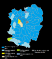
Caras-Severin ethnic map.png 626 × 707; 86 KB
-
Carte ethnographique de l'Europe (1885).jpg 4,850 × 3,470; 3.56 MB
-
Celtic peoples in Antiquity.png 1,231 × 929; 81 KB
-
Central Europe (1903) (14758166516).jpg 1,568 × 2,850; 1.35 MB
-
Central Europe (ethnic).JPG 2,230 × 1,436; 2.81 MB
-
Chuvash diaspora in Volga Federal District.png 1,144 × 669; 274 KB
-
Cluj County Hungarians.png 684 × 599; 127 KB
-
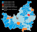
Cluj ethnic map.png 684 × 599; 141 KB
-
Corrected Sapmi in Europe.PNG 452 × 429; 15 KB
-
Covasna County Hungarians.png 400 × 405; 15 KB
-
DobroLang1903.png 674 × 594; 86 KB
-
East European population and languages - Russian map of 1907.jpg 900 × 874; 371 KB
-
Ebrei1939.PNG 857 × 800; 85 KB
-
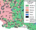
Ethnic composition of Kholmshchyna, Rittikh, 1875-en.svg 1,000 × 835; 217 KB
-
Ethnic composition of Kholmshchyna, Rittikh, 1875.svg 1,000 × 835; 214 KB
-
Ethnic composition of Pidliashshia, Rittikh, 1875-en.svg 780 × 1,340; 244 KB
-
Ethnic composition of Pidliashshia, Rittikh, 1875.svg 780 × 1,340; 243 KB
-
Ethnic composition of the westernmost parts of the Russian Empire, Erckert, 1863.jpg 2,048 × 1,695; 1.27 MB
-
Ethnic Groups in Eastern Europe - DPLA - c567a91874cba7f77391d2c03d8f7a87.jpg 2,550 × 3,278; 3.45 MB
-
Ethnic identity in and around Austria.1.png 1,690 × 930; 513 KB
-
Ethnic identity in and around Austria.jpg 1,690 × 930; 90 KB
-
Ethnic map of Asia Minor and Caucasus in 1914.jpg 1,270 × 795; 163 KB
-
Ethnic map of Tatarstan (2010).PNG 1,613 × 892; 87 KB
-
Ethnic Pakistanis in Britain.png 1,846 × 2,852; 825 KB
-
EthnicEurope.png 1,195 × 1,110; 339 KB
-
Ethnographic map of Balkan Peninsula..png 5,001 × 5,001; 2.3 MB
-
Ethnographic Map of Central and South Eastern Europe.jpg 1,932 × 2,576; 648 KB
-
Ethnographic map of Macedonia, G. Lejean (ca. 1861).jpg 408 × 283; 80 KB
-
Ethnographic map of Slavs, Lubor Niederle.JPG 1,017 × 847; 366 KB
-
Ethnographic map of the Ruthenian populaton of Galicia and Bukovina 1878.jpg 2,650 × 1,881; 2.23 MB
-
Etnoregionai.JPG 411 × 332; 21 KB
-
Eurogipsy hu.png 1,166 × 1,036; 118 KB
-
Eurogipsy official.PNG 1,159 × 519; 31 KB
-
Eurogipsy-HE.png 1,166 × 1,036; 122 KB
-
Eurogipsy.PNG 1,166 × 1,036; 117 KB
-
Eurogipsy.svg 2,044 × 1,719; 574 KB
-
Eurogipsy.tr.png 1,166 × 1,036; 91 KB
-
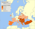
Eurogypsy.PNG 675 × 600; 174 KB
-
Europe (1896), Germanic ethnic groups.png 667 × 480; 810 KB
-
Europe, large ethnographic, Johnston, 1848.jpg 753 × 622; 118 KB
-
European countries with official Kurdish population.svg 680 × 520; 653 KB
-
Europesevolkeren.png 732 × 664; 376 KB
-
Finno-ugrian-map-de.svg 963 × 987; 927 KB
-
Finno-ugrian-map-es.svg 963 × 987; 1.01 MB
-
Finno-ugrian-map-ukr.svg 963 × 987; 927 KB
-
Finno-ugrian-map.svg 963 × 987; 927 KB
-
Finnugroj en 1000 (eo).svg 963 × 987; 927 KB
-
Gaelic genepool in Eastern Europe.png 333 × 542; 81 KB
-
Gaelic genepool in western europe.png 321 × 454; 89 KB
-
Gentic Map of Europe.png 781 × 544; 181 KB
-
Germanic peoples.jpg 1,401 × 871; 100 KB
-
Harghita County Hungarians.png 513 × 600; 71 KB
-
Hunedoara County Hungarians.png 296 × 400; 14 KB
-
Image-Languages-Europe.png 1,131 × 1,062; 496 KB
-
Image-Prussia ethnicity.JPG 395 × 343; 30 KB
-
Istorija Rusije.PNG 610 × 622; 115 KB
-
Jewish diaspora in Europe.png 2,458 × 2,048; 655 KB
-
Komi people area in Northern Russia map.svg 950 × 950; 1.67 MB
-
Kven.jpg 595 × 462; 130 KB
-
LangEur-300.jpg 815 × 571; 402 KB
-
Languages and ethnic groups in austria2-2.png 682 × 351; 269 KB
-
Languages and ethnic groups in austria2.jpg 682 × 351; 52 KB
-
Languages and ethnic groups in austria3.png 682 × 351; 260 KB
-
Languages-Europe eo.svg 886 × 793; 624 KB
-
Languages-Europe.png 886 × 793; 361 KB
-
Languages-Europe.svg 512 × 458; 406 KB
-
Lemko, West-Ukrainien & Hutsul claims 1918.png 645 × 439; 150 KB
-
Lenguas Rusia Antigua.jpg 610 × 622; 185 KB
-
LocationSapmi (cropped).png 500 × 500; 7 KB
-
LocationSapmi-2.png 190 × 190; 4 KB
-
LocationSapmi.png 811 × 789; 45 KB
-
London Asian pc 2011.PNG 1,343 × 999; 153 KB
-
London Black pc 2011.PNG 1,343 × 999; 151 KB
-
London White pc 2011.PNG 1,343 × 999; 156 KB
-
Map of ethnic Georgians significant distribution in Turkey.svg 550 × 325; 1.46 MB
-
Map of predominant national identity in the 2011 census in Northern Ireland.png 18,996 × 14,791; 16.76 MB
-
Map of the Races of Europe.jpg 2,017 × 1,669; 684 KB
-
Map-balkans-vlachs-HE.png 440 × 337; 55 KB
-
Mediterráneo año 800 dC 1.gif 2,301 × 1,455; 195 KB
-
Minorités ethniques - Autriche-Hongrie - 1910.svg 1,360 × 1,052; 1.25 MB
-
Minorités ethniques d'Autriche-Hongrie (1910).svg 1,360 × 1,052; 1.24 MB
-
Mitteleuropa – Völker und Sprachgebiete 1904.jpg 5,625 × 4,153; 16.82 MB
-
Mordva terr.png 3,225 × 2,004; 909 KB
-
Muromian-map.png 610 × 622; 165 KB
-
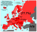
Native nationalities in Europe 2022.png 812 × 521; 185 KB
-
Numărul aromânilor din Albania.png 2,480 × 3,507; 1.13 MB
-
Oestareichische-Voiksgrubbm.PNG 1,030 × 650; 58 KB
-
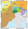
Oksywie Wielbark Przeworsk.gif 830 × 626; 21 KB
-
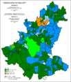
Percentage of ethnic minorities in Croatian counties.svg 600 × 551; 833 KB
-
Percentage of Serb population in Croatian counties.svg 600 × 551; 830 KB
-
Polacy w Berlinie.png 2,592 × 2,389; 412 KB
-
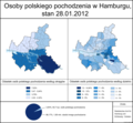
Polacy w Hamburgu.png 2,592 × 2,389; 864 KB
-
Polacynagrodzienszczyznie.png 500 × 500; 109 KB
-
Poles in German Empire, 1910 census.jpg 4,172 × 3,157; 6.23 MB
-
Polish minority in Czech Republic.png 800 × 460; 67 KB
-
Races-hum-europe.JPG 1,761 × 1,797; 745 KB
-
Racial distribution of Czechs and Slovaks in 1917.jpg 2,732 × 1,755; 3.2 MB
-
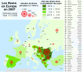
Roma in Europe 2007 map-de.svg 841 × 731; 656 KB
-
Roma in Europe 2007 map-fr.svg 841 × 731; 657 KB
-
Romani population average estimate.png 788 × 596; 160 KB
-
Romanien jakautuminen Euroopassa.jpg 675 × 600; 198 KB
-
Roumanophones 1856.jpeg 2,492 × 2,145; 974 KB
-
Russia ethnic.JPG 1,017 × 1,253; 501 KB
-
Russia IX secolo.png 610 × 622; 144 KB
-
Salaj County Hungarians.png 418 × 292; 17 KB
-
Sarajevo - Etnicki sastav po naseljima 1971 1 L.gif 2,806 × 3,252; 239 KB
-
Sarajevo - Etnicki sastav po naseljima 1981 1 L.gif 2,806 × 3,252; 247 KB
-
Sarajevo - Etnicki sastav po naseljima 1991 1 L.gif 2,806 × 3,252; 241 KB
-
Sarajevo - Etnicki sastav po naseljima 1991 2 L.gif 2,806 × 3,252; 270 KB
-
Satu Mare County Hungarians.png 791 × 600; 99 KB
-
Scottish clan map.png 1,065 × 1,400; 450 KB
-
Sedetanos.png 686 × 562; 697 KB
-
Sibiu County Hungarians.png 720 × 600; 84 KB
-
Slask cieszynski wizytacje 17wiek.png 3,000 × 2,887; 11.32 MB
-
Slavic Countries correct.png 4,592 × 3,196; 953 KB
-
Southern Dobruja ethnic religious 1930.svg 750 × 2,380; 1.27 MB
-
Sprachenkarte Böhmen.png 3,737 × 2,985; 1.67 MB
-
Tableau Ethnographique (Georg Ferdinand Robert d'Erckert, 1863).jpg 9,049 × 7,321; 8.75 MB
-
Tchernivtsi oblast 2001.png 871 × 533; 36 KB
-
The story of the map of Europe, its making and its changing (1916) (14591590390).jpg 2,828 × 1,920; 546 KB
-
The story of the map of Europe, its making and its changing (1916) (14591669538).jpg 2,864 × 1,924; 549 KB
-
Timis County Hungarians.png 800 × 529; 118 KB
-
Turcia europeana.jpg 9,753 × 6,125; 14.81 MB
-
Verspreiding-Nenetsen.png 1,622 × 960; 68 KB
-
İsviçre'de Türklerin yoğun olduğu kantonları.jpg 800 × 507; 28 KB
-
Śląsk Cieszyński-Czesi 1910.png 1,484 × 1,292; 379 KB
-
Śląsk Cieszyński-Niemcy 1910.png 1,484 × 1,292; 377 KB
-
Śląsk Cieszyński-Polacy 1910.png 1,484 × 1,292; 394 KB
-
Колонизация-немцами-славянских-земель.png 1,000 × 578; 570 KB
-
מפת אתנית אסטרו הונגריה.png 1,024 × 791; 245 KB


