Category:Maps of the history of North Macedonia in the Middle Ages
Jump to navigation
Jump to search
Subcategories
This category has the following 5 subcategories, out of 5 total.
B
M
- Maps of Kuber Bulgaria (5 F)
N
- Maps of the Empire of Nicaea (21 F)
S
- Maps of the Serbian Empire (61 F)
Media in category "Maps of the history of North Macedonia in the Middle Ages"
The following 87 files are in this category, out of 87 total.
-
 Ahtum sermon01.png 1,019 × 750; 75 KB
-
 Ahtum sermon02-sr.png 1,019 × 750; 69 KB
-
 Ahtum sermon02.gif 1,019 × 750; 38 KB
-
 Ahtum sermon03 01-es.svg 5,529 × 3,380; 279 KB
-
 Ahtum sermon03 01.png 1,019 × 750; 71 KB
-
 Ahtum sermon04 01.png 1,019 × 750; 72 KB
-
 Realms of Ahtum and Sermon in the 11th century-BG.png 1,556 × 1,202; 238 KB
-
 Realms of Ahtum and Sermon in the 11th century.png 1,559 × 1,200; 260 KB
-
 Archbishopric of Ohrid in 1020, map by Dimitar Rizov (1917).jpg 1,557 × 1,608; 868 KB
-
 Balkans in 1350 according to Gustav Droysen from 19th century.jpg 1,367 × 1,268; 546 KB
-
 Balkans1355.png 551 × 352; 62 KB
-
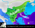
 BG 14 vek.png 888 × 729; 491 KB
-
 Bulg & neighb. XIV A.png 730 × 599; 571 KB
-
 Bulgaria Samuil (997-1014) es fr.svg 728 × 594; 208 KB
-
 Bulgaria Samuil (997-1014) es.svg 728 × 594; 185 KB
-
 Bulgaria Samuil (997-1014) pt.svg 728 × 594; 185 KB
-
 Bulgaria Samuil (997-1014) zh.svg 728 × 594; 183 KB
-
 Bulgaria Samuil (997-1014)-hu.svg 728 × 594; 185 KB
-
 Bulgaria Samuil (997-1014).svg 728 × 594; 177 KB
-
 Bulgaria Samuil (997-1014)cs.png 2,000 × 1,632; 413 KB
-
 Bulgaria Samuil raster-ar.png 825 × 672; 353 KB
-
 Bulgaria Samuil raster.png 611 × 498; 225 KB
-
 Bulgarian lands 1350 vek-es.svg 892 × 731; 818 KB
-
 Bulgarian lands 1350 vek-hu.svg 892 × 731; 348 KB
-
 Bulgarian lands 1350 vek-pt.svg 892 × 731; 332 KB
-
 Bulgarian lands 1350 vek.svg 892 × 731; 327 KB
-
 Bulgarian uprising of Peter Delyan (1040-1041)-es.svg 564 × 558; 229 KB
-
 Bulgarian uprising of Peter Delyan (1040-1041)-pt.svg 564 × 558; 163 KB
-
 Bulgarian uprising of Peter Delyan (1040-1041)-zh.svg 564 × 558; 70 KB
-
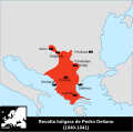
 Bulgarian uprising of Peter Delyan (1040-1041).svg 564 × 558; 83 KB
-
 Byzantine empire 1355.jpg 1,134 × 897; 380 KB
-
 Byzantine Empire 1355.jpg 743 × 600; 411 KB
-
 Byzantine empire 1355V2Make.svg 5,924 × 3,211; 629 KB
-
 Byzantine themes in the Balkans.png 1,779 × 1,615; 698 KB
-
 Central balkans 1373 1395 (cropped).png 2,523 × 2,516; 100 KB
-
 Central balkans 1373 1395 sr.png 2,600 × 2,637; 254 KB
-
 Central balkans 1373 1395.png 2,600 × 2,637; 249 KB
-
 Central balkans 1373 1395V1 en.svg 1,609 × 1,592; 463 KB
-
 Central balkans 1373 1395V1-hu.svg 1,609 × 1,592; 463 KB
-
 Central balkans 1373 1395V1-pt.svg 1,609 × 1,592; 495 KB
-
 Central balkans 1373 1395V1.svg 1,609 × 1,592; 846 KB
-
 Dardania and kosovo-sr.png 818 × 1,184; 80 KB
-
 Dardania and kosovo.png 818 × 1,184; 78 KB
-
 Deljan1040.jpg 595 × 780; 187 KB
-
 Deljan1040.svg 535 × 700; 259 KB
-
 Devolskikomitat.jpg 735 × 687; 68 KB
-
 Division of the area in Serbia by the nobility XIV cAD.svg 1,600 × 1,200; 203 KB
-
 Dušan İmparatorluğu -tr-.svg 994 × 1,104; 294 KB
-
 Empire de Dušan es.svg 994 × 1,104; 453 KB
-
 Empire de Dušan mk.svg 994 × 1,104; 294 KB
-
 Empire de Dušan pt.svg 994 × 1,104; 442 KB
-
 Empire de Dušan-hu.svg 994 × 1,104; 288 KB
-
 Empire de Dušan-zh.svg 1,243 × 1,380; 189 KB
-
 Empire de Dušan.svg 994 × 1,104; 293 KB
-
 Epir1205-1230.png 633 × 596; 37 KB
-
 Epir1315-1358.png 637 × 600; 77 KB
-
 Epirus 1205 1230.svg 633 × 598; 289 KB
-
 Kalojanborildevol.jpg 790 × 469; 31 KB
-
 Kingdom of Prilep mk.png 786 × 1,005; 60 KB
-
 Kingdom of Prilep-sr.png 786 × 1,005; 68 KB
-
 Kingdom of Prilep.png 786 × 1,005; 64 KB
-
 La serbie du debut du regne de Lazar-es.svg 994 × 1,104; 1.42 MB
-
 La serbie en Fin de regne de Lazar-es.svg 994 × 1,104; 1.24 MB
-
 La serbie en Fin de regne de Lazar-pt.svg 994 × 1,104; 519 KB
-
 Ohrid archbishopric 1020 01.png 1,087 × 1,112; 101 KB
-
 Ohrid archbishopric 1020 02.png 1,087 × 1,112; 103 KB
-
 Principality of Velbazhd-es.svg 917 × 866; 522 KB
-
 Principality of Velbazhd-pt.svg 917 × 866; 335 KB
-
 Principality of Velbazhd.png 1,352 × 1,281; 91 KB
-
 Realm of Brankovic Vuk XIV c.png 342 × 304; 64 KB
-
 Realm of Brankovic-es.svg 792 × 616; 635 KB
-
 Realm of Brankovic.png 1,180 × 954; 84 KB
-
 ReinoDePrilepSigloXIV-hu.svg 752 × 936; 28 KB
-
 ReinoDePrilepSigloXIV.svg 752 × 936; 207 KB
-
 RizMap11.jpg 1,472 × 1,505; 1.89 MB
-
 Serbian Empire 1355-cs.png 452 × 704; 184 KB
-
 Serbian Empire in 14th century-mk.svg 621 × 776; 265 KB
-
 Slavs 900AD.JPG 466 × 576; 72 KB
-
 Srbija gospodari oblasti XIV v.svg 1,600 × 1,200; 205 KB
-
 Srbsko XIV es.svg 621 × 776; 862 KB
-
 Srbsko XIV pt.svg 621 × 776; 310 KB
-
 Srbsko XIV ru.svg 621 × 776; 264 KB
-
 Taratul sarbesc.svg 994 × 1,104; 291 KB
-
 Vuk Brankovic posjedi.png 342 × 304; 57 KB
-
 Vukasin ugljesa 1371 en.png 913 × 725; 81 KB
-
 Vukasin ugljesa 1371 mk.png 913 × 725; 72 KB
-
 Vukasin ugljesa 1371 sr.png 913 × 725; 76 KB


.jpg)


_es_fr.svg)
_es.svg)
_pt.svg)
_zh.svg)
-hu.svg)
.svg)
cs.png)


-es.svg)
-pt.svg)
-zh.svg)
.svg)


.png)


