Category:Maps of the Outer Hebrides
Jump to navigation
Jump to search
Council areas (municipalities) of Scotland: Aberdeen · Aberdeenshire · Angus · Argyll and Bute · Clackmannanshire · Dumfries and Galloway · Dundee · East Ayrshire · East Dunbartonshire · East Lothian · East Renfrewshire · Edinburgh · Falkirk · Fife · Glasgow · Highland · Inverclyde · Midlothian · Moray · North Ayrshire · North Lanarkshire · Outer Hebrides · Orkney Islands · Perth and Kinross · Renfrewshire · Scottish Borders · Shetland Islands · South Ayrshire · South Lanarkshire · Stirling · West Dunbartonshire · West Lothian
| NO WIKIDATA ID FOUND! Search for Maps of the Outer Hebrides on Wikidata | |
| Upload media |
Subcategories
This category has the following 8 subcategories, out of 8 total.
!
B
- Maps of Barra, Scotland (4 F)
H
- Maps of Harris (9 F)
L
S
- Maps of St Kilda (35 F)
W
- Wards of Na h-Eileanan Siar (11 F)
Media in category "Maps of the Outer Hebrides"
The following 23 files are in this category, out of 23 total.
-
Admiralty Chart No 1144 Plans in the Hebrides, Published 1911, Corrections to 1970.jpg 8,116 × 10,986; 16.37 MB
-
Comhairle nan Eilean Siar election, 2007.svg 1,083 × 1,424; 3.09 MB
-
Comhairle nan Eilean Siar election, 2012.svg 1,083 × 1,424; 3.09 MB
-
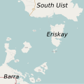
Eriskay map.svg 1,180 × 1,178; 235 KB
-
Eriskay, Outer Hebrides.jpg 2,001 × 2,632; 556 KB
-
Map Eoligarry.png 181 × 284; 20 KB
-
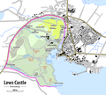
Map of Lews Castle.png 1,401 × 1,266; 572 KB
-
Mappa Ebridi est.png 200 × 229; 28 KB
-
Na h-Eileanan an Iar (Scottish Parliament constituency).svg 691 × 1,020; 456 KB
-
Ordnance Survey One-inch Sheet 17 North Uist, Published 1959.jpg 8,264 × 9,882; 7.13 MB
-
Outer Hebrides blank.svg 1,083 × 1,424; 2.36 MB
-
Outer Hebrides UK blank map.svg 1,083 × 1,424; 3.01 MB
-
Outer Hebrides UK location map.svg 1,083 × 1,424; 3.25 MB
-
Outer Hebrides UK parish map (blank).svg 1,083 × 1,424; 2.37 MB
-
Outer Hebrides UK relief location map.jpg 2,001 × 2,632; 481 KB
-
Outer Hebrides UK ward map (blank).svg 1,083 × 1,424; 3.08 MB
-
Relevant locations for the SS Politician.jpg 3,985 × 2,839; 3.04 MB
-
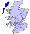
ScotlandEileanSiar.png 225 × 350; 4 KB
-
Taransay.png 443 × 458; 11 KB
-
The Quarterly journal of the Geological Society of London (14340781094).jpg 1,441 × 3,200; 1.14 MB
-
Verlauf der A865.png 422 × 972; 202 KB
-
Western Islands Location.png 400 × 457; 63 KB
-
Western Isles Area Council election, 1994.svg 1,083 × 1,424; 3.66 MB


