Category:Maps of South Lanarkshire
Jump to navigation
Jump to search
Council areas (municipalities) of Scotland: Aberdeen · Aberdeenshire · Angus · Argyll and Bute · Clackmannanshire · Dumfries and Galloway · Dundee · East Ayrshire · East Dunbartonshire · East Lothian · East Renfrewshire · Edinburgh · Falkirk · Fife · Glasgow · Highland · Inverclyde · Midlothian · Moray · North Ayrshire · North Lanarkshire · Outer Hebrides · Orkney Islands · Perth and Kinross · Renfrewshire · Scottish Borders · Shetland Islands · South Ayrshire · South Lanarkshire · Stirling · West Dunbartonshire · West Lothian
}
Wikimedia category | |||||
| Upload media | |||||
| Instance of | |||||
|---|---|---|---|---|---|
| Category combines topics | |||||
| South Lanarkshire | |||||
local government area of Scotland    | |||||
| Instance of | |||||
| Part of |
| ||||
| Location | Scotland | ||||
| Capital | |||||
| Legislative body |
| ||||
| Inception |
| ||||
| Population |
| ||||
| Area |
| ||||
 | |||||
Subcategories
This category has only the following subcategory.
W
- Wards of South Lanarkshire (23 F)
Media in category "Maps of South Lanarkshire"
The following 24 files are in this category, out of 24 total.
-

-

-
 East Kilbride (Scottish Parliament constituency).svg 165 × 165; 31 KB
-
 MapofEarnock.png 1,255 × 922; 207 KB
-
 MapOfEarnockEstate.png 808 × 724; 165 KB
-
 Melbourne Lanarkshire OSM.png 1,238 × 755; 114 KB
-
 Rutherglen (Scottish Parliament constituency).svg 151 × 127; 23 KB
-
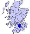 Scot1975Clydesdale.png 200 × 229; 30 KB
-
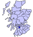 Scot1975EKilbride.png 200 × 229; 30 KB
-
 Scot1975Hamilton.png 200 × 229; 30 KB
-
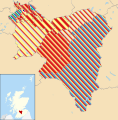
 Scotland South Lanarkshire.png 511 × 730; 12 KB
-
 ScotlandSouthLanarkshire.png 200 × 230; 4 KB
-
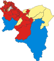
 South Lanarkshire Council election 2007.svg 1,319 × 1,345; 2.63 MB
-
 South Lanarkshire Council election 2012.svg 1,319 × 1,345; 2.63 MB
-
 South Lanarkshire Council election, 2003.svg 533 × 601; 448 KB
-
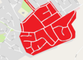
 South Lanarkshire council.PNG 2,733 × 3,411; 208 KB
-
 South Lanarkshire UK blank map.svg 1,319 × 1,345; 814 KB
-
 South Lanarkshire UK location map.svg 1,319 × 1,345; 1.3 MB
-
 South Lanarkshire UK parish map (blank).svg 1,319 × 1,345; 1.09 MB
-
 South Lanarkshire UK relief location map.jpg 1,999 × 2,039; 538 KB
-
 South Lanarkshire UK ward map (blank).svg 1,319 × 1,345; 1.13 MB
-
 South Lanarkshire UK ward map 2017 (blank).svg 1,319 × 1,345; 1.05 MB
-
 Torrance House map 1790s.jpg 1,346 × 1,369; 1.27 MB
-
 UddingstonMap1923.jpg 913 × 695; 153 KB
.jpg)
.jpg)
.svg)


.svg)


.svg)
.svg)
.svg)