Category:Maps of Edinburgh
Jump to navigation
Jump to search
Council areas (municipalities) of Scotland: Aberdeen · Aberdeenshire · Angus · Argyll and Bute · Clackmannanshire · Dumfries and Galloway · Dundee · East Ayrshire · East Dunbartonshire · East Lothian · East Renfrewshire · Edinburgh · Falkirk · Fife · Glasgow · Highland · Inverclyde · Midlothian · Moray · North Ayrshire · North Lanarkshire · Outer Hebrides · Orkney Islands · Perth and Kinross · Renfrewshire · Scottish Borders · Shetland Islands · South Ayrshire · South Lanarkshire · Stirling · West Dunbartonshire · West Lothian
English: A gallery of maps of Edinburgh.
Wikimedia category | |||||
| Upload media | |||||
| Instance of | |||||
|---|---|---|---|---|---|
| Category combines topics | |||||
| Edinburgh | |||||
capital city of Scotland, UK | |||||
| Instance of |
| ||||
| Location |
| ||||
| Located in or next to body of water | |||||
| Head of government |
| ||||
| Present in work |
| ||||
| Inception |
| ||||
| Population |
| ||||
| Area |
| ||||
| Elevation above sea level |
| ||||
| Different from | |||||
| official website | |||||
 | |||||
Subcategories
This category has the following 7 subcategories, out of 7 total.
E
- Election maps of Edinburgh (41 F)
M
- Maps of Edinburgh Castle (8 F)
O
P
T
- Travel maps of Edinburgh (4 F)
W
- Wards of Edinburgh (23 F)
Media in category "Maps of Edinburgh"
The following 87 files are in this category, out of 87 total.
-
1 o'clock gun map (5354511937).png 588 × 588; 621 KB
-
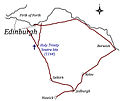
Borders Drove Roads.jpg 1,587 × 1,333; 411 KB
-
Broughton ward in Edinburgh Corporation.svg 166 × 131; 76 KB
-
Calton ward in Edinburgh Corporation.svg 166 × 131; 76 KB
-
CENTRAL EDINBURGH.jpg 3,309 × 4,841; 4.92 MB
-
Central Leith ward in Edinburgh Corporation.svg 166 × 131; 76 KB
-
City of Edinburgh 1999.svg 596 × 747; 820 KB
-
City of Edinburgh council area.svg 603 × 753; 671 KB
-
Colinton ward in Edinburgh Corporation.svg 166 × 131; 76 KB
-
Corstorphine ward in Edinburgh Corporation.svg 166 × 131; 76 KB
-
Craigentinny ward in Edinburgh Corporation.svg 166 × 131; 76 KB
-
Craigmillar ward in Edinburgh Corporation.svg 166 × 131; 76 KB
-
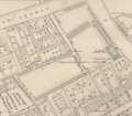
East Preston Street Burial Ground in 1845.png 522 × 455; 463 KB
-
Easter Road Map.png 970 × 576; 332 KB
-
Edinburgh (location).png 236 × 226; 47 KB
-
Edinburgh (Location).png 553 × 933; 177 KB
-
Edinburgh - City of Edinburgh dot.png 1,802 × 2,589; 189 KB
-
EDINBURGH 1.jpg 3,508 × 4,958; 3.08 MB
-
EDINBURGH 2.jpg 3,272 × 4,768; 4.95 MB
-
Edinburgh Eastern (Scottish Parliament constituency).svg 103 × 45; 53 KB
-
Edinburgh map-he.png 610 × 516; 57 KB
-
Edinburgh map.png 734 × 573; 69 KB
-
Edinburgh North and Leith (Scottish Parliament constituency).svg 103 × 45; 53 KB
-
Edinburgh Old Town Boundaries with New Town.svg 916 × 520; 1.93 MB
-
Edinburgh outline map.png 556 × 500; 137 KB
-
Edinburgh Pentlands (Scottish Parliament constituency).svg 103 × 45; 53 KB
-
Edinburgh photo heatmap (3598407845).jpg 1,590 × 1,135; 893 KB
-
Edinburgh population density map, 2011 census.png 2,847 × 1,777; 5.9 MB
-
Edinburgh printable tourist attractions map.jpg 2,105 × 1,488; 1.66 MB
-
Edinburgh relief map with OpenStreetMap road overlay (3865939852).png 1,253 × 1,253; 2.07 MB
-
Edinburgh Road Network analysis (6156201341).png 2,000 × 2,000; 1.69 MB
-
Edinburgh Southern (Scottish Parliament constituency).svg 103 × 45; 53 KB
-
Edinburgh town walls.png 1,507 × 1,417; 350 KB
-
Edinburgh UK blank map.svg 1,330 × 1,384; 704 KB
-
Edinburgh UK constituency map (blank).svg 1,330 × 1,384; 729 KB
-
Edinburgh UK locality map with Edinburgh urban boundary 2017.svg 1,837 × 1,384; 823 KB
-
Edinburgh UK location map.svg 1,330 × 1,384; 682 KB
-
Edinburgh UK parish map (blank).svg 1,330 × 1,384; 757 KB
-
Edinburgh UK relief location map.jpg 2,005 × 2,088; 285 KB
-
Edinburgh UK ward map (blank).svg 1,330 × 1,384; 889 KB
-
Edinburgh UK ward map 2017 (blank).svg 1,330 × 1,384; 890 KB
-
Edinburgh urban area (settlement area).jpg 1,562 × 1,031; 377 KB
-
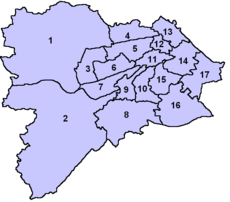
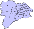
Edinburgh wards.png 753 × 660; 22 KB
-
Edinburgh Wikivoyage locator maps - Leith.png 576 × 599; 132 KB
-
Edinburgh Wikivoyage locator maps - New Town.png 576 × 599; 133 KB
-
Edinburgh Wikivoyage locator maps - Old Town.png 576 × 599; 132 KB
-
Edinburgh Wikivoyage locator maps - Stockbridge and Canonmills.png 576 × 599; 133 KB
-
Edinburgh,-Leith-and-Newhav.png 619 × 454; 53 KB
-
Edinburghareas.jpeg 720 × 505; 123 KB
-
EdinburghWestConst.png 1,771 × 2,952; 1.83 MB
-
George Square ward in Edinburgh Corporation.svg 166 × 131; 76 KB
-
Gorgie-Dalry ward in Edinburgh Corporation.svg 166 × 131; 76 KB
-
Greyfriars Map.jpg 2,820 × 3,982; 2.27 MB
-
Heriot Row in 1836.jpg 3,088 × 2,056; 1.5 MB
-
Holyrood ward in Edinburgh Corporation.svg 166 × 131; 76 KB
-
JOSM - Edinburgh.jpg 1,920 × 1,020; 286 KB
-
Liberton ward in Edinburgh Corporation.svg 166 × 131; 76 KB
-
Location map United Kingdom Edinburgh Central.png 806 × 724; 788 KB
-
Location map United Kingdom Edinburgh.png 792 × 699; 551 KB
-
Map of Edinburgh's Graveyards (5613994673).png 760 × 633; 83 KB
-
Merchiston ward in Edinburgh Corporation.svg 166 × 131; 76 KB
-
Morningside ward in Edinburgh Corporation.svg 166 × 131; 76 KB
-
Most viewed parts of Edinburgh, according to Flickr (7475188840).png 2,307 × 1,304; 1.07 MB
-
Murrayfield-Cramond ward in Edinburgh Corporation.svg 166 × 131; 76 KB
-
Newington ward in Edinburgh Corporation.svg 166 × 131; 76 KB
-
Ordnance Survey Quarter-inch sheet 3 The Forth, Clyde & Tay, published 1946.jpg 13,238 × 10,969; 16.2 MB
-
Ordnance Survey Quarter-inch sheet 7 Firth of Forth, published 1961.jpg 9,738 × 8,845; 10.16 MB
-
Ordnance Survey Sheet NT 27 37 Edinburgh, Published 1969.jpg 14,854 × 7,093; 37.01 MB
-
Physic garden on Leith Walk - detail of John Ainslie's map 1804.png 606 × 406; 601 KB
-
Pilton ward in Edinburgh Corporation.svg 166 × 131; 76 KB
-
Portobello ward in Edinburgh Corporation.svg 166 × 131; 76 KB
-
ScotlandEdinburgh.png 200 × 230; 4 KB
-
Scottish National Gallery map Edinburgh.png 743 × 535; 118 KB
-
Sighthill ward in Edinburgh Corporation.svg 166 × 131; 76 KB
-
Slezer's Prospect of Edinburgh.jpg 1,089 × 482; 460 KB
-
South Leith ward in Edinburgh Corporation.svg 166 × 131; 76 KB
-
St Andrews ward in Edinburgh Corporation.svg 166 × 131; 76 KB
-
St Bernards ward in Edinburgh Corporation.svg 166 × 131; 76 KB
-
St Giles ward in Edinburgh Corporation.svg 166 × 131; 76 KB
-
Stockbridge and Comely Bank, 1865 2012 (7617351698).png 1,938 × 1,040; 2.47 MB
-
Streets to be created in the 1827 Improvement Act in Edinburgh.png 885 × 429; 1.07 MB
-
The Moray Estate in Edinburgh.jpg 2,050 × 2,317; 2.66 MB
-
Wemyss Place 1845.png 601 × 419; 456 KB
-
West Leith ward in Edinburgh Corporation.svg 166 × 131; 76 KB


