Category:Maps of Highland council area
Jump to navigation
Jump to search
Council areas (municipalities) of Scotland: Aberdeen · Aberdeenshire · Angus · Argyll and Bute · Clackmannanshire · Dumfries and Galloway · Dundee · East Ayrshire · East Dunbartonshire · East Lothian · East Renfrewshire · Edinburgh · Falkirk · Fife · Glasgow · Highland · Inverclyde · Midlothian · Moray · North Ayrshire · North Lanarkshire · Outer Hebrides · Orkney Islands · Perth and Kinross · Renfrewshire · Scottish Borders · Shetland Islands · South Ayrshire · South Lanarkshire · Stirling · West Dunbartonshire · West Lothian
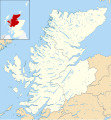
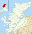
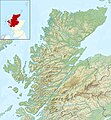
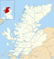
Maps of the Highland council area of Scotland.
Subcategories
This category has the following 7 subcategories, out of 7 total.
Media in category "Maps of Highland council area"
The following 42 files are in this category, out of 42 total.
-
Admiralty Chart No 1836 Plans on the west coast of Scotland, Published 1959.jpg 11,038 × 8,225; 21.74 MB
-
Affric-Beauly hydro-electric power scheme.svg 901 × 553; 1.95 MB
-
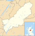
Badenoch and Strathspey UK blank map.svg 1,385 × 1,424; 1.08 MB
-
Badenoch and Strathspey UK location map.svg 1,385 × 1,424; 1.49 MB
-
Badenoch and Strathspey UK relief location map.jpg 2,002 × 2,059; 703 KB
-
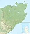
Caithness UK blank map.svg 1,233 × 1,424; 1.02 MB
-
Caithness UK location map.svg 1,233 × 1,424; 1.29 MB
-
Caithness UK relief location map.jpg 2,002 × 2,313; 368 KB
-
Caithness, Sutherland and Ross (Scottish Parliament constituency).svg 691 × 1,020; 456 KB
-
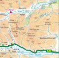
Cluanie Horseshoe.svg 745 × 731; 157 KB
-
Highland Council election 2012.svg 1,320 × 1,424; 5.01 MB
-
Highland Council election, 1995.svg 829 × 870; 5.89 MB
-
Highland Council election, 1999.svg 829 × 870; 5.59 MB
-
Highland Council election, 2003.svg 829 × 870; 5.59 MB
-
Highland UK blank map.svg 1,320 × 1,424; 4.04 MB
-
Highland UK constituency map (blank).svg 1,320 × 1,424; 4.08 MB
-
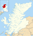
Highland UK location map.svg 1,320 × 1,424; 5.26 MB
-
Highland UK parish map (blank).svg 1,320 × 1,424; 3.93 MB
-
Highland UK parish map showing Tarbat parish.svg 1,320 × 1,424; 3.35 MB
-
Highland UK relief location map-640.png 640 × 691; 811 KB
-
Highland UK relief location map.jpg 2,000 × 2,159; 967 KB
-
Highland UK ward map (blank).svg 1,320 × 1,424; 4.45 MB
-
Highland UK ward map 2017 (blank).svg 1,320 × 1,424; 4.22 MB
-
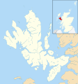
Isle of Skye UK blank map.svg 1,334 × 1,424; 1.39 MB
-
Isle of Skye UK location map.svg 1,334 × 1,424; 1.56 MB
-
Lairig Ghru and Lairig an Laoigh.svg 1,502 × 2,500; 1 MB
-
Loch Monar Munros - Lurg Mhor.svg 935 × 692; 1.2 MB
-
Loch Monar Munros.svg 935 × 692; 1.2 MB
-
Lochaber UK blank map.svg 1,425 × 893; 2.27 MB
-
Lochaber UK location map.svg 1,425 × 893; 2.39 MB
-
Lochaber UK relief location map.jpg 2,001 × 1,253; 532 KB
-
North Coast 500, Scotland.svg 742 × 482; 4.24 MB
-
Ordnance Survey Quarter-inch sheet 3 Northern Scotland, published 1966.jpg 9,696 × 8,949; 8.98 MB
-
Ordnance Survey Sheet NH 77 Ballchraggan, Published 1963.jpg 6,796 × 7,485; 16.88 MB
-
Ross and Cromarty UK blank map.svg 1,425 × 1,400; 2.42 MB
-
Ross and Cromarty UK location map.svg 1,425 × 1,400; 3.04 MB
-
Ross and Cromarty UK relief location map.jpg 2,004 × 1,967; 795 KB
-
Skye, Lochaber and Badenoch (Scottish Parliament constituency).svg 691 × 1,020; 456 KB
-
Sutherland UK location map.svg 1,425 × 1,166; 2.59 MB
-
Sutherland UK relief location map.jpg 2,001 × 1,636; 578 KB
-
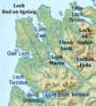
ロッホ・マリー周辺図.png 364 × 403; 300 KB


