Category:Locator maps of the Outer Hebrides
Jump to navigation
Jump to search
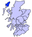
Council areas (municipalities) of Scotland: Fife · Outer Hebrides ·
| NO WIKIDATA ID FOUND! Search for Locator maps of the Outer Hebrides on Wikidata | |
| Upload media |
Media in category "Locator maps of the Outer Hebrides"
The following 103 files are in this category, out of 103 total.
-
Baleshare OH.svg 1,083 × 1,424; 2.36 MB
-
Barra OH.svg 1,083 × 1,424; 2.36 MB
-
Benbecula OH.svg 1,083 × 1,424; 2.36 MB
-
Berneray (Mingulay) OH.svg 1,083 × 1,424; 2.36 MB
-
Berneray (Sound of Harris) OH.svg 1,083 × 1,424; 2.36 MB
-
Berneray, Sound of Harris, OH.svg 388 × 236; 3.92 MB
-
Boreray (North Uist) OH.svg 1,083 × 1,424; 2.36 MB
-
Boreray, Sound of Harris, OH.svg 388 × 236; 3.92 MB
-
Eilean Kearstay OH.svg 1,083 × 1,424; 2.36 MB
-
Ensay OH.svg 1,083 × 1,424; 2.36 MB
-
Ensay, Sound of Harris, OH.svg 388 × 236; 3.92 MB
-
Eriskay (South Uist and Barra).svg 231 × 408; 1.04 MB
-
Eriskay OH.svg 1,083 × 1,424; 2.36 MB
-
Fiaray (Barra).svg 215 × 190; 2.52 MB
-
Flannan Isles OH.svg 1,083 × 1,424; 2.36 MB
-
Flannan-Scotland (Location).png 144 × 250; 30 KB
-
Flodday (Barra).svg 215 × 190; 2.52 MB
-
Fuday (Barra) OH.svg 1,083 × 1,424; 2.36 MB
-
Fuday (Benbecula) OH.svg 1,083 × 1,424; 2.36 MB
-
Fuday (South Uist and Barra).svg 231 × 408; 2.54 MB
-
Fuiay (Barra).svg 215 × 190; 2.52 MB
-
Fuiay (South Uist and Barra).svg 231 × 408; 2.54 MB
-
Gighay (South Uist and Barra).svg 231 × 408; 2.54 MB
-
Gilsay, Sound of Harris, OH.svg 388 × 236; 3.92 MB
-
Great Bernera OH.svg 1,083 × 1,424; 2.36 MB
-
Grimsay OH.svg 1,083 × 1,424; 2.36 MB
-
Grimsay South East Benbecula OH.svg 1,083 × 1,424; 2.36 MB
-
Groay, Sound of Harris, OH.svg 388 × 236; 3.92 MB
-
Harris OH.svg 1,083 × 1,424; 2.36 MB
-
Harris Scotland.PNG 648 × 584; 20 KB
-
Hellisay (South Uist and Barra).svg 231 × 408; 2.54 MB
-
Hermetray OH.svg 1,083 × 1,424; 2.36 MB
-
Hermetray, Sound of Harris, OH.svg 388 × 236; 3.92 MB
-
Hirta OH.svg 1,083 × 1,424; 2.36 MB
-
Isle of Lewis on map of United Kingdom.png 200 × 230; 3 KB
-
Killegray OH.svg 1,083 × 1,424; 2.36 MB
-
Killegray, Sound of Harris, OH.svg 388 × 236; 3.92 MB
-
Kirkibost Island OH.svg 1,083 × 1,424; 2.36 MB
-
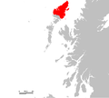
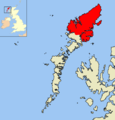
Lewis OH.svg 1,083 × 1,424; 2.36 MB
-
Lewis scotland.PNG 648 × 584; 20 KB
-
Lingay (Barra).svg 215 × 190; 2.52 MB
-
Lingay (Sound of Barra).svg 215 × 190; 2.52 MB
-
Lingay, Sound of Harris, OH.svg 388 × 236; 3.92 MB
-
Little Bernera OH.svg 1,083 × 1,424; 2.36 MB
-
Mealasta Island.svg 1,083 × 1,424; 2.36 MB
-
Mingulay OH.svg 1,083 × 1,424; 2.36 MB
-
Monach Islands OH.svg 1,083 × 1,424; 2.36 MB
-
North Uist OH.svg 1,083 × 1,424; 2.36 MB
-
Opsay, Sound of Harris, OH.svg 388 × 236; 3.92 MB
-
Orosay (Barra).svg 215 × 190; 2.52 MB
-
Orosay (South Uist and Barra).svg 231 × 408; 2.54 MB
-
Outer Hebrides blank.svg 1,083 × 1,424; 2.36 MB
-
Outerhebrideslewis2.png 1,500 × 1,562; 118 KB
-
Pabbay (Sound of Harris) OH.svg 1,083 × 1,424; 2.36 MB
-
Pabbay (Sound of Pabbay) OH.svg 1,083 × 1,424; 2.36 MB
-
Pabbay, Sound of Harris, OH.svg 388 × 236; 3.92 MB
-
Ronay OH.svg 1,083 × 1,424; 2.36 MB
-
Sandray (South Uist and Barra).svg 231 × 408; 2.54 MB
-
Sandray OH.svg 1,083 × 1,424; 2.36 MB
-
Scalpay OH.svg 1,083 × 1,424; 2.36 MB
-
Scarp OH.svg 1,083 × 1,424; 2.36 MB
-
Schotland, Eriskay.PNG 170 × 216; 3 KB
-
Sgarabhaigh, Sound of Harris, OH.svg 388 × 236; 3.92 MB
-
Shiant Isles OH.svg 1,083 × 1,424; 2.36 MB
-
Shillay, Sound of Harris, OH.svg 388 × 236; 3.92 MB
-
South Uist OH.svg 1,083 × 1,424; 2.36 MB
-
St Kilda OH.svg 1,083 × 1,424; 2.36 MB
-
Stromay, Sound of Harris, OH.svg 388 × 236; 3.92 MB
-
Stuley OH.svg 1,083 × 1,424; 2.36 MB
-
Sursay, Sound of Harris, OH.svg 388 × 236; 3.92 MB
-
Tahay OH.svg 1,083 × 1,424; 2.36 MB
-
Tahay, Sound of Harris, OH.svg 388 × 236; 3.92 MB
-
Taransay OH.svg 1,083 × 1,424; 2.36 MB
-
UK Barra.png 648 × 584; 19 KB
-
UK Benbecula.PNG 648 × 584; 19 KB
-
UK Berneray.PNG 648 × 584; 19 KB
-
UK Berneray2.PNG 648 × 584; 20 KB
-
UK Eriskay.PNG 648 × 584; 19 KB
-
UK Flannan.PNG 648 × 584; 20 KB
-
UK Great Bernera.PNG 648 × 584; 20 KB
-
UK Grimsay.PNG 648 × 584; 19 KB
-
UK Harris.PNG 648 × 584; 20 KB
-
UK Hermetray.PNG 648 × 584; 19 KB
-
UK Lewis.PNG 648 × 584; 20 KB
-
UK Mingulay.PNG 648 × 584; 19 KB
-
UK Monach.PNG 648 × 584; 19 KB
-
UK North Uist.PNG 648 × 584; 19 KB
-
UK Ronay.PNG 648 × 584; 19 KB
-
UK Rosinish.PNG 648 × 584; 19 KB
-
UK Sandray.PNG 648 × 584; 19 KB
-
UK Scalpay2.PNG 648 × 584; 19 KB
-
UK Shiant.PNG 648 × 584; 19 KB
-
UK South Uist.PNG 648 × 584; 19 KB
-
UK St Kilda.PNG 648 × 584; 19 KB
-
UK Taransay.PNG 648 × 584; 19 KB
-
UK Vatersay.PNG 648 × 584; 19 KB
-
Vaccasay OH.svg 1,083 × 1,424; 2.36 MB
-
Vallay OH.svg 1,083 × 1,424; 2.36 MB
-
Vatersay (South Uist and Barra).svg 231 × 408; 2.54 MB
-
Vatersay OH.svg 1,083 × 1,424; 2.36 MB
-
VK NorthRona.PNG 698 × 551; 10 KB
-
VK SulaSgeir.PNG 698 × 551; 10 KB
-
Wiay OH.svg 1,083 × 1,424; 2.36 MB


