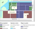
Category:Maps of cities in the Netherlands
Jump to navigation
Jump to search
Subcategories
This category has the following 94 subcategories, out of 94 total.
*
A
B
- Maps of Biddinghuizen (11 F)
- Maps of Breskens (2 F)
D
- Maps of Den Bommel (8 F)
- Maps of Drachten (27 F)
- Maps of Dussen (4 F)
E
- Maps of Echt, Limburg (4 F)
- Maps of Emmeloord (13 F)
G
H
- Maps of Hoofddorp (31 F)
I
- Maps of IJzendijke (2 F)
K
L
M
- Maps of Asperen (12 F)
N
O
- Maps of Ooltgensplaat (3 F)
- Maps of Ossenisse (2 F)
- Maps of Oud-Vossemeer (10 F)
P
- Maps of Poortvliet (5 F)
R
S
- Maps of Schokland (31 F)
- Maps of Sint Philipsland (6 F)
- Maps of Sint-Annaland (5 F)
- Maps of Stellendam (3 F)
- Maps of Swifterbant (10 F)
T
- Maps of Tollebeek (4 F)
U
V
W
Z
- Maps of Zoutelande (2 F)
Media in category "Maps of cities in the Netherlands"
The following 3 files are in this category, out of 3 total.
-
Informatie bord met slechte titel nl geen of reclame.JPG 1,000 × 1,592; 358 KB
-
Informatiebord.JPG 386 × 547; 44 KB
-
Winkelcentrum Eglantier Apeldoorn.svg 512 × 423; 241 KB


