Category:Maps of cities in Poland
Jump to navigation
Jump to search
English: Maps of cities and towns in Poland.
Subcategories
This category has the following 200 subcategories, out of 260 total.
(previous page) (next page)A
- Maps of Alwernia (2 F)
- Maps of Andrychów (2 F)
- Maps of Annopol (1 F)
B
- Maps of Babimost (1 F)
- Maps of Barczewo (6 F)
- Maps of Bartoszyce (4 F)
- Maps of Barwice (1 F)
- Maps of Bełchatów (3 F)
- Maps of Bełżyce (2 F)
- Maps of Biała Podlaska (3 F)
- Maps of Biała Rawska (2 F)
- Maps of Białobrzegi (1 F)
- Maps of Białogard (9 F)
- Maps of Białowieża (7 F)
- Maps of Bielawa (3 F)
- Maps of Bielsk Podlaski (5 F)
- Maps of Biłgoraj (22 F)
- Maps of Bolesławiec (10 F)
- Maps of Bolków (3 F)
- Maps of Brzeg (2 F)
- Maps of Brzeg Dolny (2 F)
- Maps of Brzesko (1 F)
- Maps of Brzeziny (3 F)
- Maps of Brześć Kujawski (3 F)
- Maps of Byczyna (2 F)
- Maps of Będzin (19 F)
- Maps of Błaszki (1 F)
- Maps of Błonie (7 F)
C
- Maps of Cedynia (3 F)
- Maps of Cegłów (2 F)
- Maps of Chełm (31 F)
- Maps of Chełmno (6 F)
- Maps of Chełmża (2 F)
- Maps of Chojna (2 F)
- Maps of Chorzów (14 F)
- Maps of Choszczno (5 F)
- Maps of Cieszyn (27 F)
- Maps of Czyżew (7 F)
- Maps of Człuchów (5 F)
D
- Maps of Darłowo (6 F)
- Maps of Drawno (2 F)
- Maps of Drzewica (1 F)
- Maps of Dukla (1 F)
- Maps of Dynów (3 F)
- Maps of Działoszyn (1 F)
E
G
- Maps of Gliwice (72 F)
- Maps of Goleniów (2 F)
- Maps of Goraj (2 F)
- Maps of Grajewo (4 F)
- Maps of Gryfice (5 F)
- Maps of Gryfino (4 F)
- Maps of Górowo Iławeckie (3 F)
- Maps of Głogów (33 F)
- Maps of Głowno (2 F)
H
- Maps of Hel, Poland (7 F)
I
- Maps of Inowrocław (9 F)
- Maps of Iława (39 F)
- Maps of Iłża (5 F)
J
- Maps of Jarosław (4 F)
- Maps of Jastrzębie-Zdrój (28 F)
- Maps of Jasło (4 F)
- Maps of Jaworzno (11 F)
K
- Maps of Kamień Pomorski (2 F)
- Maps of Kamieńsk (1 F)
- Maps of Kazimierz Dolny (2 F)
- Maps of Koluszki (3 F)
- Maps of Konin (3 F)
- Maps of Koszalin (32 F)
- Maps of Kozienice (2 F)
- Maps of Krasnystaw (3 F)
- Maps of Krośniewice (1 F)
- Maps of Kutno (1 F)
L
- Maps of Lesko (3 F)
- Maps of Lubaczów (2 F)
- Maps of Luboń (9 F)
- Maps of Lubsko (24 F)
- Maps of Lututów (1 F)
- Maps of Lądek-Zdrój (3 F)
- Maps of Lędziny (5 F)
M
- Maps of Malbork (10 F)
- Maps of Piwniczna-Zdrój (5 F)
- Maps of Marki (5 F)
- Maps of Miechów (4 F)
- Maps of Mielec (9 F)
- Maps of Milanówek (3 F)
- Maps of Międzyzdroje (3 F)
- Maps of Mysłowice (19 F)
- Maps of Myślenice (1 F)
N
- Maps of Niepołomice (1 F)
- Maps of Nowy Wiśnicz (1 F)
O
- Maps of Opoczno (2 F)
- Maps of Ostrów Wielkopolski (28 F)
- Maps of Ozorków (2 F)
- Maps of Oświęcim (5 F)
P
- Maps of Pabianice (2 F)
- Maps of Pajęczno (2 F)
- Maps of Piekary Śląskie (14 F)
- Maps of Piątek (1 F)
- Maps of Pniewy (3 F)
- Maps of Poddębice (2 F)
- Maps of Pruszków (2 F)
- Maps of Przedbórz (1 F)
- Maps of Przeworsk (6 F)
R
- Maps of Radomsko (2 F)
- Maps of Radzymin (6 F)
- Maps of Rawa Mazowiecka (2 F)
- Maps of Ruda Śląska (17 F)
- Maps of Rybnik (36 F)
- Maps of Rzeszów (32 F)
- Maps of Rzgów (1 F)
S
- Maps of Sędziszów (4 F)
- Maps of Siedlce (7 F)
- Maps of Sieradz (3 F)
- Maps of Skawina (2 F)
- Maps of Skierniewice (7 F)
- Maps of Skoczów (4 F)
- Maps of Sopot, Poland (24 F)
- Maps of Sosnowiec (15 F)
- Maps of Starawieś (1 F)
- Maps of Starogard Gdański (12 F)
- Maps of Stryków (1 F)
- Maps of Strzyżów (1 F)
- Maps of Sucha Beskidzka (4 F)
- Maps of Sulejów (2 F)
- Maps of Szadek (2 F)
Media in category "Maps of cities in Poland"
The following 31 files are in this category, out of 31 total.
-
2023-04 Skierki (02) Plan miejscowości.jpg 4,281 × 2,854; 4.12 MB
-
Bobrowo na mapie Polski.png 479 × 451; 249 KB
-
Bronikowo na mapie Polski.png 483 × 454; 433 KB
-
Butryny na mapie Polski.png 482 × 453; 251 KB
-
Chełmica Duża na mapie Polski.png 458 × 456; 241 KB
-
Cudzeniszki względem granic Polski.png 552 × 467; 501 KB
-
Debrzyca na mapie Polski.png 487 × 455; 440 KB
-
DąbrowaZielona na mapie Polski.png 496 × 455; 449 KB
-
Giebło na mapie Polski.png 500 × 456; 454 KB
-
Góra na mapie Polski.png 480 × 449; 427 KB
-
Janików na mapie Polski.png 473 × 457; 428 KB
-
Jerzyska na mapie Polski.png 487 × 447; 392 KB
-
Kamieniec na mapie Polski.png 483 × 453; 435 KB
-
Koziebrody na mapie Polski.png 499 × 460; 454 KB
-
Krzemienica na mapie Polski.png 486 × 451; 435 KB
-
Kukizów względem granic Polski.png 488 × 448; 435 KB
-
Kwiecewo na mapie Polski.png 488 × 455; 439 KB
-
Kłodawa location map.png 500 × 425; 9 KB
-
Leśna na mapie Polski.png 471 × 453; 421 KB
-
LeźnicaWielka na mapie Polski.png 483 × 452; 433 KB
-
Lubsza na mapie Polski.png 502 × 457; 455 KB
-
Mapa Piławy Górnej.png 4,000 × 2,328; 975 KB
-
Maps swiatniki gorne v 2.jpg 4,240 × 2,860; 1.79 MB
-
Małujowice na mapie Polski.png 506 × 460; 462 KB
-
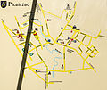
Pieniężno, Urząd Miejski, mapa.jpg 3,131 × 2,626; 2.33 MB
-
Polska aglomeracja kalisko-ostrowska WBPP Poznan 2010.png 2,041 × 1,895; 1.91 MB
-
POLSKA Miasta.png 2,041 × 1,895; 221 KB
-
Zawiercie podział mapa.jpg 900 × 600; 133 KB
-
Zawiercie podział mapa2.png 900 × 600; 130 KB
-
Zawiercie podział mapa3.png 2,630 × 1,860; 275 KB
-
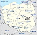
מפת פולין.jpg 442 × 420; 41 KB

