Category:Maps of metropolitan areas in the Netherlands
Jump to navigation
Jump to search
Media in category "Maps of metropolitan areas in the Netherlands"
The following 10 files are in this category, out of 10 total.
-
Carte Europe rhénane 5 nomenclature.PNG 2,550 × 3,504; 751 KB
-
Europe rhenane.svg 585 × 950; 153 KB
-
Metropoolregio Rotterdam - Den Haag (1).png 280 × 130; 7 KB
-
Metropoolregio Rotterdam Den Haag (Rotterdam The Hague Metropolitan Area).svg 1,063 × 567; 891 KB
-
Metropoolregio Rotterdam-Den Haag.png 646 × 599; 169 KB
-
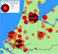
Randstad Population Bubbles (nl).svg 2,000 × 1,841; 475 KB
-
Rhine area analisys.svg 585 × 950; 275 KB
-
Rhine area analysis de.svg 585 × 950; 274 KB
-
Samenwerkingsverband Regio Eindhoven.png 280 × 210; 12 KB
-
Stadtoregio Rotterdam OMS limites.jpg 874 × 481; 85 KB


