Category:Maps of Kerkrade
Jump to navigation
Jump to search
Wikimedia category | |||||
| Upload media | |||||
| Instance of | |||||
|---|---|---|---|---|---|
| Category combines topics | |||||
| Kerkrade | |||||
municipality in Limburg, the Netherlands | |||||
| Spoken text audio | |||||
| Pronunciation audio | |||||
| Instance of |
| ||||
| Location | Limburg, Netherlands | ||||
| Capital | |||||
| Population |
| ||||
| Area |
| ||||
| Elevation above sea level |
| ||||
| official website | |||||
 | |||||
Subcategories
This category has only the following subcategory.
Media in category "Maps of Kerkrade"
The following 17 files are in this category, out of 17 total.
-
2013-Kerkrade.jpg 1,460 × 1,579; 1.46 MB
-
BAG woonplaatsen - Gemeente Kerkrade.png 2,419 × 2,419; 532 KB
-
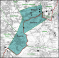
Concessie Staatsmijn Wilhelmina.png 886 × 565; 1.04 MB
-
Concessie Willem-Sophia.png 1,122 × 1,117; 1.54 MB
-
Concessies Neuprick Domaniale.png 1,132 × 1,381; 2.76 MB
-
Concessies Particuliere mijnen.png 2,095 × 2,091; 703 KB
-
Gem-Kerkrade-2014Q1.jpg 2,802 × 2,947; 5.41 MB
-
Gem-Kerkrade-OpenTopo.jpg 3,042 × 3,363; 2.23 MB
-
Kerkrade-plaats-OpenTopo.jpg 1,713 × 1,961; 1.99 MB
-
Kerkrade-stad-2014Q1.jpg 1,713 × 1,961; 1.87 MB
-
Kerkrade-topografie.jpg 1,132 × 1,813; 1.44 MB
-
Map - NL - Kerkrade (2009).svg 625 × 575; 1.03 MB
-
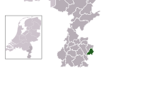
Map - NL - Municipality code 0928 (2009).svg 300 × 160; 530 KB
-
NieuwstraatRAF.JPG 2,048 × 768; 50 KB
-
NieuwstraatRAF2.jpg 435 × 288; 14 KB
-
NL - locator map municipality code GM0928 (2016).png 2,125 × 1,417; 197 KB
-
NL Kerkrade.png 300 × 400; 25 KB


