Category:Maps of The Hague
Jump to navigation
Jump to search
Wikimedia category | |||||
| Upload media | |||||
| Instance of | |||||
|---|---|---|---|---|---|
| Category combines topics | |||||
| The Hague | |||||
city and municipality in the Netherlands, seat of the Dutch government | |||||
| Spoken text audio | |||||
| Pronunciation audio | |||||
| Instance of |
| ||||
| Location |
| ||||
| Located in or next to body of water |
| ||||
| Visitor center | |||||
| Executive body | |||||
| Head of government | |||||
| Has part(s) | |||||
| Inception |
| ||||
| Population |
| ||||
| Area |
| ||||
| Elevation above sea level |
| ||||
| official website | |||||
 | |||||
Subcategories
This category has the following 12 subcategories, out of 12 total.
Media in category "Maps of The Hague"
The following 31 files are in this category, out of 31 total.
-
LocatieDenHaag.png 280 × 130; 5 KB
-
2013-DenHaag.jpg 2,845 × 2,357; 4.61 MB
-
2015 Den Haag (The Hague - La Haye).jpg 7,086 × 5,886; 18.5 MB
-
Agglomeratie 's-Gravenhage.png 1,428 × 1,238; 90 KB
-
Archeologische kaart Romeins Rijnland-Delfland in Zuid-Holland.svg 807 × 1,280; 115 KB
-
BAG woonplaatsen - Gemeente 's-Gravenhage.png 2,419 × 2,419; 1.22 MB
-
Bombing of Bezuidenhout (1945-03-03).svg 562 × 423; 60 KB
-
Den Haag-topografie.jpg 3,203 × 2,775; 7.46 MB
-
DenHaag-plaats-OpenTopo.jpg 4,580 × 3,914; 12.5 MB
-
DenHaag-stad-2014Q1.jpg 4,580 × 3,914; 12.13 MB
-
Gem-sGravenhage-2014Q1.jpg 5,692 × 4,738; 18.75 MB
-
Gem-sGravenhage-OpenTopo.jpg 5,752 × 4,812; 4.47 MB
-
Gr. 0883.jpg 6,992 × 5,352; 8.61 MB
-
Grachtenstelsel Den Haag (historisch).svg 2,655 × 2,352; 29 KB
-
Grachtenstelsel Den Haag 2010.png 2,000 × 1,399; 515 KB
-
Grote Markt, Den Haag.svg 656 × 661; 57 KB
-
Grote of Sint-Jacobskerk op plattegrond oude binnenstad Den Haag.png 2,250 × 1,799; 1.9 MB
-
Haagse ministeries.png 1,637 × 1,141; 82 KB
-
Het ontwerptekening oftewel kaart voor Laakhaven te 's-Gravenhage.jpg 10,039 × 4,372; 3.11 MB
-
Metropoolregio Rotterdam Den Haag (Rotterdam The Hague Metropolitan Area).svg 1,063 × 567; 891 KB
-
Mogelijke locaties moordaanslag op Aleid van Poelgeest en Willem Cuser in 1392.svg 3,122 × 2,286; 86 KB
-
Natura2000 - Meijendel & Berkheide.png 2,016 × 2,267; 498 KB
-
Natura2000 - Westduinpark & Wapendal.png 2,016 × 2,267; 257 KB
-
Netherlands, area around The Hague in the 2nd Century AD.jpg 1,388 × 1,252; 626 KB
-
NL - locator map municipality code GM0518 (2016).png 2,125 × 1,417; 393 KB
-
Plattegrond van 's-Gravenhage uit ca. 1889.jpg 5,216 × 5,040; 6.98 MB
-
Regio-15-Haaglanden-2009.png 444 × 454; 119 KB
-
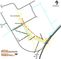
Vaillantlaan.png 827 × 800; 77 KB


