Category:Maps of cities in Finland
Jump to navigation
Jump to search
English: Maps of cities of Finland
Suomi: Suomalaisten kaupunkien karttoja
Svenska: Kartor över Finlands städer
Subcategories
This category has the following 80 subcategories, out of 80 total.
- Grid plan in Finland (38 F)
A
E
F
H
- Maps of Hyvinkää (6 F)
I
J
- Maps of Jakobstad (7 F)
- Maps of Joensuu (19 F)
K
- Maps of Kaskinen (4 F)
- Maps of Kauniainen (6 F)
- Maps of Kemijärvi (27 F)
- Maps of Kristinestad (5 F)
- Maps of Kuusamo (4 F)
L
- Maps of Lahti (10 F)
- Maps of Lapua (3 F)
- Maps of Loviisa (9 F)
M
- Maps of Mariehamn (4 F)
N
- Maps of Nurmes (7 F)
- Maps of Nykarleby (9 F)
- Maps of Närpes (6 F)
O
- Maps of Orimattila (5 F)
- Maps of Outokumpu (4 F)
P
R
- Maps of Raisio (7 F)
- Maps of Rauma, Finland (11 F)
- Maps of Rovaniemi (18 F)
S
- Maps of Seinäjoki (35 F)
- Maps of Sodankylä (6 F)
T
- Maps of Teuva (3 F)
U
- Maps of Uusikaupunki (7 F)
V
- Maps of Varkaus (3 F)
Ä
Media in category "Maps of cities in Finland"
This category contains only the following file.
-
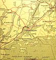
Tammisaari map 1950's.jpg 885 × 961; 481 KB
