Category:Maps of Tamil Nadu
Jump to navigation
Jump to search
States of India: Andhra Pradesh · Arunachal Pradesh · Assam · Bihar · Chhattisgarh · Goa · Gujarat · Haryana · Himachal Pradesh · Jharkhand · Karnataka · Kerala · Madhya Pradesh · Maharashtra · Manipur · Meghalaya · Mizoram · Nagaland · Odisha · Punjab · Rajasthan · Sikkim · Tamil Nadu · Telangana · Tripura · Uttar Pradesh · Uttarakhand · West Bengal
Union territories: Andaman and Nicobar Islands · Chandigarh · Dadra and Nagar Haveli and Daman and Diu · Delhi · Jammu and Kashmir · Ladakh · Lakshadweep · Puducherry
Former states of India: Jammu and Kashmir ·
Former union territories: Dadra and Nagar Haveli district · Daman and Diu ·
Union territories: Andaman and Nicobar Islands · Chandigarh · Dadra and Nagar Haveli and Daman and Diu · Delhi · Jammu and Kashmir · Ladakh · Lakshadweep · Puducherry
Former states of India: Jammu and Kashmir ·
Former union territories: Dadra and Nagar Haveli district · Daman and Diu ·
Wikimedia category | |||||
| Upload media | |||||
| Instance of | |||||
|---|---|---|---|---|---|
| Category combines topics | |||||
| Tamil Nadu | |||||
Indian state | |||||
| Instance of |
| ||||
| Part of | |||||
| Named after | |||||
| Location | India | ||||
| Capital | |||||
| Legislative body | |||||
| Executive body | |||||
| Official language | |||||
| Head of state |
| ||||
| Head of government |
| ||||
| Inception |
| ||||
| Population |
| ||||
| Area |
| ||||
| Replaces |
| ||||
| Different from | |||||
| official website | |||||
 | |||||
Subcategories
This category has the following 20 subcategories, out of 20 total.
Pages in category "Maps of Tamil Nadu"
This category contains only the following page.
Media in category "Maps of Tamil Nadu"
The following 44 files are in this category, out of 44 total.
-
58E.1.jpg 4,300 × 4,300; 7.83 MB
-
Blank Map of Tamil Nadu State.png 1,000 × 1,250; 1.57 MB
-
Cholanadu.gif 596 × 739; 19 KB
-
IN-TN small.png 144 × 180; 7 KB
-
India Tamil Nadu COVID-19 map.png 1,668 × 2,032; 332 KB
-
India Tamil Nadu relief map.png 1,989 × 2,469; 4.26 MB
-
India Tamil Nadu relief map.svg 1,591 × 1,975; 2.02 MB
-
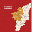
Kangee speaking areas.jpg 1,324 × 1,614; 524 KB
-
Kongu Nadu Tamil Nadu.png 1,000 × 1,241; 237 KB
-
Kongu-nadu-2.png 1,088 × 1,416; 2.3 MB
-
Kongu-nadu.png 648 × 652; 513 KB
-
Kotagiri.jpg 485 × 399; 25 KB
-
Kousikarivermap.jpg 4,588 × 3,245; 1.52 MB
-
Map banner2- aug2017- real1.jpg 3,437 × 2,292; 438 KB
-
Metropolitan Area of Vellore.jpg 573 × 992; 85 KB
-
Nadu nadu.png 202 × 250; 13 KB
-
Neyveli (State Assembly Constituency).jpg 1,589 × 1,516; 336 KB
-
Operational Areas office location.jpg 1,512 × 1,134; 156 KB
-
Pallavaramwardmap.jpg 1,023 × 815; 98 KB
-
Pamba-Achankovil-Vaippar-river-link-project.jpg 640 × 479; 49 KB
-
Parrot district Map.pdf 1,752 × 2,479; 115 KB
-
Parrot districts with code.pdf 1,752 × 2,479; 103 KB
-
Pudukkottai.jpg 839 × 628; 194 KB
-
Streams around Vidyavanam Tribal School, Anaikatti, Coimbatore, India.png 18,416 × 16,265; 13.55 MB
-
Subdivisionsgudiyatham.png 454 × 513; 43 KB
-
Tamil map.jpg 634 × 600; 26 KB
-
Tamil Nadu Defence Corridor.jpg 912 × 1,096; 144 KB
-
Tamil Nadu district animation.gif 354 × 540; 434 KB
-
Tamil Nadu HDI map (2017).png 1,592 × 1,976; 343 KB
-
Tamil Nadu in India (mini).svg 360 × 430; 95 KB
-
Tamil Nadu Literacy Map 2011.png 1,122 × 1,240; 235 KB
-
Tamil Nadu outline shape.svg 300 × 300; 140 KB
-
Tamil Nadu soil map NBSS.png 10,473 × 15,141; 184.17 MB
-
Tamil Nadu topo deutsch.png 592 × 529; 542 KB
-
Tamilakam map.jpg 739 × 415; 19 KB
-
Tamilnadu Literacy Map 2001.png 2,104 × 1,488; 422 KB
-
Tamilnadu Map inTamil.png 2,480 × 3,280; 1.51 MB
-
Tondai Nadu (INRS).jpg 500 × 620; 93 KB
-
Tondai Nadu AP + TN (INRS).png 850 × 1,041; 277 KB
-
Tondai Nadu AP+TN (NRS).jpg 1,080 × 1,439; 669 KB
-
Tondainadu.gif 596 × 739; 19 KB
-
Vellar Basin Overlay.xcf 1,773 × 2,201; 2.11 MB
-
Village Map 4.jpg 1,190 × 1,682; 232 KB
-
ஆவடி மாநகராட்சி Avadi City Municipal Corporation.png 2,176 × 2,060; 1.57 MB


