Category:Maps of Maharashtra
Jump to navigation
Jump to search
States of India: Andhra Pradesh · Arunachal Pradesh · Assam · Bihar · Chhattisgarh · Goa · Gujarat · Haryana · Himachal Pradesh · Jharkhand · Karnataka · Kerala · Madhya Pradesh · Maharashtra · Manipur · Meghalaya · Mizoram · Nagaland · Odisha · Punjab · Rajasthan · Sikkim · Tamil Nadu · Telangana · Tripura · Uttar Pradesh · Uttarakhand · West Bengal
Union territories: Andaman and Nicobar Islands · Chandigarh · Dadra and Nagar Haveli and Daman and Diu · Delhi · Jammu and Kashmir · Ladakh · Lakshadweep · Puducherry
Former states of India: Jammu and Kashmir ·
Former union territories: Dadra and Nagar Haveli district · Daman and Diu ·
Union territories: Andaman and Nicobar Islands · Chandigarh · Dadra and Nagar Haveli and Daman and Diu · Delhi · Jammu and Kashmir · Ladakh · Lakshadweep · Puducherry
Former states of India: Jammu and Kashmir ·
Former union territories: Dadra and Nagar Haveli district · Daman and Diu ·
Wikimedia category | |||||
| Upload media | |||||
| Instance of | |||||
|---|---|---|---|---|---|
| Category combines topics | |||||
| Maharashtra | |||||
state in the western and central peninsular region of India | |||||
| Instance of | |||||
| Location | India | ||||
| Capital | |||||
| Legislative body |
| ||||
| Executive body |
| ||||
| Official language | |||||
| Head of state |
| ||||
| Head of government | |||||
| Inception |
| ||||
| Highest point | |||||
| Population |
| ||||
| Area |
| ||||
| Replaces | |||||
| Different from | |||||
| official website | |||||
 | |||||
Subcategories
This category has the following 17 subcategories, out of 17 total.
Media in category "Maps of Maharashtra"
The following 43 files are in this category, out of 43 total.
-
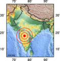
1993 Latur earthquake map.png 179 × 182; 24 KB
-
Admiralty Chart No 1487 Approaches to Bombay, Published 1964.jpg 16,388 × 11,241; 34.53 MB
-
Akola.jpg 250 × 193; 17 KB
-
Baramati Geomorphology Map.jpg 1,444 × 1,148; 429 KB
-
Beed City Map2.jpg 3,012 × 2,126; 392 KB
-
Cheul.jpg 1,675 × 2,492; 929 KB
-
Chinchani-Sch-Map.jpg 2,881 × 4,000; 1.5 MB
-
Dikwal Map.jpg 2,802 × 4,273; 799 KB
-
Gosikhurd Map.jpg 800 × 1,128; 285 KB
-
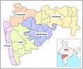
Gr Wiki MH Regions 96ppi.png 1,001 × 851; 158 KB
-
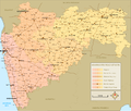
Gr Wiki MH Transport Road 192dpi.png 2,003 × 1,701; 1.08 MB
-
Hatkanangale Assembly Segments.png 449 × 328; 9 KB
-
India Maharashtra COVID-19 map.svg 2,168 × 1,671; 536 KB
-
Indien karta jagpur.jpg 270 × 199; 12 KB
-
Khande3.gif 384 × 292; 30 KB
-
Khandesh Map.jpg 550 × 364; 31 KB
-
Maharashtra Flag Map (unofficial).png 909 × 747; 154 KB
-
Maharashtra locator map.png 3,097 × 2,257; 878 KB
-
Maharashtra outline shape.svg 300 × 300; 213 KB
-
MaharashtraIcon.png 98 × 82; 5 KB
-
Maharastra-small.jpg 113 × 83; 3 KB
-
Maharastra-stub.svg 146 × 128; 8 KB
-
Mahaರಶ್ತ್ರ.jpg 341 × 255; 9 KB
-
Map of Maharashtra State, India.png 146 × 128; 4 KB
-
Matheran-map.jpg 595 × 843; 67 KB
-
MNS violence map.svg 1,639 × 1,852; 1.06 MB
-
Mumbai Maharashtra locator map Bengali.png 749 × 599; 141 KB
-
Mumbai Pune Expressway map.svg 1,419 × 1,152; 162 KB
-
Nagpur.png 1,440 × 992; 282 KB
-
Pimpri gavali.jpg 724 × 1,024; 284 KB
-
Pimprigavali.jpg 724 × 1,024; 241 KB
-
PMC4355649 biodiversity data journal-3-e4541-g001.png 512 × 703; 396 KB
-
Ratnagiri district map.jpg 1,902 × 2,883; 1.15 MB
-
Regional map of maharashtra.jpg 2,546 × 2,122; 466 KB
-
S.R.T.M.University, Nanded University Jurisdiction Map.jpg 6,000 × 7,500; 5.3 MB
-
Shevgaon Tehsil in Ahmednagar District Maharashtra.png 800 × 599; 151 KB
-
Sindhudurg District.jpg 2,906 × 3,647; 2.61 MB
-
University Jurisdiction Map SRTMUN.jpg 6,000 × 7,500; 12.27 MB
-
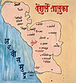
Vengurla Taluka.jpg 3,232 × 3,532; 2.53 MB
-
काेल्हापूर मधील चंदगडचे स्थान.jpg 640 × 503; 64 KB
-
शिर्डी विधानसभा मतदारसंघ.jpg 1,615 × 1,080; 372 KB

