Category:Maps of Arunachal Pradesh
Jump to navigation
Jump to search
States of India: Andhra Pradesh · Arunachal Pradesh · Assam · Bihar · Chhattisgarh · Goa · Gujarat · Haryana · Himachal Pradesh · Jharkhand · Karnataka · Kerala · Madhya Pradesh · Maharashtra · Manipur · Meghalaya · Mizoram · Nagaland · Odisha · Punjab · Rajasthan · Sikkim · Tamil Nadu · Telangana · Tripura · Uttar Pradesh · Uttarakhand · West Bengal
Union territories: Andaman and Nicobar Islands · Chandigarh · Dadra and Nagar Haveli and Daman and Diu · Delhi · Jammu and Kashmir · Ladakh · Lakshadweep · Puducherry
Former states of India: Jammu and Kashmir ·
Former union territories: Dadra and Nagar Haveli district · Daman and Diu ·
Union territories: Andaman and Nicobar Islands · Chandigarh · Dadra and Nagar Haveli and Daman and Diu · Delhi · Jammu and Kashmir · Ladakh · Lakshadweep · Puducherry
Former states of India: Jammu and Kashmir ·
Former union territories: Dadra and Nagar Haveli district · Daman and Diu ·
Wikimedia category | |||||
| Upload media | |||||
| Instance of | |||||
|---|---|---|---|---|---|
| Category combines topics | |||||
| Arunachal Pradesh | |||||
region administered by India as a state | |||||
| Instance of |
| ||||
| Location | India | ||||
| Capital | |||||
| Legislative body | |||||
| Executive body |
| ||||
| Head of state |
| ||||
| Head of government |
| ||||
| Inception |
| ||||
| Population |
| ||||
| Area |
| ||||
| Replaces | |||||
| Different from | |||||
| official website | |||||
 | |||||
Subcategories
This category has the following 6 subcategories, out of 6 total.
Pages in category "Maps of Arunachal Pradesh"
This category contains only the following page.
Media in category "Maps of Arunachal Pradesh"
The following 32 files are in this category, out of 32 total.
-
Adi Speakers Map.jpg 564 × 581; 53 KB
-
Anjaw district with circles and other details.png 966 × 559; 379 KB
-
Arunachal Christ 2011.png 9,890 × 7,585; 4.06 MB
-
Arunachal Chrétiens 2011.png 9,013 × 5,187; 5.74 MB
-
Arunachal Hindou 2011.png 9,890 × 7,585; 4.09 MB
-
Arunachal pradesh close-up.PNG 138 × 147; 12 KB
-
Arunachal Pradesh outline shape.svg 300 × 300; 76 KB
-
Arunachal Pradesh relief (no text).svg 589 × 326; 2.2 MB
-
Arunachal relief topo.svg 728 × 382; 1.53 MB
-
Arunachal rivers and basins.jpg 1,130 × 589; 1.01 MB
-
China india border.png 300 × 240; 27 KB
-
China India eastern border 88.jpg 1,019 × 1,265; 297 KB
-
China India eastern border.jpg 1,048 × 1,294; 359 KB
-
Dibang District Valley with circles and various labels.png 914 × 568; 319 KB
-
Geographic locations of Qiangic and other East Asian populations.png 4,519 × 2,456; 1.41 MB
-
ICBR Roads in Arunachal Pradesh Phase 1.png 1,620 × 831; 481 KB
-
India Arunachal Pradesh relief map.png 1,456 × 800; 1.96 MB
-
Manasrivermap.png 1,000 × 1,000; 924 KB
-
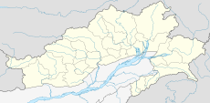
Map of Arunachal pradesh.png 542 × 359; 41 KB
-
McMahon Line (map).jpg 750 × 528; 46 KB
-
McMahon Line.svg 512 × 335; 1.49 MB
-
McMahon-Line-at-Migyitun-LSIB-vs-Chinese-claims.png 987 × 658; 116 KB
-
Mipi Circle with Mathun Valley and Andrala Valley.png 1,253 × 1,015; 3.03 MB
-
Sumdorong-Chu.jpg 1,288 × 744; 378 KB
-
Tawang district with labels.png 905 × 566; 255 KB
-
Tawang locator map.png 530 × 507; 144 KB
-
Upper Siang district.png 744 × 567; 295 KB
-
Upper Subansiri district.png 789 × 542; 253 KB
-
Yangtse-Tawang-map.jpg 1,765 × 885; 658 KB
-
增补藏南地区公开使用地名(第三批)分布图.jpg 5,827 × 4,114; 6.32 MB
-
增补藏南地区公开使用地名(第二批)分布图.jpg 5,827 × 4,114; 6.48 MB
-
增补藏南地区公开使用地名(第四批)分布图.png 3,966 × 2,800; 6.57 MB


