Category:Maps of Uttar Pradesh
Jump to navigation
Jump to search
States of India: Andhra Pradesh · Arunachal Pradesh · Assam · Bihar · Chhattisgarh · Goa · Gujarat · Haryana · Himachal Pradesh · Jharkhand · Karnataka · Kerala · Madhya Pradesh · Maharashtra · Manipur · Meghalaya · Mizoram · Nagaland · Odisha · Punjab · Rajasthan · Sikkim · Tamil Nadu · Telangana · Tripura · Uttar Pradesh · Uttarakhand · West Bengal
Union territories: Andaman and Nicobar Islands · Chandigarh · Dadra and Nagar Haveli and Daman and Diu · Delhi · Jammu and Kashmir · Ladakh · Lakshadweep · Puducherry
Former states of India: Jammu and Kashmir ·
Former union territories: Dadra and Nagar Haveli district · Daman and Diu ·
Union territories: Andaman and Nicobar Islands · Chandigarh · Dadra and Nagar Haveli and Daman and Diu · Delhi · Jammu and Kashmir · Ladakh · Lakshadweep · Puducherry
Former states of India: Jammu and Kashmir ·
Former union territories: Dadra and Nagar Haveli district · Daman and Diu ·
Wikimedia category | |||||
| Upload media | |||||
| Instance of | |||||
|---|---|---|---|---|---|
| Category combines topics | |||||
| Uttar Pradesh | |||||
state in northern India | |||||
| Instance of | |||||
| Named after | |||||
| Location | India | ||||
| Capital | |||||
| Legislative body |
| ||||
| Executive body |
| ||||
| Official language | |||||
| Head of state |
| ||||
| Head of government |
| ||||
| Inception |
| ||||
| Population |
| ||||
| Area |
| ||||
| Different from | |||||
| official website | |||||
 | |||||
Subcategories
This category has the following 9 subcategories, out of 9 total.
!
*
B
D
L
S
T
Pages in category "Maps of Uttar Pradesh"
This category contains only the following page.
Media in category "Maps of Uttar Pradesh"
The following 54 files are in this category, out of 54 total.
-
Allahabad surroundings.png 1,148 × 769; 106 KB
-
Aurai Block Map (2011 census).jpg 3,507 × 2,482; 2.01 MB
-
Auraiyadistrict.jpg 219 × 237; 39 KB
-
Awadhilangmap.png 1,376 × 1,806; 566 KB
-
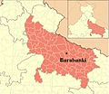
Barabanki.jpg 696 × 606; 51 KB
-
Bhimapar.pdf 1,275 × 1,650; 2.49 MB
-
Bhojpur Region in Utter Pradesh.png 800 × 800; 100 KB
-
BlueOutlineUttarPradesh.png 900 × 900; 17 KB
-
BrajBhashiRegion.png 2,500 × 2,500; 1.36 MB
-
Chandauli District Block Map.jpg 565 × 757; 81 KB
-
Dhanapur block of Chandauli District.jpg 493 × 496; 28 KB
-
Dhanapur block.jpg 2,976 × 2,022; 707 KB
-
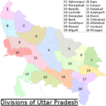
Divisions of up.png 350 × 350; 53 KB
-
Faizabad.png 250 × 244; 50 KB
-
Fj6lkeOaMAE-8sm.jpg 2,160 × 2,160; 491 KB
-
Kanauji.png 1,600 × 2,000; 300 KB
-
Kannauji language map.png 3,442 × 1,982; 1.33 MB
-
Kushinagar Map 1.jpg 3,824 × 2,628; 4.18 MB
-
Location of Babri Masjid site map.png 909 × 886; 284 KB
-
Mainpuri .jpg 202 × 250; 9 KB
-
Map Of Deoria.jpg 495 × 314; 37 KB
-
Map of india position of Allahabad highlighted.png 327 × 351; 53 KB
-
Map of Jalaun.png 1,030 × 860; 12 KB
-
Map of Moradabad (1955).jpg 534 × 416; 97 KB
-
Map Of Paina.JPG 650 × 314; 34 KB
-
PilibhitAmariyajpg.jpg 1,123 × 794; 467 KB
-
PilibhitBilsanda.jpg 1,123 × 794; 354 KB
-
PilibhitlAllBlocks.jpg 720 × 509; 46 KB
-
PilibhitlLalaurikhera.jpg 720 × 509; 85 KB
-
PilibhitMarori.jpg 720 × 509; 74 KB
-
Saraiya Peerzada.jpg 582 × 559; 109 KB
-
SOS-UP-2-13-Jun2020-1 770x433 0-x433.webp 770 × 433; 43 KB
-
Tahsil nawabganj map.jpg 1,275 × 1,650; 576 KB
-
Tahsil.jpg 225 × 225; 11 KB
-
Ull River map image.jpg 1,080 × 395; 92 KB
-
UP Police Ranges.png 434 × 450; 118 KB
-
UP Police Zones.png 434 × 450; 116 KB
-
UP region map.gif 1,175 × 829; 124 KB
-
UP-Map---Logistics-(1)-(1).jpg 1,194 × 612; 58 KB
-
UP-Map--Warehousing-Facilities.jpg 1,194 × 612; 50 KB
-
UPIndustrial-Corridors.jpg 1,194 × 612; 52 KB
-
Uttar Pradesh ke mandal.png 1,080 × 1,080; 336 KB
-
Uttar Pradesh religion 2011.png 8,182 × 8,510; 4.01 MB
-
Uttar Pradesh small.jpg 146 × 145; 7 KB
-
Uttar Pradesh Wikivoyage map.png 1,073 × 1,046; 461 KB
-
Uttar Pradesh Wikivoyage map.svg 1,006 × 981; 1.02 MB
-
Uttarpradesh-industrial-map.jpg 600 × 586; 93 KB
-
Uttarpradesh-languages.GIF 1,175 × 828; 121 KB
-
Utter Pradesh divided into regions.png 1,200 × 1,044; 306 KB
-
Wp-1697540723847.webp 1,280 × 808; 118 KB
-
Braj Bhasha language map.png 3,507 × 2,480; 3.05 MB
-
Bundeli langauge map.png 3,507 × 2,480; 3.49 MB
-
Горакханд.png 571 × 601; 95 KB
