Category:Old maps of Tamil Nadu
Jump to navigation
Jump to search
States of India: Andhra Pradesh · Arunachal Pradesh · Assam · Bihar · Goa · Gujarat · Jharkhand · Karnataka · Kerala · Madhya Pradesh · Maharashtra · Manipur · Meghalaya · Odisha · Sikkim · Tamil Nadu · Telangana · Tripura · Uttar Pradesh · Uttarakhand · West Bengal
Union territories: Andaman and Nicobar Islands · Dadra and Nagar Haveli and Daman and Diu · Delhi · Jammu and Kashmir · Ladakh · Lakshadweep · Puducherry
Former states of India: Jammu and Kashmir ·
Former union territories: Daman and Diu ·
Union territories: Andaman and Nicobar Islands · Dadra and Nagar Haveli and Daman and Diu · Delhi · Jammu and Kashmir · Ladakh · Lakshadweep · Puducherry
Former states of India: Jammu and Kashmir ·
Former union territories: Daman and Diu ·
Subcategories
This category has the following 4 subcategories, out of 4 total.
Media in category "Old maps of Tamil Nadu"
The following 34 files are in this category, out of 34 total.
-
Madurai Mission Map.png 913 × 795; 1.05 MB
-
Madurai, Mission map (1737 detail2).jpg 531 × 559; 144 KB
-
1801 - 20 - 11 Carical.jpg 1,953 × 3,422; 1 MB
-
1808 map of Mahabalipuram, Colin Mackenzie collection.png 1,550 × 1,238; 3.14 MB
-
Ootacamund cantonment 1834.jpg 2,048 × 1,612; 2.8 MB
-
Ooty plan.png 5,408 × 4,400; 16.67 MB
-
NilgiriGeologyJASB.jpg 1,713 × 1,074; 2.88 MB
-
Admiralty Chart No 827 Vengurla to Cape Comorin, Published 1877, New Edition 1914.jpg 10,881 × 16,191; 50.36 MB
-
Admiralty Chart No 827 Vengurla to Cape Comorin, Published 1877.jpg 10,542 × 16,083; 51.21 MB
-
*"Map of the Presidency of Madras," 1880*.jpg 876 × 1,024; 157 KB
-
Ootacamund Hunt Map 1930.jpg 2,000 × 2,479; 1.14 MB
-
A map of India, showing Malabar, Madura and Cormeddel Wellcome L0038175.jpg 3,888 × 3,120; 3.34 MB
-
Admiralty Chart No 68b Palk Strait and Gulf of Mannar, Published 1862, New Edition 1935.jpg 18,351 × 11,208; 46.07 MB
-
Centre Division India 1843.jpg 2,074 × 2,552; 4.15 MB
-
Chingleput 1854.jpg 5,136 × 6,112; 9.41 MB
-
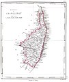
Coimbatore 1854.jpg 5,248 × 6,208; 17.84 MB
-
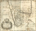
Coromandel 1750.jpg 1,139 × 1,500; 373 KB
-
Dutch Tuticorin.jpg 535 × 430; 74 KB
-
IGI1908 Madras Northern Section - Jeypore.jpg 2,027 × 1,664; 1.7 MB
-
IGI1908 Madras Northern Section.jpg 2,027 × 1,664; 1.37 MB
-
Madurai 1854.jpg 6,336 × 5,296; 19.17 MB
-
Ootacamund map 1903.jpg 3,052 × 2,352; 6.55 MB
-
Palk Strait Map.png 6,937 × 9,672; 127.92 MB
-
Plan de la bataille terrestre de Gondelour 1783.jpg 1,175 × 874; 691 KB
-
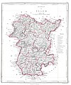
Salem 1854.jpg 5,152 × 6,208; 15.69 MB
-
Tanjore 1854.jpg 5,248 × 6,368; 10.78 MB
-
Thanjavurtown1955.png 1,064 × 1,209; 1.65 MB
-
Tiruchirappalli(Trichinopoly)-during-CarnaticWars1751.jpg 684 × 924; 322 KB
-
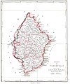
Tirunelveli district 1854.jpg 5,185 × 6,219; 13.19 MB
-
Trichinopoly 1854.jpg 5,232 × 6,368; 10.46 MB
-
Wellington map.jpg 1,709 × 2,519; 1.22 MB


