Category:Maps of Stuttgart
Jump to navigation
Jump to search
Urban districts (cities): Baden-Baden · Freiburg · Heidelberg · Heilbronn · Karlsruhe · Mannheim · Pforzheim · Stuttgart · Ulm
Use the appropriate category for maps showing all or a large part of Stuttgart. See subcategories for smaller areas:
| If the map shows | Category to use |
|---|---|
| Stuttgart on a recently created map | Category:Maps of Stuttgart or its subcategories |
| Stuttgart on a map created more than 70 years ago | Category:Old maps of Stuttgart or its subcategories |
| the history of Stuttgart on a recently created map | Category:Maps of the history of Stuttgart or its subcategories |
| the history of Stuttgart on a map created more than 70 years ago | Category:Old maps of the history of Stuttgart or its subcategories |
Wikimedia category | |||||
| Upload media | |||||
| Instance of | |||||
|---|---|---|---|---|---|
| Category combines topics | |||||
| Stuttgart | |||||
capital of the federal state Baden-Württemberg, Germany | |||||
| Pronunciation audio | |||||
| Instance of |
| ||||
| Part of | |||||
| Named after | |||||
| Location |
| ||||
| Located in or next to body of water | |||||
| Visitor center | |||||
| Legislative body | |||||
| Head of government |
| ||||
| Legal form | |||||
| Highest point |
| ||||
| Population |
| ||||
| Area |
| ||||
| Elevation above sea level |
| ||||
| Budget |
| ||||
| Different from | |||||
| official website | |||||
 | |||||
Subcategories
This category has the following 10 subcategories, out of 10 total.
*
- Tram maps of Stuttgart (5 F)
C
E
O
- Old maps of Stuttgart (89 F)
P
- Plans of Wilhelma Zoo (7 F)
S
- Stadtkarte Stuttgart 1:1000 (10 F)
Pages in category "Maps of Stuttgart"
This category contains only the following page.
Media in category "Maps of Stuttgart"
The following 40 files are in this category, out of 40 total.
-
Hohenheim-gartenplan.jpg 800 × 595; 99 KB
-
Karte s innen.png 115 × 109; 3 KB
-
Karte Stuttgart in Deutschland.png 188 × 235; 5 KB
-
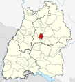
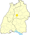
Locator map S in Baden-Württemberg.svg 1,058 × 1,161; 278 KB
-
Locator map S in Germany.svg 1,075 × 1,273; 578 KB
-
Map Stuttgart 21 outer zh-cn.png 1,040 × 961; 465 KB
-
Nesenbach Verlauf.png 780 × 509; 830 KB
-
Parkseen (Stuttgart) 16.11.2008 15-04-35.JPG 3,072 × 2,304; 1.33 MB
-
S in Baden-Württemberg.svg 753 × 868; 159 KB
-
Alte Kanzlei Stuttgart, 004.jpg 546 × 629; 181 KB
-
Schloßplatz (Stuttgart), 001.jpg 992 × 1,036; 226 KB
-
Stuttgart Plan Schloss und Gaerten Solitude.jpg 1,588 × 2,084; 755 KB
-
Stadtweiterung Stuttgart.svg 795 × 710; 506 KB
-
Stimmenmehrheiten Wahlbezirke Gemeinderatswahl2009.svg 1,191 × 842; 1.17 MB
-
Streckenverlauf Killesbergbahn.svg 534 × 791; 193 KB
-
STUTTGART 1.jpg 518 × 388; 66 KB
-
Stuttgart 1945 Zerstörung Walter Kittel Zeichnung.jpg 916 × 554; 161 KB
-
Stuttgart SI Centrum Informationstafel 2003 (turned and cropped).jpg 917 × 571; 419 KB
-
Stuttgart SI Centrum Informationstafel 2003.jpg 1,024 × 768; 306 KB
-
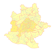
Stuttgart Stadtbezirke Namen.svg 850 × 780; 62 KB
-
Stuttgart Stadtbezirke.svg 850 × 780; 45 KB
-
Stuttgart Stadtteile.svg 850 × 780; 135 KB
-
Stuttgart, Stadtplan, 1640, Legende.pdf 1,239 × 1,754, 2 pages; 19 KB
-
Stuttgart, Stadtplan, 1652, Legende.pdf 1,239 × 1,754; 20 KB
-
Stuttgart, Stadtplan, 1771, Legende.jpg 1,445 × 1,742; 284 KB
-
Stuttgart, Stadtplan, 1771, Legende.pdf 1,239 × 1,754, 2 pages; 19 KB
-
Stuttgart, Stadtplan, 1780, Legende.pdf 1,754 × 1,239, 2 pages; 20 KB
-
Stuttgart, Stadtplan, 1794, 1, Legende, 2.jpg 1,544 × 2,948; 790 KB
-
Stuttgart, Stadtplan, 1794, 1, Legende.pdf 1,239 × 1,754, 3 pages; 17 KB
-
Stuttgart, Stadtplan, 1831, Legende.pdf 1,239 × 1,754; 16 KB
-
Stuttgart, Stadtplan, 1846, Legende.pdf 1,239 × 1,754, 2 pages; 18 KB
-
Stuttgart, Stadtplan, 1888, Legende.pdf 1,239 × 1,754, 3 pages; 19 KB
-
Stuttgart, Stadtplan, 1896 (2), Legende.pdf 1,239 × 1,754, 4 pages; 22 KB
-
Stuttgart, Stadtplan, 1896, Legende.pdf 1,239 × 1,754, 4 pages; 22 KB
-
Stuttgart, Stadtplan, 1896, Straßenliste.jpg 4,672 × 3,423; 1.93 MB
-
Stuttgart, Stadtpläne, Gesamtlegende.pdf 1,239 × 1,754, 25 pages; 61 KB
-
Stuttgarter Stadtteil Stöckach.png 2,048 × 2,048; 808 KB
-
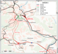
Tracks around the Birkenkopf.png 1,300 × 1,050; 467 KB
-
Wegbeschreibung.png 680 × 464; 139 KB
-
Weissenhof Haus Stam Tafel2.png 1,286 × 927; 185 KB


