Category:OpenStreetMap maps of Stuttgart
Jump to navigation
Jump to search
Urban districts (cities): Freiburg · Heilbronn · Karlsruhe · Mannheim · Stuttgart ·
Media in category "OpenStreetMap maps of Stuttgart"
The following 17 files are in this category, out of 17 total.
-
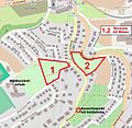
Birkenwaldstraße, 001.jpg 752 × 736; 367 KB
-
Feuersee Stuttgart, 002.jpg 851 × 780; 396 KB
-
Filderbäumle mit Herz, City bike trail and loop road in Stuttgart (Germany), UTM 32.jpg 1,170 × 1,812; 519 KB
-
Flughafen und Messe Stuttgart.png 1,225 × 680; 451 KB
-
Karte der Stuttgarter Stäffele.png 797 × 655; 791 KB
-
Karte Weißenhofsiedlung.svg 1,062 × 1,212; 118 KB
-
Lageplan Kaufhof Bad Cannstatt.png 897 × 604; 285 KB
-
Location map Stuttgart.svg 2,433 × 2,556; 107.48 MB
-
Prinzenbau, 58.jpg 1,208 × 755; 465 KB
-
Schloss Rosenstein, 035.jpg 456 × 382; 23 KB
-
Skulpturen in Stuttgart, 0094.jpg 1,317 × 917; 1.17 MB
-
Skulpturen in Stuttgart, 0096.jpg 1,315 × 1,863; 2.01 MB
-
St. Fideliskirche (Stuttgart), 005.jpg 889 × 594; 279 KB
-
Stuttgart location map.png 616 × 572; 549 KB
-
Stuttgart, Schlossplatz, Schema.jpg 768 × 841; 119 KB
-
Stuttgart-Berg, Stadtplanausschnitt um die Berger Kirche.jpg 678 × 514; 255 KB
-
Übersichtskarte Tunnel Wagenladungsstraße.svg 2,020 × 1,769; 4.99 MB


