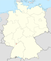
Category:Maps of Heidelberg
Jump to navigation
Jump to search
Urban districts (cities): Baden-Baden · Freiburg · Heidelberg · Heilbronn · Karlsruhe · Mannheim · Pforzheim · Stuttgart · Ulm
Use the appropriate category for maps showing all or a large part of Heidelberg. See subcategories for smaller areas:
| If the map shows | Category to use |
|---|---|
| Heidelberg on a recently created map | Category:Maps of Heidelberg or its subcategories |
| Heidelberg on a map created more than 70 years ago | Category:Old maps of Heidelberg or its subcategories |
| the history of Heidelberg on a recently created map | Category:Maps of the history of Heidelberg or its subcategories |
| the history of Heidelberg on a map created more than 70 years ago | Category:Old maps of the history of Heidelberg or its subcategories |
Wikimedia category | |||||
| Upload media | |||||
| Instance of | |||||
|---|---|---|---|---|---|
| Category combines topics | |||||
| Heidelberg | |||||
large city in Baden-Württemberg, Germany | |||||
| Instance of |
| ||||
| Part of |
| ||||
| Location |
| ||||
| Located in or next to body of water | |||||
| Head of government |
| ||||
| Significant event |
| ||||
| Population |
| ||||
| Area |
| ||||
| Elevation above sea level |
| ||||
| Different from | |||||
| official website | |||||
 | |||||
Subcategories
This category has the following 5 subcategories, out of 5 total.
Media in category "Maps of Heidelberg"
The following 64 files are in this category, out of 64 total.
-
Basiskarte Heidelberg (ohne Bahnlinien).png 6,573 × 4,933; 12.09 MB
-
Basiskarte Heidelberg.png 6,573 × 4,933; 12.44 MB
-
AltstadtPos.png 812 × 605; 19 KB
-
BahnstadtPos.png 812 × 605; 19 KB
-
Baufelder.png 1,708 × 1,080; 2.45 MB
-
Bergheim in HD-City.svg 210 × 169; 36 KB
-
BergheimPos.png 812 × 605; 19 KB
-
BoxbergPos.png 812 × 605; 19 KB
-
EmmertsgrundPos.png 812 × 605; 19 KB
-
Fahrpreis-Navigator (5653268436).jpg 2,128 × 2,832; 1.44 MB
-
GER Heidelberg, Im Neuenheimer Feld 008.jpg 2,163 × 2,162; 951 KB
-
HandschuhsheimPos.png 812 × 605; 19 KB
-
HD (St) in Baden-Württemberg.svg 753 × 868; 159 KB
-
Heidelberg Eingemeindungen.png 812 × 605; 10 KB
-
Heidelberg in römischer Zeit.png 725 × 476; 23 KB
-
Heidelberg OSM 01.png 657 × 494; 496 KB
-
Heidelberg OSM 02.png 657 × 494; 817 KB
-
Heidelberg OSM 03.png 657 × 494; 563 KB
-
Heidelberg Stadtteile 2012.svg 2,034 × 1,528; 1.03 MB
-
Heidelberg-Altstadt 2012.svg 2,034 × 1,528; 715 KB
-
Heidelberg-Bahnstadt 2012.svg 2,034 × 1,528; 714 KB
-
Heidelberg-Bergheim 2012.svg 2,034 × 1,528; 714 KB
-
Heidelberg-Boxberg 2012.svg 2,034 × 1,528; 715 KB
-
Heidelberg-Emmertsgrund 2012.svg 2,034 × 1,528; 715 KB
-
Heidelberg-Handschuhsheim 2012.svg 2,034 × 1,528; 715 KB
-
Heidelberg-Kirchheim 2012.svg 2,034 × 1,528; 715 KB
-
Heidelberg-Kohlhof 2012.svg 2,034 × 1,528; 714 KB
-
Heidelberg-Neuenheim 2012.svg 2,034 × 1,528; 715 KB
-
Heidelberg-Neurott 2012.svg 2,034 × 1,528; 714 KB
-
Heidelberg-Partick-Henry-Village 2012.svg 2,034 × 1,528; 714 KB
-
Heidelberg-Peterstal.svg 2,034 × 1,528; 714 KB
-
Heidelberg-Pfaffengrund 2012.svg 2,034 × 1,528; 714 KB
-
Heidelberg-Position.png 188 × 235; 3 KB
-
Heidelberg-Rohrbach 2012.svg 2,034 × 1,528; 715 KB
-
Heidelberg-Schlierbach 2012.svg 2,034 × 1,528; 715 KB
-
Heidelberg-Südstadt 2012.svg 2,034 × 1,528; 715 KB
-
Heidelberg-Weststadt 2012.svg 2,034 × 1,528; 714 KB
-
Heidelberg-Wieblingen 2012.svg 2,034 × 1,528; 715 KB
-
Heidelberg-Ziegelhausen 2012.svg 2,034 × 1,528; 715 KB
-
KirchheimPos.png 812 × 605; 19 KB
-
Lage Kohlhof.png 800 × 596; 98 KB
-
Locator map HD (town) in Baden-Württemberg.svg 1,058 × 1,161; 278 KB
-
Locator map HD (town) in Germany.svg 1,075 × 1,273; 578 KB
-
NeuenheimPos.png 812 × 605; 19 KB
-
NeurottPos.png 812 × 605; 19 KB
-
Old Town in HD-City.svg 210 × 169; 36 KB
-
Patrick Henry VillagePos.png 812 × 605; 19 KB
-
PeterstalPos.png 812 × 605; 19 KB
-
Pfaffengrund in HD-City.svg 210 × 169; 36 KB
-
PfaffengrundPos.png 812 × 605; 19 KB
-
Rohrbach in HD-City.svg 210 × 169; 36 KB
-
RohrbachPos.png 812 × 605; 19 KB
-
Schlierbach in HD-City.svg 210 × 169; 36 KB
-
SchlierbachPos.png 812 × 605; 19 KB
-
HeidelbergStadtteile.png 822 × 605; 25 KB
-
Strecke HD.jpg 498 × 200; 19 KB
-
Südstadt in HD-City.svg 210 × 169; 36 KB
-
SüdstadtPos.png 812 × 605; 19 KB
-
Weststadt (with Bahnstadt) in HD-City.svg 210 × 169; 36 KB
-
WeststadtPos.png 812 × 605; 19 KB
-
Wieblingen (with Bahnstadt) in HD-City.svg 210 × 169; 36 KB
-
WieblingenPos.png 812 × 605; 19 KB
-
Ziegelhausen in HD-City.svg 210 × 169; 36 KB
-
ZiegelhausenPos.png 812 × 605; 19 KB


