Category:Maps of Freiburg im Breisgau
Jump to navigation
Jump to search
Urban districts (cities): Baden-Baden · Freiburg · Heidelberg · Heilbronn · Karlsruhe · Mannheim · Pforzheim · Stuttgart · Ulm
Use the appropriate category for maps showing all or a large part of Freiburg im Breisgau. See subcategories for smaller areas:
| If the map shows | Category to use |
|---|---|
| Freiburg im Breisgau on a recently created map | Category:Maps of Freiburg im Breisgau or its subcategories |
| Freiburg im Breisgau on a map created more than 70 years ago | Category:Old maps of Freiburg im Breisgau or its subcategories |
| the history of Freiburg im Breisgau on a recently created map | Category:Maps of the history of Freiburg im Breisgau or its subcategories |
| the history of Freiburg im Breisgau on a map created more than 70 years ago | Category:Old maps of the history of Freiburg im Breisgau or its subcategories |
Wikimedia category | |||||
| Upload media | |||||
| Instance of | |||||
|---|---|---|---|---|---|
| Category combines topics | |||||
| Freiburg im Breisgau | |||||
large city in Baden-Württemberg, Germany | |||||
| Pronunciation audio | |||||
| Instance of |
| ||||
| Part of | |||||
| Patron saint | |||||
| Location |
| ||||
| Located in or next to body of water | |||||
| Street address |
| ||||
| Visitor center | |||||
| Head of government |
| ||||
| Legal form | |||||
| Population |
| ||||
| Area |
| ||||
| Elevation above sea level |
| ||||
| official website | |||||
 | |||||
Subcategories
This category has the following 4 subcategories, out of 4 total.
Media in category "Maps of Freiburg im Breisgau"
The following 74 files are in this category, out of 74 total.
-
After Action Report - Freiburg - NARA - 100384909.jpg 10,766 × 7,776; 22.27 MB
-
Bahnhof Freiburg Lage.png 359 × 352; 106 KB
-
Bergwerk Schoenberg Freiburg Breisgau Riss Sicherheitspfeiler.jpg 960 × 680; 102 KB
-
Carte Fribourg en Allemagne.png 177 × 235; 4 KB
-
Colmar freibourg.jpg 1,364 × 402; 96 KB
-
FR (St) in Baden-Württemberg.svg 753 × 868; 159 KB
-
Fr-altstadt.png 300 × 281; 40 KB
-
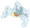
Fr-betzenhausen.png 300 × 281; 34 KB
-
Fr-bruehl.png 300 × 281; 41 KB
-
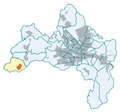
Fr-ebnet.png 300 × 281; 40 KB
-
Fr-guenterstal.png 300 × 281; 41 KB
-
Fr-haid.png 300 × 281; 34 KB
-
Fr-haslach.png 300 × 281; 40 KB
-
Fr-herdern.png 300 × 281; 40 KB
-
Fr-hochdorf.png 300 × 281; 41 KB
-
Fr-kappel.png 299 × 280; 41 KB
-
Fr-landwasser.png 300 × 281; 40 KB
-
Fr-littenweiler.png 300 × 281; 40 KB
-
Fr-mooswald.png 300 × 281; 40 KB
-
Fr-mundenhof.png 300 × 281; 34 KB
-
Fr-munzingen.png 300 × 281; 34 KB
-
Fr-neuburg.png 300 × 281; 40 KB
-
Fr-oberau.png 300 × 281; 40 KB
-
Fr-rieselfeld.png 300 × 281; 40 KB
-
Fr-stgeorgen.png 300 × 281; 41 KB
-
Fr-stuehlinger.png 300 × 281; 40 KB
-
Fr-tiengen.png 300 × 281; 41 KB
-
Fr-waldsee.png 300 × 281; 41 KB
-
Fr-waltershofen.png 300 × 281; 40 KB
-
Fr-weingarten.png 300 × 281; 40 KB
-
Fr-wiehre.png 300 × 281; 41 KB
-
Fr-zaehringen.png 300 × 281; 40 KB
-
Freiburg Br. 2012-09-06 (33).JPG 2,736 × 3,648; 3.95 MB
-
Freiburg map.png 1,265 × 973; 2.77 MB
-
Freiburg relief.svg 550 × 532; 1.79 MB
-
Freiburg-im-Breisgau-Bebauung.png 681 × 638; 18 KB
-
Freiburg-im-Breisgau-Stuehinger.png 681 × 638; 18 KB
-
Freiburg-mit-umland-bebauung.png 913 × 841; 36 KB
-
Freiburg-public Citymap-01ASD.jpg 3,024 × 4,032; 4.35 MB
-
Freiburg-stadtteile.png 681 × 638; 41 KB
-
Freiburg-topographie.png 739 × 684; 702 KB
-
Freiburger Schlossberg, Tafel 6.jpg 3,697 × 2,752; 3.64 MB
-
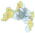
Freiburgerseen.png 300 × 281; 37 KB
-
Fribourg-en-Brisgau OSM 01.png 1,206 × 1,132; 2.4 MB
-
Fribourg-en-Brisgau OSM 02.png 1,206 × 1,132; 3.21 MB
-
Fribourg-en-Brisgau OSM 03.png 850 × 836; 1.37 MB
-
Fußgängerleitsystem.jpg 1,758 × 3,924; 2.52 MB
-
Grafik Radnetz Plus Anbindung Ortschaften.jpg 3,838 × 2,546; 1.34 MB
-
Grafik Radnetz Plus Radvorrangrouten.jpg 3,838 × 2,546; 1.32 MB
-
Grafik Radschnellweg nach Breisach.jpg 988 × 929; 205 KB
-
Hauptvarianten Freiburg.pdf 1,752 × 1,237; 1.78 MB
-
Haus zum Walfisch Hausnamen.jpg 587 × 999; 81 KB
-
Haus zum Walfisch Plan 1890.jpg 887 × 562; 90 KB
-
Karte Erzbistum Freiburg.png 500 × 646; 22 KB
-
Karte Freiburg i.B. - Stadttunnel.png 2,013 × 1,037; 3.24 MB
-
Karte Freiburg im Breisgau in Deutschland.png 188 × 235; 3 KB
-
Karte Lehen in Freiburg im Breisgau (Deutschland).png 300 × 281; 40 KB
-
Locator map FR (town) in Baden-Württemberg.svg 1,058 × 1,161; 278 KB
-
Locator map FR (town) in Germany.svg 1,075 × 1,273; 578 KB
-
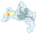
Opfingen-fr.png 300 × 281; 34 KB
-
Radverkehr Mooswaldstadion.jpg 827 × 765; 147 KB
-
Routenplan Radnetz 2020.pdf 6,962 × 3,512; 5.56 MB
-
Schlachtbeifreiburg-alem.jpg 400 × 373; 39 KB
-
Schlachtbeifreiburg.jpg 400 × 373; 33 KB
-
Stadtplan Freiburg Konzerhaus cropped.png 359 × 352; 91 KB
-
Stadtplan Freiburg Konzerhaus.gif 775 × 610; 147 KB
-
Uni-freiburg.png 300 × 281; 34 KB
-
Vauban-fr.png 300 × 281; 34 KB
-
VaubanTraficNetwork-Schematic.png 510 × 424; 85 KB
-
Vordringlicher Bedarf.pdf 1,752 × 1,239; 1.79 MB
-
Vordringlicher und weiterer Bedarf.pdf 1,752 × 1,239; 1.8 MB
-
Weitere Planungen.pdf 1,752 × 1,239; 1.8 MB
-
Übersicht FR 2.jpg 420 × 1,262; 645 KB


