Category:Maps of Baden-Baden
Jump to navigation
Jump to search
Urban districts (cities): Baden-Baden · Freiburg · Heidelberg · Heilbronn · Karlsruhe · Mannheim · Pforzheim · Stuttgart · Ulm
Use the appropriate category for maps showing all or a large part of Baden-Baden. See subcategories for smaller areas:
| If the map shows | Category to use |
|---|---|
| Baden-Baden on a recently created map | Category:Maps of Baden-Baden or its subcategories |
| Baden-Baden on a map created more than 70 years ago | Category:Old maps of Baden-Baden or its subcategories |
| the history of Baden-Baden on a recently created map | Category:Maps of the history of Baden-Baden or its subcategories |
| the history of Baden-Baden on a map created more than 70 years ago | Category:Old maps of the history of Baden-Baden or its subcategories |
Wikimedia category | |||||
| Upload media | |||||
| Instance of | |||||
|---|---|---|---|---|---|
| Category combines topics | |||||
| Baden-Baden | |||||
town in Baden-Württemberg, Germany | |||||
| Instance of |
| ||||
| Part of | |||||
| Location |
| ||||
| Located in or next to body of water | |||||
| Head of government |
| ||||
| Heritage designation |
| ||||
| Population |
| ||||
| Area |
| ||||
| Elevation above sea level |
| ||||
| Different from | |||||
| Said to be the same as | Stadtkreis Baden-Baden | ||||
| official website | |||||
 | |||||
Subcategories
This category has only the following subcategory.
Media in category "Maps of Baden-Baden"
The following 22 files are in this category, out of 22 total.
-
Baden - btv1b53238704w (1 of 2).jpg 5,117 × 3,543; 5.53 MB
-
Plan Baden-Baden (ca. 1840).jpg 1,277 × 891; 339 KB
-
Stadtplan Baden (Baden) - ca.1840.jpg 1,277 × 891; 620 KB
-
459 of 'Neue Folge' (11189696834).jpg 4,238 × 4,883; 5.42 MB
-
Amt Steinbach 1784.jpg 5,140 × 3,935; 4.98 MB
-
BAD in Baden-Württemberg.svg 753 × 868; 159 KB
-
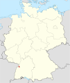
Baden-Baden in Deutschland.png 176 × 234; 5 KB
-
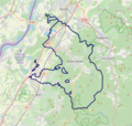
Baden-Baden OSM 01.png 560 × 530; 249 KB
-
Baden-Baden OSM 02.png 560 × 530; 419 KB
-
Britannica Baden (Germany) - Ground-Plan.jpg 2,412 × 1,665; 696 KB
-
Ehemaliger Landsee in Kinzig-Murg-Rinne zwischen Baden-Baden und Rastatt - Skizze.tif 1,443 × 1,641; 9.09 MB
-
Infotafel - panoramio (1).jpg 1,600 × 1,125; 1.62 MB
-
Infotafel - panoramio.jpg 994 × 1,314; 1.21 MB
-
Lagekarte Haueneberstein.png 1,965 × 2,469; 1.26 MB
-
Leitstellenbereich 144 Notruf NÖ Baden.png 1,017 × 880; 27 KB
-
Locator map BAD in Baden-Württemberg.svg 1,058 × 1,161; 278 KB
-
Locator map BAD in Germany.svg 1,075 × 1,273; 578 KB
-
Merkur Bergstation - panoramio (2).jpg 3,072 × 2,304; 3.8 MB
-
Meßtischblatt 7215 Baden-Baden von 1938 Df dk 0010001 7215.jpg 1,555 × 1,600; 1.23 MB
-
Tornado Pforzheim.jpg 1,128 × 733; 136 KB
-
Wanderportal Altes-Schloss.jpg 2,491 × 1,896; 1 MB


