Category:Maps of Southeast Asia
Jump to navigation
Jump to search
Wikimedia category | |||||
| Upload media | |||||
| Instance of | |||||
|---|---|---|---|---|---|
| Category combines topics | |||||
| Southeast Asia | |||||
south-eastern region of Asia | |||||
| Instance of | |||||
| Part of | |||||
| Location |
| ||||
| Located in or next to body of water | |||||
| Has part(s) | |||||
| Population |
| ||||
| Area |
| ||||
 | |||||
Subcategories
This category has the following 17 subcategories, out of 17 total.
+
2
A
- Maps of ASEAN (65 F)
F
- Maps of the Far East (15 F)
G
- Maps of the Gulf of Thailand (36 F)
H
L
M
O
T
Media in category "Maps of Southeast Asia"
The following 84 files are in this category, out of 84 total.
-
2013 South Asia Malaria (30249979733).jpg 2,109 × 1,651; 1.03 MB
-
2014-15 Southeast Asia floods as of 2 Jan 2015.png 1,276 × 843; 155 KB
-
2016 Singapur, Downtown Core, Muzeum Cywilizacji Azjatyckich, Ekspozycja (070).jpg 4,530 × 3,648; 14.1 MB
-
2018 AFF Suzuki Cup countries.svg 492 × 378; 473 KB
-
3 Regions Far East Southeast Asia Indian Subcontinent 2.PNG 370 × 304; 6 KB
-
AKB48 Group Overseas.png 315 × 339; 44 KB
-
API geogrphical coverage.jpg 735 × 464; 32 KB
-
Asia C Current.jpg 1,074 × 512; 150 KB
-
Asien Financial Crisis.png 1,095 × 705; 79 KB
-
B46 Frequencies.PNG 334 × 374; 23 KB
-
Bamboo network.jpg 1,080 × 820; 181 KB
-
Bamboonetwork.svg 550 × 550; 1.24 MB
-
Blue-throated bee-eater range map.png 642 × 549; 54 KB
-
Carte ; Asie du Sud-Est.png 404 × 484; 235 KB
-
Cengranite2.2-1.jpg 1,014 × 1,688; 193 KB
-
CGulfOfThailand.gif 305 × 389; 13 KB
-
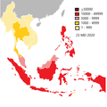
COVID-19 di Asia Tenggara.png 2,000 × 2,000; 300 KB
-
Eastern Belt1.jpg 307 × 559; 777 KB
-
Eastern World.PNG 1,903 × 837; 188 KB
-
EasternWorld.png 9,473 × 9,532; 9.27 MB
-
Endonyms of Southeast Asia.svg 936 × 1,368; 7.26 MB
-
Ethnic mosaic of Southeast Asia (2011).jpg 1,216 × 1,452; 480 KB
-
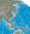
First island chain perimeter (marked in red).jpg 509 × 584; 69 KB
-
Gong and Chime Culture Map.jpg 2,975 × 2,675; 633 KB
-
Greater China.PNG 184 × 138; 7 KB
-
Gujarat Jawadwipa maps.svg 1,000 × 670; 964 KB
-
Gujarat Jawadwipa.svg 1,100 × 837; 956 KB
-
Gujarat Jawadwipa2.svg 1,100 × 837; 964 KB
-
Hinterindien.jpg 225 × 305; 15 KB
-
IMT-GT and BIMP-EAGA Countries.png 2,560 × 1,967; 504 KB
-
Indes orientales.JPG 956 × 681; 53 KB
-
InsulindiaMap.png 1,000 × 677; 26 KB
-
Jade culture distribution.jpg 1,280 × 1,056; 251 KB
-
Journal of three voyages along the coast of China - Map of the Coast of Siam China.jpg 1,938 × 2,306; 504 KB
-
Khmer Implementation ASEAN.png 2,000 × 1,636; 351 KB
-
LandForms.jpg 164 × 120; 7 KB
-
Mainland Southeast Asia - DPLA - ce6f58d206140d545f2b3c1c20c60453.jpg 2,552 × 3,272; 5.35 MB
-
Mainland Southeast Asia - DPLA - f10992ecf1eb70344c082b4dd67f832c.jpg 2,552 × 3,282; 5.53 MB
-
Map IM Asean & Districts.gif 1,490 × 1,053; 350 KB
-
Map of Southeast Asia.jpg 1,208 × 1,378; 542 KB
-
Map of Super GT.png 320 × 370; 12 KB
-
Map-World-Southeast-Asia.png 1,357 × 628; 45 KB
-
Masyarakat China-Malaysia.png 508 × 470; 238 KB
-
Masyarakat melayu.png 550 × 434; 274 KB
-
Membres francophonie - Asie de l'Est.png 743 × 435; 60 KB
-
New Four Asian Tigers.svg 439 × 631; 180 KB
-
Novos Tigres Asiáticos.png 2,000 × 2,875; 431 KB
-
P1994-2011.gif 590 × 525; 810 KB
-
PAT - Southeast Asia.gif 2,000 × 1,550; 464 KB
-
Phi Pan Nam Range-SE Asia.png 705 × 634; 304 KB
-
Philippines area map.jpg 402 × 405; 44 KB
-
Plataforma y región de la Sonda.PNG 605 × 469; 65 KB
-
Political Southeast Asia Map.jpeg 559 × 660; 146 KB
-
Political Southeast Asia.jpg 510 × 600; 340 KB
-
RCEP.jpg 508 × 398; 47 KB
-
Regional map of SE Asia with Borneo Highlighted.svg 2,864 × 1,644; 82 KB
-
Relief map of southern East Asia and northern Southeast Asia.png 1,360 × 1,300; 1.79 MB
-
Routes nord sud.png 381 × 421; 227 KB
-
Se asia malaysia.png 1,722 × 2,000; 637 KB
-
SEA Country Names in Thai Sign Language Written in Sutton SignWriting.png 1,890 × 1,890; 636 KB
-
South Eastern Asia - DPLA - 25be86d8bfa761a9a46a5a779d3fb323.jpg 12,042 × 18,975; 25.73 MB
-
Southeast Asia - DPLA - 261eeba4f2ed20578769b9faadf44176 (page 1).jpg 2,552 × 3,272; 6.83 MB
-
Southeast Asia - DPLA - 261eeba4f2ed20578769b9faadf44176 (page 2).jpg 2,560 × 3,270; 6.77 MB
-
Southeast Asia - DPLA - 275b0b3a34b3f4ada01a378565f2e83f.jpg 2,554 × 3,278; 6.27 MB
-
Southeast Asia - DPLA - 2ff2ae3739b084da04384174a31da15a.jpg 2,556 × 3,276; 5.98 MB
-
Southeast Asia - DPLA - 62a3c64e85b6c19ee7b4de5c60ac2602.jpg 2,556 × 3,282; 6.82 MB
-
Southeast Asia - DPLA - 648b3fdc2bfd811eafe68c1ed48817c5.jpg 2,558 × 3,280; 6.6 MB
-
Southeast Asia - DPLA - 86a10ccda8af322d02f30917148f4a88.jpg 2,558 × 3,272; 7.74 MB
-
Southeast Asia - DPLA - d5781a47aa7388a78408738ee253f704.jpg 2,558 × 3,286; 6.33 MB
-
Southeast Asia - DPLA - e5eca6b00852275c4b652261cf271bd2 (page 1).jpg 2,262 × 2,616; 4.83 MB
-
Southeast Asia - DPLA - e5eca6b00852275c4b652261cf271bd2 (page 2).jpg 2,258 × 2,616; 4.99 MB
-
Southeast Asia Map-tagalog.png 600 × 515; 80 KB
-
Southeast Asia Political Map World Factbook 2020.png 2,172 × 2,517; 1.14 MB
-
Southeast asia.jpg 1,344 × 1,537; 353 KB
-
SudestAsiatico.png 378 × 300; 8 KB
-
Suresteasia324.jpg 800 × 500; 201 KB
-
Szunda.png 947 × 783; 232 KB
-
Three Parallel Rivers of Yunnan Protected Areas map01.png 1,000 × 733; 1.28 MB
-
TIS-route.png 80 × 106; 3 KB
-
Treaty of Amity and Cooperation.png 1,425 × 625; 57 KB
-
Varanus salvator.PNG 860 × 720; 38 KB


