Category:SVG maps of Southeast Asia
Jump to navigation
Jump to search
Subcategories
This category has only the following subcategory.
I
Media in category "SVG maps of Southeast Asia"
The following 61 files are in this category, out of 61 total.
-
 Apamm Balik Name in South East Asian.svg 1,260 × 765; 780 KB
-
 Austroasiatic-ar.svg 540 × 615; 534 KB
-
 Austroasiatic-de.svg 540 × 615; 240 KB
-
 Austroasiatic-en.svg 540 × 615; 314 KB
-
 Austroasiatic-es.svg 540 × 615; 482 KB
-
 Austroasiatic-id.svg 540 × 615; 314 KB
-
 Austroasiatickhmermap2.svg 540 × 615; 322 KB
-
 Bamboo Curtain.svg 360 × 280; 317 KB
-
 Bamboonetwork.svg 550 × 550; 1.24 MB
-
 COVID-19 pandemic Southeast Asia map.svg 1,000 × 888; 182 KB
-
 Eastern World.svg 2,560 × 1,314; 1.12 MB
-
 Freedom of panorama in Southeast Asia.svg 1,500 × 1,236; 2.7 MB
-
 Grundlage Karte historisches Südostasien.svg 220 × 328; 12.51 MB
-
 Hinduism Expansion in Asia de.svg 1,060 × 791; 845 KB
-
 Hinduism Expansion in Asia-es.svg 512 × 382; 1.28 MB
-
 Hinduism Expansion in Asia-hu.svg 512 × 382; 824 KB
-
 Hinduism Expansion in Asia-id.svg 512 × 382; 779 KB
-
 Hinduism Expansion in Asia-pt.svg 512 × 382; 826 KB
-
 Hinduism Expansion in Asia-zh-hans.svg 512 × 382; 779 KB
-
 Hinduism Expansion in Asia.svg 512 × 382; 769 KB
-
 Hmong-Mien-de.svg 900 × 800; 285 KB
-
 Hmong-Mien-en.svg 900 × 800; 287 KB
-
 Hmong-Mien-fr.svg 900 × 800; 296 KB
-
 Hmong-Mien-id.svg 900 × 800; 287 KB
-
 Hmong-Mien-mk.svg 900 × 800; 353 KB
-
 Hmong-Mien-vi.svg 900 × 800; 296 KB
-
 Image-WAGGGSAsiaPacificMap-World notpink.svg 1,100 × 900; 1.96 MB
-
 Karte der Indochinesischen Halbinsel-de.svg 220 × 328; 15.26 MB
-
 Location Southeast Asia.svg 1,100 × 900; 2.12 MB
-
 LocationAnnam.svg 1,000 × 500; 862 KB
-
 LocationBurma.svg 1,000 × 500; 1.09 MB
-
 LocationCochinchina.svg 1,000 × 500; 861 KB
-
 LocationSoutheastAsia.svg 940 × 415; 1.5 MB
-
 Map of French Indochina expansion.svg 675 × 970; 733 KB
-
 Map of Siam (territorial cessions).svg 656 × 1,243; 760 KB
-
 Map of Siam and French Indochina -by Milenioscuro- (modified Thai language).png 1,039 × 1,726; 586 KB
-
 Map of Siam and French Indochina.svg 748 × 1,243; 1,014 KB
-
 Map of Siam territory (lost)TH.svg 604 × 1,012; 512 KB
-
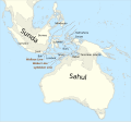 Map of Sunda and Sahul.svg 976 × 907; 847 KB
-
 Map of the Rattanakosin Kingdom.svg 656 × 1,243; 686 KB
-
 MekongChaoPhraya.svg 862 × 1,052; 1.3 MB
-
 Possible extent of the Langkasuka kingdom.svg 1,500 × 1,236; 2.62 MB
-
 Rivers of Southeast Asia - blank map.svg 1,358 × 1,815; 1.15 MB
-
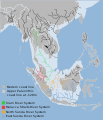 SEA submerged River Systems.svg 512 × 595; 692 KB
-
 South east Asia.svg 1,100 × 1,303; 3.39 MB
-
 Southeast Asia (orthographic projection).svg 550 × 551; 414 KB
-
 Southeast asia 2.svg 506 × 400; 223 KB
-
 Southeast Asia blank political map.svg 1,500 × 1,236; 2.79 MB
-
 Southeast asia fr.svg 506 × 577; 434 KB
-
 Southeast Asia location map.svg 492 × 378; 436 KB
-
 Southeast Asia outline.svg 1,000 × 888; 182 KB
-
 Southeast Asia plus Timor Leste location map.svg 492 × 378; 473 KB
-
 Southeast asia-mk.svg 506 × 598; 1.22 MB
-
 Southeast asia.svg 506 × 598; 729 KB
-
 Southeast Asia.svg 2,754 × 1,398; 1.11 MB
-
 Southeast Asian Historical Mandalas.svg 512 × 503; 154 KB
-
 Southeast Asian history (around 1540) ru.svg 776 × 1,138; 218 KB
-
 Southeastasia 1317 map de.svg 1,070 × 1,150; 12.63 MB
-
 Südostasien 1380.svg 1,070 × 1,150; 12.62 MB
-
 Südostasien 1450.svg 1,070 × 1,150; 12.63 MB
-
 Wikimedia regions - East, Southeast Asia, & Pacific.svg 800 × 800; 372 KB


.svg)
.png)

TH.svg)


.svg)


_ru.svg)


