Category:Maps of Mainland Southeast Asia
Jump to navigation
Jump to search
Subcategories
This category has the following 4 subcategories, out of 4 total.
I
M
- Maps of the Kra Canal (2 F)
Media in category "Maps of Mainland Southeast Asia"
The following 31 files are in this category, out of 31 total.
-
Austroasiatic-ar.svg 540 × 615; 534 KB
-
Austroasiatic-de.svg 540 × 615; 240 KB
-
Austroasiatic-en.svg 540 × 615; 314 KB
-
Austroasiatic-es.svg 540 × 615; 482 KB
-
Austroasiatic-id.svg 540 × 615; 314 KB
-
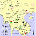
Austroasiatic.svg 725 × 604; 307 KB
-
Austroasiatickhmermap2.svg 540 × 615; 322 KB
-
Daen Lao Range-Southeast asia.jpg 540 × 614; 81 KB
-
Dawna Range-Southeast asia.jpg 543 × 769; 100 KB
-
Ethnolinguistic Groups of Mainland Southeast Asia.png 1,874 × 3,108; 2.08 MB
-
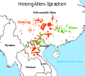
Hmong-Mien-de.svg 900 × 800; 285 KB
-
Hmong-Mien-en.svg 900 × 800; 287 KB
-
Hmong-Mien-fr.svg 900 × 800; 296 KB
-
Hmong-Mien-id.svg 900 × 800; 287 KB
-
Hmong-Mien-mk.svg 900 × 800; 353 KB
-
Hmong-Mien-vi.svg 900 × 800; 296 KB
-
Indochine.png 462 × 503; 145 KB
-
Karen Hills-Southeast asia.jpg 537 × 716; 94 KB
-
Karte der Indochinesischen Halbinsel-de.jpg 916 × 1,368; 689 KB
-
Karte der Indochinesischen Halbinsel-de.svg 220 × 328; 15.26 MB
-
Karte der Indochinesischen Halbinsel-en.jpg 916 × 1,368; 675 KB
-
Luang Prabang Range-Southeast asia.jpg 531 × 480; 61 KB
-
Mainland Southeast Asia.png 645 × 687; 695 KB
-
MAP IndoBurma.png 479 × 456; 46 KB
-
Map Laos Cambodia Thailand Vietnam blank.svg 2,400 × 3,195; 6.42 MB
-
Rivers of Southeast Asia - blank map.svg 1,358 × 1,815; 1.15 MB
-
Shan Hills-Southeast asia.jpg 543 × 713; 95 KB
-
Tenasserim Hills-Southeast asia.jpg 633 × 668; 98 KB


