Category:Maps of the South China Sea
Jump to navigation
Jump to search
| NO WIKIDATA ID FOUND! Search for Maps of the South China Sea on Wikidata | |
| Upload media |
Subcategories
This category has the following 7 subcategories, out of 7 total.
M
O
P
- Maps of the Paracel Islands (1 P, 42 F)
S
- Maps of the Spratly Islands (1 P, 56 F)
T
- Maps of the Gulf of Thailand (36 F)
W
Media in category "Maps of the South China Sea"
The following 69 files are in this category, out of 69 total.
-
South China Sea claims 2.png 896 × 1,232; 87 KB
-
75967 South-China-Sea-1 (Paracel Islands cropped).jpg 1,190 × 746; 429 KB
-
75967 South-China-Sea-1.pdf 1,754 × 1,239; 3.71 MB
-
9 dotted line.png 979 × 1,206; 1.79 MB
-
9doan.jpg 1,024 × 808; 75 KB
-
Admiralty Chart No 1311 Singapore Strait to Borneo Northern Sheet, Published 1959.jpg 17,573 × 11,178; 49.14 MB
-
Admiralty Chart No 2661b China Sea Northern Portion Eastern Sheet, Published 1967.jpg 11,262 × 16,428; 32.15 MB
-
Anambas.png 350 × 350; 15 KB
-
Bien Dong.png 388 × 399; 173 KB
-
CIA-RDP08C01297R000300180018-3.pdf 1,275 × 1,650, 28 pages; 1.99 MB
-
Gothus teemo range map.svg 1,134 × 1,229; 647 KB
-
Gulf of Tonkin location.gif 500 × 500; 90 KB
-
Hainanincidentmap zh.jpg 865 × 678; 61 KB
-
Hainanincidentmap.png 865 × 678; 45 KB
-
Heng Jiao to Haima Tan (Routh Shoal) (Seahorse Shoal) NGA Nautical Chart 93045.jpg 21,419 × 16,459; 8.11 MB
-
Hoang Sa3.PNG 642 × 442; 72 KB
-
Karta CN SouthChinaSea-zh.png 350 × 350; 14 KB
-
Karta CN SouthChinaSea.PNG 350 × 350; 13 KB
-
Lingayengulfmap.png 500 × 447; 119 KB
-
Locatie Zuid-Chinese Zee.PNG 484 × 362; 13 KB
-
Luconia Shoals Department of State map 2016587286 (2015) (cropped).jpg 987 × 1,466; 121 KB
-
Mantangule Island to Eran Bay (Palawan Passage) NGA Nautical Chart 93046.jpg 21,800 × 15,000; 9.7 MB
-
Map North Natuna Sea.jpg 1,484 × 1,231; 467 KB
-
Map of South China Sea.jpg 7,842 × 3,804; 10.3 MB
-
MH370 ATC and air routes map-en.svg 700 × 547; 61 KB
-
MH370 ATC and air routes map-zh-s.svg 700 × 547; 60 KB
-
MH370 ATC and air routes map.png 4,952 × 3,864; 1.79 MB
-
MH370 ATC-Routes map.png 4,952 × 3,864; 1.94 MB
-
MH370 SIO search-en.svg 4,791 × 3,673; 4.99 MB
-
MH370 SIO search-zh-s.svg 4,791 × 3,673; 4.99 MB
-
Nam Con Son Basin Location.png 542 × 678; 181 KB
-
Nansha huangyan.jpg 486 × 526; 40 KB
-
Nine-Dash-Line-2009-wrong-scale.jpg 1,632 × 2,111; 965 KB
-
North and South Luconia Shoals.jpg 1,280 × 2,320; 478 KB
-
OpenSeaMap-ChartBundleArea-SouthChineseSea-2016-05.png 681 × 806; 308 KB
-
Pacific War - Southeast Asia 1941 - Map.jpg 1,261 × 971; 178 KB
-
Paracel Spratly Islands.png 298 × 418; 5 KB
-
Relief Map of South China Sea.png 1,134 × 1,229; 1.69 MB
-
Scarborough Shoal (South China Sea) NGA Nautical Chart 91004.jpg 19,400 × 13,600; 6.45 MB
-
Schina sea 88.png 979 × 1,206; 1.79 MB
-
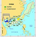
South China Sea Claims and Boundary Agreements 2012.jpg 853 × 864; 184 KB
-
South China Sea claims map.jpg 570 × 620; 131 KB
-
South China Sea claims map.svg 1,134 × 1,319; 1.9 MB
-
South China Sea in its region (IHO 1953).svg 500 × 281; 4.82 MB
-
South China Sea Islands.svg 3,461 × 3,845; 1.76 MB
-
South China Sea location map.svg 1,134 × 1,229; 617 KB
-
South China Sea map.jpg 700 × 755; 167 KB
-
South China Sea Maritime Claims.jpg 1,223 × 1,282; 273 KB
-
South China Sea raid.png 800 × 768; 136 KB
-
South China Sea vector Chinese.svg 1,004 × 945; 707 KB
-
South China Sea vector de.svg 764 × 705; 556 KB
-
South China Sea vector.svg 1,004 × 945; 657 KB
-
South China Sea-Vanguard Bank to Spratly Island NGA Nautical Chart 93049.jpg 23,000 × 16,600; 9.78 MB
-
SouthChinaSea He.png 414 × 330; 26 KB
-
SouthChinaSea-ar.png 414 × 330; 32 KB
-
SouthChinaSea.png 414 × 330; 23 KB
-
Spratly Islands (US State Department) 2015.jpg 5,340 × 4,040; 5.23 MB
-
Spratly Islands in the South China Sea Department of State map 2016587286 (2015).jpg 17,014 × 13,147; 18.37 MB
-
Spratly Islands in the South China Sea Department of State map 2016587286 (2015).pdf 3,300 × 2,550; 11.15 MB
-
Spratly Islands location map.svg 567 × 506; 586 KB
-
Spratly Islands relief location map.svg 720 × 643; 2.23 MB
-
Vanguard Bank cropped from Department of State map 2016587286 (2015).jpg 1,500 × 750; 126 KB
-
Vietnamese irredentism and expansionism.png 5,536 × 3,656; 674 KB
-
Wushi oil field.jpg 842 × 870; 288 KB
-
Yongshu Jiao to Po-Lang Chiao NGA Nautical Chart 93047.jpg 22,965 × 16,493; 8.75 MB
-
Yongshu Jiao to Yongdeng Ansha (South China Sea) NGA Nautical Chart 93044.jpg 23,200 × 16,400; 9.61 MB
-
南海诸岛.jpg 475 × 695; 228 KB


