Category:Maps of the Gulf of Thailand
Jump to navigation
Jump to search
Media in category "Maps of the Gulf of Thailand"
The following 36 files are in this category, out of 36 total.
-
Admiralty Chart Catalogue 1967 Page 056 Index I.jpg 8,565 × 6,901; 8.26 MB
-
Admiralty Chart No 2414 Gulf of Siam, Published 1855, Corrections to 1858.jpg 3,778 × 5,000; 4.43 MB
-
Admiralty Chart No 3727 Approaches to Ao Sattahip, Published 1969.jpg 8,328 × 11,024; 22.31 MB
-
Admiralty Chart No 3967 Baie de Ream to Ko Kut, Published 1957.jpg 11,103 × 16,137; 60.9 MB
-
Bay of Bangkok mk.svg 488 × 337; 136 KB
-
Bay of Bangkok.svg 488 × 337; 99 KB
-
Bodleian Libraries, South China Sea and the Gulf of Siam by Joan Blaeu, 1679.jpg 672 × 1,000; 126 KB
-
Dive Sites of Ko Tao.png 868 × 1,306; 90 KB
-
Gulf of Thailand in its region.svg 500 × 281; 4.82 MB
-
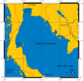
Gulf of Thailand it.svg 488 × 479; 407 KB
-
Gulf of Thailand ja.png 303 × 389; 7 KB
-
Gulf of Thailand mk.svg 488 × 479; 421 KB
-
Gulf of Thailand.png 323 × 457; 18 KB
-
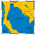
Gulf of Thailand.svg 488 × 479; 387 KB
-
Karte Golf von Thailand es.png 446 × 515; 114 KB
-
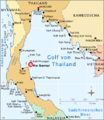
Karte Golf von Thailand.png 446 × 515; 675 KB
-
Ko samui.png 446 × 515; 170 KB
-
Koh Samui map (small).png 270 × 235; 29 KB
-
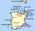
Koh Samui map.png 300 × 320; 34 KB
-
LocationGulfOfThailand.png 250 × 115; 3 KB
-
Map of Mu Ko Ang Thong.jpg 399 × 952; 75 KB
-
Mapa de Koh Tao.png 970 × 1,164; 166 KB
-
MH370 ATC and air routes map-en.svg 700 × 547; 61 KB
-
MH370 ATC and air routes map-zh-s.svg 700 × 547; 60 KB
-
MH370 ATC and air routes map.png 4,952 × 3,864; 1.79 MB
-
MH370 ATC-Routes map.png 4,952 × 3,864; 1.94 MB
-
MH370 SIO search-en.svg 4,791 × 3,673; 4.99 MB
-
MH370 SIO search-zh-s.svg 4,791 × 3,673; 4.99 MB
-
Mukoh angthong 256.gif 256 × 310; 31 KB
-
Phangan Karte.png 644 × 620; 227 KB
-
Relief map of the Malay Peninsula and Gulf of Thailand.png 482 × 413; 144 KB
-
Samui Archipelago Transportation Map.png 648 × 624; 96 KB
-
Thailand-Exclusive-Economic-Zone.png 432 × 288; 48 KB
-
থাইল্যান্ড উপসাগর.svg 488 × 479; 404 KB


