Category:Maps of Kumamoto prefecture
Jump to navigation
Jump to search
日本語: 熊本県の地図のカテゴリ。 日本全体における県の位置図は"Locator maps of ~"を、県内における各市町村の位置図は"Locator maps of municipalities ~"を、各郡の地図は"Maps of districts ~"を、過去の市町村の地図は"Maps of former municipalities ~"を参照。
Wikimedia category | |||||
| Upload media | |||||
| Instance of | |||||
|---|---|---|---|---|---|
| Category combines topics | |||||
| Kumamoto Prefecture | |||||
prefecture of Japan | |||||
| Instance of | |||||
| Named after | |||||
| Location | Japan | ||||
| Located in or next to body of water | |||||
| Capital | |||||
| Legislative body | |||||
| Executive body | |||||
| Anthem |
| ||||
| Head of government |
| ||||
| Mascot | |||||
| Legal form |
| ||||
| Significant event |
| ||||
| Highest point | |||||
| Population |
| ||||
| Area |
| ||||
| Replaces |
| ||||
| official website | |||||
 | |||||
Subcategories
This category has the following 6 subcategories, out of 6 total.
Pages in category "Maps of Kumamoto prefecture"
This category contains only the following page.
Media in category "Maps of Kumamoto prefecture"
The following 54 files are in this category, out of 54 total.
-
Flag map of Kumamoto Prefecture.svg 772 × 938; 11 KB
-
Admiralty Chart No 3692 Shimabara Kaiwan, Published 1908.jpg 10,638 × 15,929; 78.32 MB
-
Admiralty Chart No 836 Amakusa Islands and Yatsushiro Sea, Published 1892.jpg 11,067 × 15,999; 72.03 MB
-
Growth rate map of municipalities of Kumamoto prefecture, Japan.svg 680 × 732; 28 KB
-
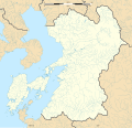
Japan Kumamoto Prefecture location map.svg 527 × 497; 17 KB
-
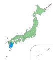
Japan South Kyushu Region 2.png 1,397 × 1,593; 89 KB
-
Japan- Kumamoto-Ken - DPLA - bd5a06a4a7b12af9d94f2d8365a89064.jpg 8,148 × 6,316; 4.83 MB
-
Kuma river map.jpg 716 × 1,072; 80 KB
-
Kumamoto Akita-gun.png 250 × 200; 6 KB
-
Kumamoto districts.png 791 × 746; 127 KB
-
Kumamoto Goshi-gun.png 250 × 200; 6 KB
-
Kumamoto géolocalisation relief.svg 593 × 572; 3.42 MB
-
Kumamoto géolocalisation.svg 593 × 572; 2.88 MB
-
Kumamoto Hotaku-gun.png 250 × 200; 6 KB
-
Kumamoto Kamoto-gun.png 250 × 200; 6 KB
-
Kumamoto map.png 800 × 754; 150 KB
-
Kumamoto Metropolitan Employment Area 2010.svg 301 × 301; 48 KB
-
Kumamoto Plain Relief Map, SRTM-1.jpg 800 × 600; 413 KB
-
Kumamoto prefecture it.svg 700 × 680; 50 KB
-
Kumamoto Prefecture regions map.svg 527 × 497; 40 KB
-
Kumamoto Prefecture shadow picture.svg 1,226 × 1,126; 50 KB
-
Kumamoto Takuma-gun.png 250 × 200; 6 KB
-
Kumamoto Uto-gun.png 250 × 200; 6 KB
-
Kumamoto Yamamoto-gun.png 250 × 200; 6 KB
-
Kumamoto-geo-stub.png 843 × 804; 42 KB
-
Kumamoto-map.jpg 2,000 × 1,937; 706 KB
-
KumamotoKenMap1991.png 260 × 210; 7 KB
-
KumamotoKenMap2003.png 260 × 210; 7 KB
-
KumamotoKenMap2004-3.png 260 × 210; 7 KB
-
KumamotoKenMap2005-5.png 260 × 210; 8 KB
-
KumamotoKenMap2005-8.png 260 × 210; 8 KB
-
KumamotoKenMap2006-4.png 260 × 210; 6 KB
-
KumamotoKenMap2011-4.png 260 × 210; 10 KB
-
KumamotoMapCurrent.png 981 × 901; 42 KB
-
KumamotoMapCurrent.svg 1,226 × 1,126; 50 KB
-
KumamotoShiKennai2003.png 260 × 210; 7 KB
-
Map of Japan with highlight on 43 Kumamoto prefecture.svg 1,024 × 1,024; 15 KB
-
Map of Kumamoto Prefecture Ja.svg 527 × 497; 15 KB
-
Map of license plates in Kumamoto Japan.svg 527 × 497; 25 KB
-
Miike map circa 1930.PNG 1,768 × 1,237; 1.51 MB
-
Reihoku in Kumamoto Prefecture.png 250 × 200; 6 KB
-
Shadow picture of Kumamoto prefecture.png 340 × 388; 3 KB
-
Tenpō Kuniezu - Higo Province (National Archives of Japan).jpg 12,009 × 11,078; 16.77 MB
-
Yatsushiro Sea.png 628 × 599; 175 KB
-
Yatsushiro See.png 695 × 663; 56 KB
-
基礎自治体位置図 43342.svg 680 × 732; 21 KB
-
基礎自治体位置図 43511.svg 527 × 497; 15 KB
-
基礎自治体位置図 43512.svg 527 × 497; 15 KB
-
基礎自治体位置図 43513.svg 527 × 497; 15 KB
-
基礎自治体位置図 43514.svg 527 × 497; 15 KB
-
基礎自治体位置図 43531.svg 527 × 497; 15 KB
-
水俣病-位置-地図.jpg 1,130 × 1,490; 508 KB
-
熊本県-地方行政区分.jpg 1,630 × 1,630; 499 KB
-
衆議院小選挙区 熊本県.svg 527 × 497; 27 KB

