Category:Maps of Kagoshima prefecture
Jump to navigation
Jump to search
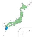
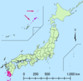
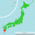
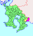
日本語: 鹿児島県の地図のカテゴリ。 日本全体における県の位置図は"Locator maps of ~"を、県内における各市町村の位置図は"Locator maps of municipalities ~"を、各郡の地図は"Maps of districts ~"を、過去の市町村の地図は"Maps of former municipalities ~"を参照。
Wikimedia category | |||||
| Upload media | |||||
| Instance of | |||||
|---|---|---|---|---|---|
| Category combines topics | |||||
| Kagoshima Prefecture | |||||
prefecture of Japan | |||||
| Instance of | |||||
| Named after | |||||
| Location | Japan | ||||
| Capital | |||||
| Legislative body |
| ||||
| Executive body | |||||
| Anthem |
| ||||
| Head of government |
| ||||
| Mascot |
| ||||
| Legal form |
| ||||
| Significant event |
| ||||
| Highest point |
| ||||
| Population |
| ||||
| Area |
| ||||
| Replaces |
| ||||
| official website | |||||
 | |||||
Subcategories
This category has the following 14 subcategories, out of 14 total.
Pages in category "Maps of Kagoshima prefecture"
This category contains only the following page.
Media in category "Maps of Kagoshima prefecture"
The following 100 files are in this category, out of 100 total.
-
Admiralty Chart No 835 Osumi Kaikyo, Published 1936.jpg 18,506 × 11,332; 66 MB
-
Ancient kagoshima pref map.jpg 569 × 526; 55 KB
-
Ariake Kagoshima map.png 245 × 270; 7 KB
-
Bonotsu-town map.svg 656 × 807; 455 KB
-
Divided Morokata-gun.PNG 126 × 142; 3 KB
-
Eilanden Kagoshima 2.png 518 × 816; 116 KB
-
Flag map of Kagoshima Prefecture.svg 463 × 701; 10 KB
-
Genroku Kuniezu - Satsuma Province (National Archives of Japan).jpg 4,067 × 7,725; 2.66 MB
-
Genroku Kuniezu - Ōsumi Province (National Archives of Japan).jpg 3,461 × 7,410; 2.21 MB
-
Growth rate map of municipalities of Kagoshima prefecture, Japan.svg 600 × 1,242; 32 KB
-
Hioki District, Kagoshima.png 218 × 255; 12 KB
-
Hokusatsu odan road map 2018.svg 500 × 700; 199 KB
-
Hokusatsu tunnel map.png 922 × 760; 183 KB
-
Japan Kagoshima Prefecture location map.svg 395 × 600; 14 KB
-
Japan South Kyushu Region 2.png 1,397 × 1,593; 89 KB
-
Japan South Kyushu Region.png 1,397 × 1,593; 89 KB
-
Kagoshima Ata-gun.png 290 × 380; 7 KB
-
Kagoshima Ei-gun.png 290 × 380; 7 KB
-
Kagoshima Gomu-gun.png 290 × 380; 7 KB
-
Kagoshima géolocalisation relief.svg 595 × 1,214; 2.01 MB
-
Kagoshima géolocalisation.svg 595 × 1,214; 1.93 MB
-
Kagoshima HigashiSoo-gun.png 290 × 380; 7 KB
-
Kagoshima Hioki-gun.png 290 × 380; 7 KB
-
Kagoshima Hishikari-gun.png 290 × 380; 7 KB
-
Kagoshima Ibusuki-gun.png 290 × 380; 7 KB
-
Kagoshima Isa-gun.png 290 × 380; 7 KB
-
Kagoshima Kagoshima-city.png 533 × 885; 22 KB
-
Kagoshima Kagoshima-city.PNG 533 × 885; 23 KB
-
Kagoshima Kagoshima-gun.png 290 × 380; 7 KB
-
Kagoshima Kawanabe-gun.png 290 × 380; 7 KB
-
Kagoshima Kiire-gun.png 290 × 380; 7 KB
-
Kagoshima KitaIsa-gun.png 290 × 380; 7 KB
-
Kagoshima KitaOsumi-gun.png 290 × 380; 7 KB
-
Kagoshima Koshikijima-gun.png 290 × 380; 7 KB
-
Kagoshima Kuwabara-gun.png 290 × 380; 7 KB
-
Kagoshima map.png 1,041 × 2,048; 160 KB
-
Kagoshima marathon course map.png 1,248 × 707; 958 KB
-
Kagoshima MinamiIsa-gun.png 290 × 380; 7 KB
-
Kagoshima MinamiMorokata-gun.png 290 × 380; 7 KB
-
Kagoshima MinamiOsumi-gun.png 290 × 380; 7 KB
-
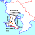
Kagoshima Nankai railway routemap.png 819 × 833; 210 KB
-
Kagoshima NishiSoo-gun.png 290 × 380; 7 KB
-
Kagoshima Okinoerabu-island.png 533 × 950; 14 KB
-
Kagoshima Osumi-gun.png 290 × 380; 7 KB
-
Kagoshima pref road Kaseda-Hiyoshi Cycling Path Map.png 405 × 628; 120 KB
-
Kagoshima pref.png 533 × 940; 23 KB
-
Kagoshima prefecture Electoral district map.svg 395 × 777; 29 KB
-
Kagoshima Prefecture regions map.svg 395 × 600; 29 KB
-
Kagoshima Taki-gun.png 290 × 380; 7 KB
-
Kagoshima Taniyama-gun.png 290 × 380; 7 KB
-
Kagoshima-geo-stub.png 221 × 338; 8 KB
-
Kagoshima-map.png 5,000 × 6,824; 6.08 MB
-
Kagoshima-pref Small ver2.png 275 × 266; 15 KB
-
KagoshimaMapCurrent.png 1,201 × 801; 34 KB
-
Kimotsuki River side Tumulus map.jpg 1,014 × 605; 107 KB
-
Kirishima city map 1.png 8,544 × 11,163; 2.94 MB
-
Kirishima city map 2.png 8,544 × 11,163; 3.16 MB
-
Kumage Subprefecture in Kagoshima Prefecture.png 1,201 × 801; 34 KB
-
Location map of Kagoshima.svg 395 × 600; 15 KB
-
Map 4morokata district.PNG 126 × 142; 3 KB
-
Map morokata district.PNG 126 × 142; 3 KB
-
Map of Japan with highlight on 46 Kagoshima prefecture.svg 1,024 × 1,024; 15 KB
-
Map of Kagoshima Prefecture Ja.svg 395 × 777; 12 KB
-
Map of license plates in Kagoshima Japan.svg 395 × 777; 58 KB
-
Miyakonojo-Shibushi Road map 2021.png 362 × 644; 379 KB
-
Miyakonojo-Shibushi-road map 2018.png 487 × 620; 425 KB
-
Morokata-gun.png 220 × 270; 5 KB
-
Okinoerabujima towns.svg 200 × 200; 4 KB
-
Osaki in Kagoshima Prefecture.png 290 × 380; 7 KB
-
Oshima Subprefecture in Kagoshima Prefecture.png 1,201 × 801; 35 KB
-
Oshima Subprefecture Kagoshima Map.png 800 × 534; 75 KB
-
Osumi island ja.png 1,799 × 1,380; 729 KB
-
Route 224 map.png 1,225 × 755; 513 KB
-
Satsuma Province Tojo.svg 1,200 × 1,600; 201 KB
-
Satsuma-Osumi-Morokata.svg 480 × 976; 31 KB
-
Satsumasendai central area map.jpg 2,385 × 1,465; 1.66 MB
-
Satsunan Islands.png 780 × 1,083; 76 KB
-
Shadow picture of Ibusuki city.svg 600 × 600; 7 KB
-
Shadow picture of Kagoshima prefecture.png 515 × 359; 4 KB
-
Shibushi city map 1.png 7,456 × 6,512; 1.08 MB
-
Shibushi city map 2.png 7,456 × 6,512; 1.12 MB
-
Shibushi Town Kagoshima map 1891-2005.png 245 × 270; 7 KB
-
Soo city map 1.png 8,351 × 8,544; 1.54 MB
-
Soo city map 2.png 8,351 × 8,544; 1.57 MB
-
Southern kyushu with adjacent islands.png 1,799 × 1,380; 720 KB
-
Tokunoshima towns.svg 200 × 200; 4 KB
-
Yatsushiro Sea.png 628 × 599; 175 KB
-
Yatsushiro See.png 695 × 663; 56 KB
-
Yūsui city map 1.png 5,191 × 5,069; 811 KB
-
Yūsui city map 2.png 5,191 × 5,069; 805 KB
-
加世田市.png 533 × 940; 18 KB
-
基礎自治体位置図 46209.svg 600 × 1,242; 22 KB
-
基礎自治体位置図 46323.svg 600 × 1,242; 23 KB
-
基礎自治体位置図 46344.svg 600 × 1,242; 23 KB
-
基礎自治体位置図 46345.svg 600 × 1,242; 23 KB
-
基礎自治体位置図 46421.svg 600 × 1,242; 22 KB
-
枕崎市.png 533 × 940; 18 KB
-
阿久根市.png 533 × 940; 18 KB
-
鹿児島県の地形.png 870 × 750; 1.02 MB
-
鹿児島県川辺町.png 533 × 940; 18 KB


