Category:Maps and diagrams of the 2016 Kumamoto earthquake
Jump to navigation
Jump to search
Media in category "Maps and diagrams of the 2016 Kumamoto earthquake"
The following 12 files are in this category, out of 12 total.
-
Futagawa-Hinagu Fault Zone.png 494 × 489; 49 KB
-
2016 Kumamoto earthquake aftershock-2.png 2,100 × 470; 73 KB
-
2016 Kumamoto earthquake aftershock.png 1,470 × 470; 50 KB
-
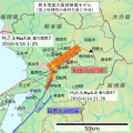
2016 Kumamoto earthquake Focal Area by GSI ja.svg 700 × 700; 354 KB
-
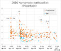
2016 Kumamoto earthquakes (Magnitude).svg 618 × 515; 188 KB
-
Epicenter of 2016 Kumamoto earthquakes-2.png 570 × 360; 78 KB
-
Epicenter of 2016 Kumamoto earthquakes.png 580 × 360; 75 KB
-
Futagawa-Hinagu Fault Zone map ja.svg 1,000 × 800; 272 KB
-
Japan Shakemap 15 April 2016.jpg 612 × 718; 96 KB
-
Japan Shakemap April 2016.jpg 612 × 718; 94 KB
-
Surface deformation from Kumamoto earthquake ESA360322.png 1,518 × 1,200; 1.17 MB
-
熊本地震 (2016年)の際の熊本市東区東町付近での地震の振動.webm 20 s, 1,600 × 900; 686 KB


