Category:Maps of Osaka prefecture
Jump to navigation
Jump to search
日本語: 大阪府の地図のカテゴリ。 日本全体における府の位置図は"Locator maps of ~"を、府内における各市町村の位置図は"Locator maps of municipalities ~"を、各郡の地図は"Maps of districts ~"を、過去の市町村の地図は"Maps of former municipalities ~"を参照。
Wikimedia category | |||||
| Upload media | |||||
| Instance of | |||||
|---|---|---|---|---|---|
| Category combines topics | |||||
| Osaka Prefecture | |||||
prefecture of Japan | |||||
| Instance of | |||||
| Named after | |||||
| Location | Japan | ||||
| Located in or next to body of water | |||||
| Capital | |||||
| Legislative body | |||||
| Executive body | |||||
| Currency | |||||
| Head of government |
| ||||
| Mascot |
| ||||
| Legal form |
| ||||
| Inception |
| ||||
| Highest point | |||||
| Population |
| ||||
| Area |
| ||||
| Replaces |
| ||||
| official website | |||||
 | |||||
Subcategories
This category has the following 15 subcategories, out of 15 total.
E
L
M
- Maps of Kawachinagano, Osaka (13 F)
- Maps of Kishiwada, Osaka (4 F)
- Maps of Yao, Osaka (13 F)
O
S
- Maps of Sakai, Osaka (23 F)
T
Pages in category "Maps of Osaka prefecture"
This category contains only the following page.
Media in category "Maps of Osaka prefecture"
The following 37 files are in this category, out of 37 total.
-
Osaka-geo-stub.svg 300 × 433; 8 KB
-
Growth rate map of municipalities of Osaka prefecture, Japan.svg 500 × 772; 23 KB
-
Hanshinkan.png 1,040 × 780; 23 KB
-
Japan kinki map small.png 235 × 300; 6 KB
-
Japan Osaka Prefecture location map.svg 490 × 690; 28 KB
-
Japan prov map izumi.png 235 × 300; 6 KB
-
Japan prov map kawachi.png 235 × 300; 6 KB
-
Japan prov map settsu.png 235 × 300; 6 KB
-
Japan- Osaka-Fu - DPLA - 017fc342547e47e83b79e6b3362f9fbc.jpg 8,184 × 6,325; 4.74 MB
-
Keichō Kuniezu - Settsu Province (Nishinomiya City Museum).jpg 3,689 × 3,299; 12.3 MB
-
KitaOsakaCycleLineMap.png 559 × 501; 49 KB
-
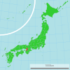
Map of Japan with highlight on 27 Osaka prefecture.svg 1,024 × 1,024; 15 KB
-
Map of Kawachi Province (14213118439).jpg 2,500 × 964; 739 KB
-
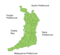
Map of Osaka Prefecture Ja.svg 429 × 612; 54 KB
-
NcodePic06.JPG 381 × 497; 23 KB
-
Osaka géolocalisation relief.svg 742 × 1,004; 2.07 MB
-
Osaka géolocalisation.svg 742 × 1,004; 1.81 MB
-
Osaka Prefecture Regions.png 727 × 1,024; 110 KB
-
Osaka-map.png 1,500 × 2,155; 1.8 MB
-
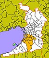
Osaka-Senshu001.PNG 400 × 500; 16 KB
-
OsakaMapCurrent.png 981 × 901; 36 KB
-
Sakai-city kuiki.png 100 × 97; 12 KB
-
Senboku-Chiiki001.jpg 500 × 588; 191 KB
-
Sennan-Chiiki001.jpg 500 × 588; 188 KB
-
Senriokain20s.jpg 5,000 × 3,828; 4.61 MB
-
Shadow picture of Osaka prefecture.png 282 × 390; 2 KB
-
Ōsaka-Map-Silhouette-Vector.svg 300 × 434; 16 KB
-
きららシティ街区位置図.png 836 × 687; 218 KB
-
きららシティ街区範囲図.png 836 × 687; 205 KB
-
万博公園西交差点概略図.PNG 480 × 400; 19 KB
-
大阪北部地震 茨木市で災害ボランティア(2018年6月26日・27日) (29189305268).jpg 2,663 × 3,550; 5.16 MB
-
大阪経済大学E館4階エレベーター横喫煙所マップ.jpeg 3,024 × 4,032; 3.15 MB
-
河内山本2 サムネイル用 01.jpg 292 × 534; 45 KB
-
河内山本PrtSc画像07.PNG 900 × 405; 59 KB
-
第二阪和国道 全線開通1.png 702 × 442; 460 KB
-
衆議院小選挙区 大阪府2.svg 500 × 708; 64 KB
-
衆議院小選挙区 大阪府拡大枠.svg 500 × 708; 63 KB


