Category:Maps of Saga prefecture
Jump to navigation
Jump to search
日本語: 佐賀県の地図のカテゴリ。 日本全体における県の位置図は"Locator maps of ~"を、県内における各市町村の位置図は"Locator maps of municipalities ~"を、各郡の地図は"Maps of districts ~"を、過去の市町村の地図は"Maps of former municipalities ~"を参照。
Wikimedia category | |||||
| Upload media | |||||
| Instance of | |||||
|---|---|---|---|---|---|
| |||||
Subcategories
This category has the following 8 subcategories, out of 8 total.
D
L
N
Pages in category "Maps of Saga prefecture"
This category contains only the following page.
Media in category "Maps of Saga prefecture"
The following 27 files are in this category, out of 27 total.
-
Flag map of Saga Prefecture.svg 373 × 371; 12 KB
-
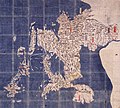
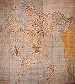
Genroku Kuniezu - Hizen Province (Chōkokan).jpg 900 × 685; 913 KB
-
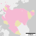
Growth rate map of municipalities of Saga prefecture, Japan.svg 520 × 592; 15 KB
-
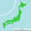
Japan Saga Prefecture location map.svg 515 × 520; 18 KB
-
Karatsushinaisen.png 640 × 480; 23 KB
-
Keichō Kuniezu - Hizen Province (C19 copy) (Chōkokan).jpg 900 × 830; 587 KB
-
Map of Japan with highlight on 41 Saga prefecture.svg 1,024 × 1,024; 15 KB
-
Map of license plates in Saga Japan.svg 515 × 520; 25 KB
-
Map of Saga Prefecture Ja.svg 599 × 599; 69 KB
-
Saga géolocalisation relief.svg 1,049 × 1,027; 2.24 MB
-
Saga géolocalisation.svg 1,049 × 1,027; 1.76 MB
-
Saga map.png 580 × 563; 39 KB
-
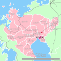
Saga Metropolitan Employment Area.svg 201 × 201; 48 KB
-
Saga prefecture it.svg 540 × 540; 27 KB
-
Saga Prefecture regions map.svg 515 × 520; 20 KB
-
Saga-geo-stub.png 560 × 557; 36 KB
-
Saga-ken.png 160 × 140; 5 KB
-
Saga-map.jpg 2,000 × 1,968; 560 KB
-
SagaMapCurrent.png 981 × 801; 33 KB
-
Shadow picture of Saga prefecture.png 409 × 392; 3 KB
-
Shōhō Kuniezu - Hizen Province (Chōkokan).jpg 799 × 900; 735 KB
-
Tenpō Kuniezu - Hizen Province (National Archives of Japan).jpg 7,088 × 5,236; 4.6 MB
-
佐賀県久保田町県内位置図.svg 403 × 408; 14 KB
-
佐賀県川副町県内位置図.svg 403 × 408; 14 KB
-
佐賀県東与賀町県内位置図.svg 403 × 408; 14 KB
-
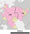
衆議院小選挙区 佐賀県.svg 520 × 592; 18 KB
