Category:Maps of Europe in the 7th century
Jump to navigation
Jump to search
English: This category is about the subject of Europe 601-700 CE: History maps showing all or a substantial part of the territory of Europe as it was in the 7th century.
Contemporary old maps belong into: Category:Old maps of Europe and its subcategories.
Contemporary old maps belong into: Category:Old maps of Europe and its subcategories.
Maps of the history of Europe: (BCE) 9th century · 8th century · 5th century · 4th century · 3rd century · 2nd century · 1st century · (CE) 1st century · 2nd century · 3rd century · 4th century · 5th century · 6th century · 7th century · 8th century · 9th century · 10th century · 11th century · 12th century · 13th century · 14th century · 15th century · 16th century · 17th century · 18th century · 19th century · 20th century · 21st century ·
Subcategories
This category has the following 13 subcategories, out of 13 total.
Media in category "Maps of Europe in the 7th century"
The following 14 files are in this category, out of 14 total.
-
C. 650 Europe.jpg 1,611 × 1,206; 703 KB
-
Europe en 600.pdf 1,752 × 1,239; 600 KB
-
626 CE, Europe.svg 512 × 438; 1.51 MB
-
Europa BV042518589.jpg 1,954 × 1,337; 315 KB
-
Europe en 650.pdf 1,752 × 1,239; 605 KB
-
Historical atlas of modern Europe 1903 (135895354).jpg 9,126 × 6,828; 52.5 MB
-
651 CE, Europe.svg 512 × 438; 1.56 MB
-
Europe en 601.pdf 1,752 × 1,239; 599 KB
-
Europe en 651.pdf 1,752 × 1,239; 603 KB
-
Europe VII-e VIII-e siècles.jpg 10,902 × 7,080; 6.84 MB
-
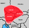
Państwo Samona.png 300 × 293; 21 KB
-
Ungarn BV042512105.jpg 1,584 × 1,127; 255 KB
-
Миграции булгар после смерти Кубрата.jpg 1,017 × 721; 403 KB


