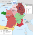
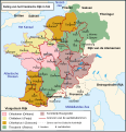
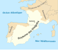
Category:Maps of Europe in the 6th century
Jump to navigation
Jump to search
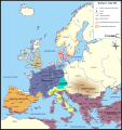
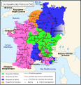
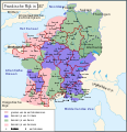
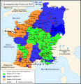
English: This category is about the subject of Europe 501-600 CE: History maps showing all or a substantial part of the territory of Europe as it was in the 6th century.
Contemporary old maps belong into: Category:Old maps of Europe and its subcategories.
Contemporary old maps belong into: Category:Old maps of Europe and its subcategories.
Maps of the history of Europe: (BCE) 9th century · 8th century · 5th century · 4th century · 3rd century · 2nd century · 1st century · (CE) 1st century · 2nd century · 3rd century · 4th century · 5th century · 6th century · 7th century · 8th century · 9th century · 10th century · 11th century · 12th century · 13th century · 14th century · 15th century · 16th century · 17th century · 18th century · 19th century · 20th century · 21st century ·
Subcategories
This category has the following 13 subcategories, out of 13 total.
Media in category "Maps of Europe in the 6th century"
The following 141 files are in this category, out of 141 total.
-
C. 526 Germanic Kingdoms.jpg 1,257 × 1,011; 925 KB
-
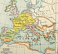
Europe 526-600.jpg 907 × 1,427; 410 KB
-
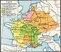
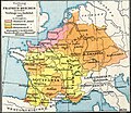
Europe 533-600.jpg 860 × 667; 352 KB
-
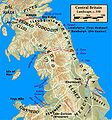
Central.Britain.c550.jpg 1,674 × 1,794; 425 KB
-
C. 565 Europe.jpg 1,609 × 1,193; 773 KB
-
533-600 Europe and Eastern Roman Empire.jpg 1,570 × 1,233; 1.17 MB
-
C. 600 Europe.jpg 1,610 × 1,201; 759 KB
-
C. 600 Western Europe.jpg 735 × 724; 520 KB
-
Yr.Hen.Ogledd.550.650.Koch.jpg 1,500 × 1,794; 510 KB
-
118 of '(Italy and her Invaders, Vol. 1-4.)' (11217175325).jpg 2,793 × 2,213; 1.47 MB
-
2022 04 16 - MAP West Germanic – cc. 580 CE - END.png 2,752 × 2,551; 3.64 MB
-
2022 10 16 - Westgermanisch – um 580 - END.png 2,752 × 2,646; 3.71 MB
-
2022 11 13 - Map West Germanic – cc. 580 CE - final.png 2,752 × 2,646; 3.69 MB
-
34 of '(Italy and her Invaders, Vol. 1-4.)' (11214674914).jpg 3,428 × 2,518; 1.62 MB
-
A history of Rome (1917) (14761658634).jpg 2,072 × 3,086; 969 KB
-
A history of Rome (1917) (14761659264).jpg 2,058 × 2,924; 884 KB
-
Europe en 500.pdf 1,752 × 1,239; 455 KB
-
Atlas of European history (1909) (14597297739).jpg 2,170 × 1,600; 832 KB
-
Putz93.jpg 1,252 × 1,168; 755 KB
-
528 CE, Europe.svg 512 × 438; 1.5 MB
-
537 Septimania mk.svg 458 × 327; 29 KB
-
537Septimania.JPG 456 × 326; 23 KB
-
537Septimania3 es.svg 1,998 × 1,422; 80 KB
-
537Septimania3 pt.svg 1,998 × 1,422; 25 KB
-
537Septimania3.JPG 456 × 326; 24 KB
-
537Septimania4.JPG 456 × 326; 23 KB
-
537SeptimaniaGIF.png 456 × 326; 12 KB
-
Europe en 550.pdf 1,752 × 1,239; 458 KB
-
555 justinian conquests-fr.svg 1,648 × 1,049; 1.93 MB
-
Europa BV042518575.jpg 1,954 × 1,337; 304 KB
-
Historical atlas of modern Europe 1903 (135895354).jpg 9,126 × 6,828; 52.5 MB
-
565 CE, Europe.svg 512 × 438; 1.5 MB
-
Putz92.jpg 1,237 × 1,153; 716 KB
-
600 CE, Europe.svg 512 × 438; 1.55 MB
-
Allemanie in de middeleeuwen.jpg 663 × 676; 165 KB
-
Anglo saxon jute 575ad.png 960 × 720; 178 KB
-
Anglo-Saxon England 2.svg 900 × 1,100; 574 KB
-
Britain peoples circa 600 de.svg 578 × 772; 1.78 MB
-
Britain peoples circa 600 ru.svg 994 × 1,233; 1.32 MB
-
Britain peoples circa 600 zh-hans.svg 994 × 1,233; 1.33 MB
-
Britain peoples circa 600-es.svg 994 × 1,233; 3.44 MB
-
Britain peoples circa 600-fr.svg 994 × 1,233; 1.45 MB
-
Britain peoples circa 600-hu.svg 994 × 1,233; 1.65 MB
-
Britain peoples circa 600-ko.svg 994 × 1,233; 1.33 MB
-
Britain peoples circa 600-pt.svg 994 × 1,233; 1.33 MB
-
Britain.circa.540.jpg 2,046 × 2,814; 675 KB
-
Britain.early.6th.century.nascent.kingdoms.jpg 2,292 × 2,777; 896 KB
-
Britonia6hcentury-ar.jpg 1,670 × 2,928; 375 KB
-
Britonia6hcentury.png 1,670 × 2,928; 542 KB
-
Britonia6hcentury2.svg 1,464 × 2,405; 181 KB
-
Byzantinisches Reich BV042750793.jpg 4,484 × 3,357; 2.55 MB
-
Droysens-20b.jpg 2,082 × 1,828; 3.15 MB
-
Droysens-20c.jpg 2,104 × 1,820; 3.36 MB
-
Droysens-20d.jpg 2,103 × 1,819; 3.45 MB
-
Early Medieval Scotland areas.png 794 × 1,123; 1.51 MB
-
Early Slavic settlement Prague-type CZ.png 1,477 × 873; 153 KB
-
East Roman.jpg 835 × 664; 165 KB
-
Erster und Zweiter Gotenkrieg-SW.png 2,264 × 2,478; 441 KB
-
Erster und Zweiter Gotenkrieg.png 1,133 × 1,240; 1.33 MB
-
Europa in 526 hu.png 1,000 × 800; 308 KB
-
Europa in 526-es.svg 1,844 × 1,472; 523 KB
-
Europa in 526-pt.svg 512 × 409; 49 KB
-
Europa in 526.png 799 × 639; 98 KB
-
Europe 526-600 japref.jpg 900 × 1,400; 325 KB
-
Europe at the close of the 6th century, showing the Gothic monarchies (14780052291).jpg 2,176 × 1,392; 544 KB
-
Europe at the death of Justinian I in 565.jpg 2,747 × 1,966; 4.19 MB
-
Europe at the death of Theoderic the Great in 526.jpg 2,754 × 1,961; 3.71 MB
-
Europe en 551.pdf 1,752 × 1,239; 457 KB
-
Europe in 526.jpg 1,541 × 961; 1.43 MB
-
Europee en 501.pdf 1,752 × 1,239; 454 KB
-
Európa 600.svg 512 × 542; 4.6 MB
-
Frankenreich unter den Merowingern.jpg 3,287 × 2,874; 2 MB
-
Germanic East Roman.jpg 840 × 658; 156 KB
-
Germanic kingdoms 526CE.png 822 × 661; 1.01 MB
-
Gotenkrieg.png 514 × 624; 14 KB
-
Gotische oorlog.png 1,133 × 1,240; 1.09 MB
-
Großbritannien BV042518600.jpg 1,954 × 1,337; 302 KB
-
KII-pms.jpg 793 × 574; 156 KB
-
KulturaPraska KulturaPienkowska.png 777 × 471; 20 KB
-
Le concile d'Agde en 506-hu.svg 755 × 784; 621 KB
-
Le concile d'Agde en 506.svg 755 × 784; 696 KB
-
Le concile d'Orléans en 511 de.svg 680 × 705; 325 KB
-
Le concile d'Orléans en 511-es.svg 755 × 784; 1.31 MB
-
Le concile d'Orléans en 511-hu.svg 680 × 705; 354 KB
-
Le concile d'Orléans en 511-pt.svg 755 × 784; 340 KB
-
Le concile d'Orléans en 511.svg 755 × 784; 577 KB
-
Le royaume des Francs en 561 ru.svg 755 × 784; 296 KB
-
Le royaume des Francs en 561-es.svg 755 × 784; 291 KB
-
Le royaume des Francs en 561.svg 755 × 784; 364 KB
-
Le royaume des Francs en 567-es.svg 756 × 785; 706 KB
-
Le royaume des Francs en 567-nl.svg 756 × 785; 245 KB
-
Le royaume des Francs en 567.svg 756 × 785; 207 KB
-
Lenguas de la Península Itálica en el siglo VI a. C.svg 512 × 594; 74 KB
-
Les conquêtes franques en Gaule (486 - 511)-pt.svg 755 × 784; 79 KB
-
Les conquêtes franques en Gaule (486 - 511).svg 755 × 784; 231 KB
-
Les royaumes francs en 587-es.svg 758 × 785; 334 KB
-
Les royaumes francs en 587.svg 758 × 785; 432 KB
-
Lgnbrd dmn 568.png 1,873 × 1,177; 1.21 MB
-
Ludy Brytanii ok. 600.svg 994 × 1,233; 1.47 MB
-
Map Europe around 560 AD - Touring Club Italiano CART-TRC-50 01.jpg 3,873 × 3,205; 1.52 MB
-
Map Frank campaigns in Aquitaine 507-509-de.svg 755 × 784; 819 KB
-
Map Frank campaigns in Aquitaine 507-509-es.svg 755 × 784; 807 KB
-
Map Frank campaigns in Aquitaine 507-509-fr.svg 755 × 784; 505 KB
-
Map Frank campaigns in Aquitaine 507-509-pt.svg 755 × 784; 318 KB
-
Map Frank campaigns in Aquitaine 507-509-ru.png 1,594 × 1,655; 541 KB
-
Map Gaul 481-511-ru.png 1,600 × 1,661; 626 KB
-
Map Gaul divisions 511-de.svg 755 × 784; 125 KB
-
Map Gaul divisions 511-nl.svg 755 × 784; 163 KB
-
Map Gaul divisions 511-ru.png 1,600 × 1,661; 675 KB
-
Map of Septimania in 537 AD grc.svg 458 × 327; 22 KB
-
Map of Septimania in 537 AD la.svg 458 × 327; 21 KB
-
Map of Septimania in 537 AD ru.svg 458 × 327; 6 KB
-
Map of Septimania in 537 AD uk.svg 458 × 327; 21 KB
-
Map of Septimania in 537 AD-ar.svg 488 × 349; 22 KB
-
Map of Septimania in 537 AD-hu.svg 458 × 327; 22 KB
-
Map of Septimania in 537 AD.svg 458 × 327; 23 KB
-
Map Suebia550pChrn.png 400 × 363; 82 KB
-
Mapa da Europa c.500 (com legenda).png 1,985 × 1,686; 444 KB
-
Mapa da Europa c.500 (sem legenda).png 1,985 × 1,686; 301 KB
-
Osteuropa BV042511931.jpg 1,954 × 1,337; 265 KB
-
Ostmitteleuropa BV042518465.jpg 1,954 × 1,337; 286 KB
-
ReialmeVisigòts.svg 446 × 383; 48 KB
-
Reinos barbaros.svg 440 × 500; 47 KB
-
Royaume d'Aquitaine en 584-585-nl.svg 551 × 457; 259 KB
-
Royaume wisigoth2-es.svg 446 × 383; 42 KB
-
Royaume wisigoth2.svg 446 × 383; 83 KB
-
Shepherd 526-600.jpg 857 × 1,411; 442 KB
-
Europe in 526 (Shepherd).jpg 836 × 669; 256 KB
-
Slavs in the 6th century.jpg 1,193 × 836; 205 KB
-
Teilungen des Frankenreich unter den Merowingern.jpg 1,111 × 2,782; 878 KB
-
Térkép511.jpg 1,215 × 713; 508 KB
-
Térkép569.jpg 1,483 × 730; 567 KB
-
Vatra.jpg 2,128 × 1,515; 203 KB
-
Visigothic Kingdom Map c.500.png 1,985 × 1,686; 230 KB
-
Walls of Rome 6th century (cropped).png 1,157 × 819; 215 KB
-
Walls of Rome 6th century.png 1,200 × 853; 174 KB
-
The Collegiate Atlas 1876 (73059150).jpg 6,736 × 5,243; 5.25 MB
-
Миграции булгар после смерти Кубрата.jpg 1,017 × 721; 403 KB


