Category:Maps of Burgundy in the 7th century
Jump to navigation
Jump to search
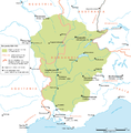
English: This category is about non-contemporary maps showing historical territories of Burgundy as it was in the 7th century.
Contemporary old maps belong into: Category:Old maps of Burgundy and its subcategories.
Contemporary old maps belong into: Category:Old maps of Burgundy and its subcategories.
Media in category "Maps of Burgundy in the 7th century"
The following 2 files are in this category, out of 2 total.
-
Kingdom of Burgundy.png 220 × 224; 70 KB
-
Map Burgundian Kingdom 2 EN.png 1,500 × 1,529; 204 KB

